Butun axtardiqlarinizi tapmaq ucun buraya: DAXIL OLUN
  Mp4 Mp3 Axtar Yukle
  Video Axtar Yukle
  Shekil Axtar Yukle
  Informasiya Melumat Axtar
  Hazir Inshalar Toplusu
  AZERI CHAT + Tanishliq
  Saglamliq Tibbi Melumat
  Whatsapp Plus Yukle(Yeni)

  • Home
  • Random
  • Nearby
  • Log in
  • Settings
Donate Now If this site has been useful to you, please give today.
  • About Wikimedia Commons
  • Disclaimers

Category:Cape Guardafui

<nowiki>Cabo Guardafui; Гвардафей; Гвардафуй; Kap Guardafui; Гвардафуй; Գվարդաֆույ; 瓜達富伊角; Capul Guardafui; 瓜達富伊角; Raas Caseyr; Kap Gardafai; Cap Guardafui; Promontorium Aromata; 瓜達富伊角; Gvardafuy; Guardafui; Kap Guardafui; Capo Guardafui; cap Gardafui; Caseyri neem; Mũi Guardafui; Гуардафуй; Gvardafui rags; Gvardafujaus kyšulys; rt Guardafui; Cabo Guardafui; Ras Asir; Gees Gwardafuy; راس عسیر; Cape Guardafui; Мис Гвардафуй; Qvardafuy burnu; グアルダフィ岬; Guardafui; Cape Guardafui; رأس عسير; 瓜达富伊角; Kap Guardafui; rt na konici vzhodne Afrike; cap de Somalie; Мис на Сомалійському півострові; promontoriu din Somalia; мыс на восточном побережье Африки у Аденского залива; cape; Ostspitze Afrikas; Điểm cực đông thứ hai của châu Phi; мыс на ўсходнім узбярэжжы Афрыкі; رأس في الصومال; mys v Somálsku; promontorio della Somalia; Guardafui; Guardafuí; アシール岬; アシル岬; グワルダフィ岬; ガルダフィ岬; Cap Guardafui; Gees Gwardafuy; Gees Gwardafuy; Aromatum Promontorium; Guardafui; Guardafui neem; Ras Asir; Przylądek Guardafui; Ras Ghardafuj; Przylądek Gwardafuy; Przylądek Ghardafuj; Gwardafuy; Guardafui; Ghardafuj; Мис Гардафуй; Cap Guardafui; Kap Guardafui; Ras Asir; Aromata; мыс Гвардафуй; رأس الفيل; راس عسير; رأس فيلوك‎; Рас-Айсер; Асир n; Slonji rt</nowiki>
Cape Guardafui 
cape
 image 
 locator map image 
Upload media
 Wikipedia
Instance of
  • cape
  • headland
LocationBari, Somalia
Located in or next to body of water
  • Gulf of Aden
Map11° 49′ 00″ N, 51° 17′ 00″ E
Authority file
Wikidata Q1145030
VIAF cluster ID:
GND ID:
  • Reasonator
  • Scholia
  • Wikidocumentaries
  • PetScan
  • statistics
  • WikiMap
  • Locator tool
  • KML file
  • WikiShootMe
  • OpenStreetMap
  • Search depicted
Edit infobox data on Wikidata

Subcategories

This category has only the following subcategory.

F

  • Faro Francesco Crispi (5 F)

Media in category "Cape Guardafui"

The following 9 files are in this category, out of 9 total.

  • Admiralty Chart No 2954 Gulf of Aden Eastern Portion including Socotra Island, Published 1950.jpg 16,440 × 11,334; 19.23 MB
  • Admiralty Chart No 597 Africa east coast Delagoa Bay to Cape Guardafui and Madagascar, Published 1882.jpg 8,249 × 14,670; 18.81 MB
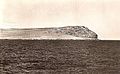
  • Cape Guardafui c. 1900-1910.jpg 792 × 491; 213 KB
  • Desert and ocean - 44533517561.jpg 5,568 × 3,712; 3.99 MB
  • Guardafui.jpeg 343 × 482; 19 KB
  • Internal waves off Somalia NASA.jpg 800 × 1,050; 79 KB
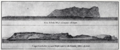
  • Le Tour du monde-02-p347.jpg 494 × 296; 42 KB
  • Periplus 086 Ras Feluk & Gardafui.png 1,452 × 604; 1.16 MB
  • Shipwreck off Guardafui 1905.png 637 × 668; 395 KB
Retrieved from "/w/index.php?title=Category:Cape_Guardafui&oldid=866140603"
Informasiya Melumat Axtar