Category:Bohol (island)
Brezhoneg: Bohol
· Ελληνικά: Μποχόλ
· English: Bohol (island)
· Español: Isla Bohol
· Galego: Illa Bohol
· 한국어: 보홀 섬
· 日本語: ボホール島
· Русский: Бохоль (остров)
· 中文:保和島
· See also category: Bohol.
island in the Philippines   | |||||
| Upload media | |||||
| Instance of | |||||
|---|---|---|---|---|---|
| Location | Bohol, Central Visayas, PH | ||||
| Located in or next to body of water |
| ||||
| Population |
| ||||
| Area |
| ||||
| Elevation above sea level |
| ||||
| Different from | |||||
 | |||||
 |
} |
Subcategories
This category has the following 5 subcategories, out of 5 total.
Media in category "Bohol (island)"
The following 47 files are in this category, out of 47 total.
-
 A cross atop a hill (9275240131).jpg 4,608 × 3,072; 1.5 MB
-
 Bien Unido Academy Inc.jpg 4,000 × 3,000; 5.06 MB
-
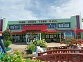 BienUnidoTownHall2022.jpg 4,000 × 3,000; 4.73 MB
-
 Bohol coast 1 ca. 1970.jpg 3,721 × 2,444; 1.29 MB
-
 Bohol in Philippines.png 800 × 1,055; 180 KB
-
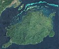 Bohol Island, PH, Sentinel-2.jpg 730 × 613; 144 KB
-
 Bohol Landscape.jpg 5,147 × 3,431; 12.51 MB
-
 BUCES Bohol.jpg 4,000 × 3,000; 5.24 MB
-
 Chocolate Hills historical marker.jpg 5,312 × 2,988; 4.67 MB
-
 Farmer tilling the land (9274949893).jpg 4,608 × 3,072; 2.94 MB
-
 Field near Choklate hills - panoramio.jpg 2,592 × 1,944; 2.05 MB
-
 Fish pens in Bohol.jpg 960 × 720; 78 KB
-
 Flickr - JennyHuang - Tarsier.jpg 800 × 533; 97 KB
-
 Forest in Bohol, Palm trees, Philippines.jpg 4,000 × 2,667; 9.7 MB
-
 Forest in Bohol, Philippines.jpg 4,000 × 3,000; 12.1 MB
-
 Forest road in Bohol 2, Philippines.jpg 4,000 × 2,667; 9.46 MB
-
 Forest road in Bohol, Philippines.jpg 4,000 × 3,000; 9.34 MB
-
 HCABBI.jpg 4,000 × 3,000; 4.09 MB
-
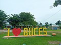
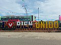 ILoveBienUnido.jpg 4,000 × 3,000; 5.48 MB
-
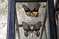 Jumbo sized glass mounted butterflies (9275053639).jpg 4,608 × 3,072; 1.63 MB
-
 Local farm houses (9277848952).jpg 4,608 × 3,072; 2.89 MB
-
 Local farmer- distant shot (9275065053).jpg 4,608 × 3,072; 2.66 MB
-
 Philippine Island - Bohol - NARA - 68156400.jpg 6,895 × 5,360; 14.64 MB
-
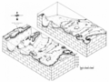 Philippine-reef-block hg.png 3,800 × 2,844; 3.51 MB
-
 Philippines-1981-50 hg.jpg 2,695 × 1,779; 667 KB
-
 Philippines-1981-51 hg.jpg 1,779 × 2,695; 396 KB
-
 Philippines-1981-55 hg.jpg 1,834 × 1,160; 601 KB
-
 Philippines-1981-57 hg.jpg 2,695 × 1,779; 634 KB
-
 Philippines-1981-58 hg.jpg 2,685 × 1,756; 742 KB
-
 Philippines-1981-59 hg.jpg 2,695 × 1,779; 639 KB
-
 Philippines-1981-60 hg.jpg 2,687 × 1,749; 730 KB
-
 Philippines-1981-61 hg.jpg 2,695 × 1,665; 938 KB
-
 Philippines-1981-62 hg.jpg 1,779 × 2,695; 1.01 MB
-
 Rain in the Philippines.jpg 2,272 × 1,704; 1.24 MB
-
 Rajah Sikatuna Protected Landscape.jpg 3,072 × 2,048; 1.32 MB
-
 Rice fields in Bohol island - panoramio.jpg 1,752 × 1,314; 641 KB
-
 Sea urchins Boholano delicacy.jpg 960 × 720; 161 KB
-
 Tagbilaran, Sunset in Cebu Strait, Bohol Island, Philippines.jpg 4,000 × 2,667; 5.22 MB
-
 Tagbilaran, Sunset in Cebu Strait, Bohol Sea, Philippines.jpg 4,000 × 2,667; 5.25 MB
-
 Tagbilaran, Sunset in Cebu Strait, Bohol, Philippines.jpg 4,000 × 2,667; 5.83 MB
-
 Tarsier of Bohol.jpg 4,268 × 2,845; 8.59 MB
-
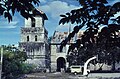
 The sea from the Blood compact site (9274586319).jpg 4,320 × 3,240; 1.53 MB
-
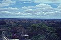
 The surrounding countryside (9277867702).jpg 4,608 × 3,072; 2.24 MB
-
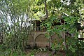
 Traditional house (9274962173).jpg 4,608 × 3,072; 2.52 MB
-
 Traditional house with amakan walls (9278032260).jpg 4,608 × 3,072; 2.67 MB
-
 Traditional long house (9274977687).jpg 4,608 × 3,072; 2.42 MB
-
 View of the surrounding countryside (9277857110).jpg 4,608 × 3,072; 2.07 MB
.jpg)


.jpg)


.jpg)
.jpg)
.jpg)


.jpg)
.jpg)
.jpg)
.jpg)
.jpg)
.jpg)