Category:Blackburn
town in Lancashire, England  | |||||
| Upload media | |||||
| Instance of | |||||
|---|---|---|---|---|---|
| Location | Blackburn with Darwen, Lancashire, North West England, England | ||||
| Population |
| ||||
| Area |
| ||||
| Different from | |||||
| official website | |||||
 | |||||
Asturianu: Blackburn ye una ciudá inglesa del condáu de Lancashire .Dende 1998 depende de l'autoridá unitaria de Blackburn y Darwen. (→Blackburn)
Български: Блѐкбърн (произнасяно също и като Бла̀кбърн) е голям индустриален град в графство Ланкашър, Англия. Той се намира на север от Уест Пени Мурс на южния край на долината Рибъл, 14,3 км (8,9 мили) източно от град Престън и 34 км (21 мили) северозападно от град Манчестър. Блекбърн граничи на юг с Даруен и заедно те образуват унитарната област Блакбърн с Даруен, като Блекбърн е административният център. При масовото преброяване през 2001 г. Блекбърн има население от 105 085 души, (→Блекбърн)
Čeština: Blackburn je anglické město v hrabství Lancashire. Podle sčítání lidu z roku 2001 zde žije 105 085 lidí. Ve městě žijí výrazné menšiny Indů (10,7 % populace) a Pákistánců (8,7 % populace). K islámu se ve městě hlásí 19,4 % populace, což činí z Blackburnu město s třetí největší koncentrací islámské populace v Anglii a Walesu. (→Blackburn)
Dansk: Blackburn er en by i det nordvestlige England, med et indbyggertal (pr. 2001) på cirka 105.000. Byen ligger i grevskabet Lancashire i regionen North West England. Byens navn kommer fra floden Blakewater, der passerer gennem byen. (→Blackburn)
Deutsch: Blackburn ist eine Stadt in der Unitary Authority Blackburn with Darwen im Nordwesten Englands und hat 105.085 Einwohner (2001). (→Blackburn)
English: Blackburn is a large industrial town in Lancashire, England. It lies to the north of the West Pennine Moors on the southern edge of the Ribble Valley, 9 miles east of the city of Preston, 21 miles north-northwest of the city of Manchester and 8 miles north of the border with Greater Manchester. Blackburn is bounded to the south by Darwen, with which it forms the unitary authority area of Blackburn with Darwen, Blackburn being the administrative centre. At the time of the UK Government's 2001 census, Blackburn had a population of 105,085, (→Blackburn)
Español: Blackburn es una ciudad inglesa, del condado de Lancashire. Desde 1998 depende de la autoridad unitaria de Blackburn y Darwen. (→Blackburn)
Euskara: Blackburn Ingalaterrako Lancashire konderrian dagoen hiri bat da. 1998. urtetik aurrera Blackburn eta Darwen aginte unitatea osatzen du. 2001eko erroldaren arabera 105.085 biztanle inguru zituen. (→Blackburn)
Suomi: Blackburn on kaupunki Pohjois- Englannissa, Lancashiren kreivikunnassa. Vuonna 2001 kaupungissa arvioitiin olevan noin 137 500 asukasta. Teollisen vallankumouksen aikana se oli merkittävä tekstiiliteollisuuskaupunki, johon tuotiin puuvillaa kehrättäväksi ja kudottavaksi Amerikasta asti. (→Blackburn)
Français : Blackburn est une ville britannique. Elle dépendait du Lancashire mais relève depuis 1998 de l'autorité unitaire de Blackburn et Darwen. La population est d'environ à 140 000 habitants en incluant l'agglomération urbaine de Darwen. Elle est la ville natale de Jason (Jay) Kay le leader du groupe Jamiroquai. (→Blackburn)
Galego: Blackburn é unha cidade británica, situada antigamente no condado inglés de Lancashire, mais que dende 1998 depende da autoridade unitaria de Blackburn e Darwen. A súa poboación estimada é de 140.000 habitantes. É a cidade natal de Jason Kay, líder do grupo musical Jamiroquai. (→Blackburn)
Bahasa Indonesia: Blackburn merupakan kota yang terletak di Inggris bagian tengah. Penduduknya berjumlah 104.000 jiwa (2005). (→Blackburn)
Italiano: Blackburn è una città del Lancashire. Fu un centro chiave per l'industria tessile durante la rivoluzione industriale. Oggi conta circa 105.000 abitanti. (→Blackburn)
Lietuvių: Blakbernas – miestas šiaurinėje Anglijoje, 30 km į šiaurę nuo Mančesterio. Išvystyta tekstilės, siuvimo, maisto, avalynės pramonė. (→Blakbernas)
Nederlands: Blackburn is een stad in de Engelse regio North West in de graafschap Lancashire en telt 105.085 inwoners. De stad was het centrum van de textielindustrie gedurende de Industriële revolutie. De stad ligt in het Noorden van de West Pennine Moors. (→Blackburn (Lancashire))
Norsk bokmål: Blackburn er en by i Lancashire, England. Den er administrasjonsby for den enhetlige myndigheten Blackburn with Darwen. Under den industrielle revolusjon var Blackburn et sentrum for tekstilindustrien. (→Blackburn)
Português: Blackburn é uma cidade do Condado de Lancashire, na Inglaterra. É a cidade mais importante do borough de Blackburn with Darwen, um distrito inglês com 140.200 habitantes. (→Blackburn)
Română: Blackburn este un oraș în comitatul Lancashire, regiunea North West, Anglia. Orașul este principala localitate din autoritatea unitară Blackburn with Darwen. (→Blackburn)
Русский: Блэкберн — город в графстве Ланкашир, в Англии, на р. Блэкберн, у Лидс-Ливерпульского канала, на узле четырёх железн. дорог и вблизи богатых копей каменного угля, в 38 км к ССЗ от Манчестера. (→Блэкберн)
Simple English: Blackburn is a town in Lancashire, England. The town has a population of about 105,000 people. (→Blackburn)
Slovenščina: Blackburn je mesto, ki leži v Lancashiru (Anglija). Med industrijsko revolucijo je bilo glavno mesto tekstilne industrije. (→Blackburn)
Svenska: Blackburn, stad i Lancashire, England med 140 000 invånare. Staden var ett centrum för textilindustrin under den industriella revolutionen. Blackburn Rovers FC kommer från staden. (→Blackburn)
ไทย: แบล็กเบิร์น (ภาษาอังกฤษ Blackburn) เป็นชื่อเมืองใหญ่เมืองหนึ่งซึ่งตั้งอยู่ในในแคว้นแลงคาเชียร์ ประเทศอังกฤษ และเป็นที่ตั้งของสโมสรฟุตบอลทีมแบล็กเบิร์นโรเวอร์สด้วยนั่นเอง (→แบล็กเบิร์น)
Türkçe: Blackburn Birleşik Krallık İngiltere ülkesini'nin Kuzey Batı bölgesinde bir kentsel yerleşkedir. İdari bakımdan törensel Lancashire kontluğuna bağlı olup 2009dan itibaren tek-seviyeli "Blackburn ile Darwen" Yerel İdaresi'nin merkezidir. (→Blackburn)
Subcategories
This category has the following 20 subcategories, out of 20 total.
A
B
C
E
G
H
J
M
N
P
- Panoramas of Blackburn (3 F)
- Panoramics of Blackburn (empty)
R
- Royal Blackburn Hospital (2 F)
S
T
W
- Witton Country Park (6 F)
Media in category "Blackburn"
The following 200 files are in this category, out of 923 total.
(previous page) (next page)-
De-Blackburn.ogg 1.7 s; 17 KB
-
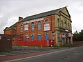
 "Bank Cottage" Eanam Wharf, Blackburn BB1 5BX - geograph.org.uk - 2279269.jpg 2,304 × 3,072; 1.33 MB
-

-
 "Bootstrap Annexe" Salford, Blackburn, Lancashire - geograph.org.uk - 2280434.jpg 3,069 × 2,053; 834 KB
-

-

-

-

-
-

-
 "Prospect House" Wharf Street - geograph.org.uk - 2279128.jpg 3,072 × 2,027; 1.05 MB
-

-
 "The Chippery" 3 Corporation Street, Blackburn BB2 1LB - geograph.org.uk - 2279783.jpg 3,069 × 1,659; 900 KB
-

-

-
 "The Young People's Hall" Salford, Blackburn, Lancashire - geograph.org.uk - 2280428.jpg 3,069 × 2,028; 947 KB
-
 - panoramio (2134).jpg 3,264 × 2,448; 2.13 MB
-
 - panoramio (2136).jpg 3,264 × 2,448; 2 MB
-
 - panoramio (2139).jpg 3,264 × 2,448; 1.79 MB
-
 BlackburnDarwenSpace.jpg 630 × 846; 370 KB
-
 4 generations of James Pitts's family at plaque unveiling.jpg 2,497 × 1,222; 680 KB
-
 A mill with a traditional north light roof - geograph.org.uk - 3896339.jpg 4,592 × 2,579; 7.31 MB
-
 A pleasant walk, Blackburn Cathedral - geograph.org.uk - 3372585.jpg 1,024 × 768; 209 KB
-
 A shortened journey - geograph.org.uk - 7999647.jpg 2,000 × 1,500; 540 KB
-
 A Statue near Blackburn bus station - geograph.org.uk - 2160013.jpg 800 × 600; 228 KB
-

-
 Advert for Shares in Blackburn Exchange Ltd 1860.png 635 × 654; 359 KB
-
 Ainsworth Street - geograph.org.uk - 3727266.jpg 1,000 × 750; 235 KB
-
 Ainsworth Street, Blackburn – 1973 - geograph.org.uk - 7545918.jpg 1,280 × 848; 398 KB
-
 Alfred wainwright plaque Blackburn.jpg 1,200 × 1,600; 792 KB
-
 All Hallows Spring Well Plaque (wide view), Blackburn.jpg 1,910 × 859; 568 KB
-
 All thats left of freckleton street church - panoramio.jpg 1,000 × 750; 116 KB
-
 Almost there - geograph.org.uk - 867581.jpg 480 × 640; 73 KB
-
 Altogether now - geograph.org.uk - 867586.jpg 480 × 640; 160 KB
-
 Alum Scar Bridge - panoramio.jpg 1,000 × 750; 963 KB
-
 Alum Scar wood - panoramio (1).jpg 1,008 × 756; 285 KB
-
 Alum Scar wood - panoramio (2).jpg 1,008 × 756; 387 KB
-
 Alum Scar wood - panoramio (3).jpg 1,008 × 756; 404 KB
-
 Alum Scar wood - panoramio (4).jpg 1,008 × 756; 413 KB
-
 Alum Scar wood - panoramio (5).jpg 1,008 × 756; 377 KB
-
 Alum Scar wood - panoramio (6).jpg 1,008 × 756; 350 KB
-
 Alum Scar wood - panoramio (7).jpg 1,008 × 756; 339 KB
-
 Alum Scar wood - panoramio (8).jpg 1,008 × 756; 331 KB
-
 Alum Scar wood - panoramio (9).jpg 1,008 × 756; 380 KB
-
 Alum Scar wood - panoramio.jpg 1,008 × 756; 379 KB
-
 Ancient Crab Apple tree - panoramio.jpg 1,185 × 889; 482 KB
-
 Ancient trees - panoramio.jpg 1,205 × 904; 536 KB
-
 Anglesey Street - geograph.org.uk - 2518949.jpg 1,280 × 960; 611 KB
-

-
 Aquamania, Petmania ^ Reptilemania - geograph.org.uk - 2285681.jpg 4,224 × 3,168; 3.11 MB
-
 Asda car park in Blackburn - geograph.org.uk - 5716692.jpg 800 × 656; 186 KB
-
 Audley Bridge - geograph.org.uk - 7770657.jpg 4,000 × 3,000; 3.36 MB
-
 Audley Range - geograph.org.uk - 2514900.jpg 640 × 480; 174 KB
-
 Audley Shopping Centre, Blackburn - geograph.org.uk - 2465479.jpg 640 × 480; 121 KB
-
 Audley Street Bridge No 102A - geograph.org.uk - 5716698.jpg 800 × 553; 120 KB
-
 B20974.jpg 3,024 × 4,032; 4.47 MB
-
 B41948.jpg 3,024 × 4,032; 4.09 MB
-
 B49075.jpg 3,024 × 4,032; 4.45 MB
-
 B49076.jpg 3,024 × 4,032; 3.76 MB
-
 B49778.jpg 3,024 × 4,032; 5.85 MB
-
 B49779.jpg 3,024 × 4,032; 3.03 MB
-
 B49780.jpg 3,024 × 4,032; 5.63 MB
-
 B50383.jpg 3,024 × 4,032; 5.72 MB
-
 B50639.jpg 2,649 × 3,531; 2.63 MB
-
 B51434.jpg 4,032 × 3,024; 5 MB
-
 B53161.jpg 3,024 × 4,032; 2.05 MB
-
 B53162.jpg 3,024 × 4,032; 4.02 MB
-
 B53287.jpg 3,024 × 4,032; 5.02 MB
-
 B53317.jpg 3,024 × 4,032; 1.92 MB
-
 B53318.jpg 3,024 × 4,032; 3.86 MB
-
 B53319.jpg 3,024 × 4,032; 3.98 MB
-
 B55055.jpg 3,024 × 4,032; 2.42 MB
-
 B55056.jpg 3,024 × 4,032; 2.54 MB
-
 B55057.jpg 3,024 × 4,032; 2.53 MB
-
 Back street opposite blackburn museum - panoramio.jpg 2,048 × 1,536; 141 KB
-
 Bar Ibiza, Mincing Lane, Blackburn - geograph.org.uk - 7896381.jpg 2,000 × 1,501; 451 KB
-
 Barbara Castle Way - geograph.org.uk - 1216822.jpg 640 × 480; 80 KB
-
 Barbara Castle Way in Blackburn - geograph.org.uk - 4186072.jpg 1,500 × 999; 145 KB
-
 Barbara Castle Way, Blackburn - geograph.org.uk - 2279275.jpg 3,063 × 1,801; 1.16 MB
-
 Barrier Snake - geograph.org.uk - 398409.jpg 640 × 345; 229 KB
-

-

-

-
 Benchmark on Holy Trinity Church buttress - geograph.org.uk - 7831724.jpg 564 × 1,024; 282 KB
-

-

-
 Benchmark on SW parapet of Navigation Bridge - geograph.org.uk - 7832224.jpg 1,024 × 556; 283 KB
-
 Benchmark on wall at NE end of Bridge Street - geograph.org.uk - 7832533.jpg 1,024 × 576; 271 KB
-
 Benchmark on wall of the Town Hall - geograph.org.uk - 7831579.jpg 1,024 × 576; 272 KB
-

-
 Benchmark on west porch of Cathedral Church - geograph.org.uk - 7831014.jpg 576 × 1,024; 310 KB
-
 Benchmark on ^1 Railway Road - geograph.org.uk - 7832286.jpg 1,024 × 558; 241 KB
-
 Benchmark on ^1 Richmond Terrace (Limbrick face) - geograph.org.uk - 7831560.jpg 562 × 1,024; 196 KB
-
 Benchmark on ^2 Preston New Road - geograph.org.uk - 7831391.jpg 1,024 × 576; 297 KB
-
 Beneath the Audley Street Bridge No 102A - geograph.org.uk - 5716702.jpg 800 × 600; 163 KB
-
 Bennington Street, Blackburn - geograph.org.uk - 2127225.jpg 640 × 480; 136 KB
-
 Bicknell Street, Blackburn - geograph.org.uk - 3275640.jpg 480 × 640; 73 KB
-
 Big wheel - panoramio - jim walton.jpg 2,048 × 1,536; 730 KB
-
 Billinge Avenue - panoramio.jpg 1,000 × 750; 222 KB
-
 Billinge Street, Blackburn - geograph.org.uk - 5229177.jpg 640 × 480; 63 KB
-
 Blackburn - Blackburn Aerial Scenery (geograph 5257551).jpg 6,000 × 4,000; 7.88 MB
-
 Blackburn - DSC03844.JPG 3,648 × 2,736; 3.53 MB
-
 Blackburn - DSC03851.JPG 3,648 × 2,736; 3.57 MB
-
 Blackburn - DSC03855.JPG 3,648 × 2,736; 3.68 MB
-
 Blackburn - DSC03868.JPG 3,648 × 2,736; 3.57 MB
-
 Blackburn - DSC03948.JPG 2,736 × 3,648; 3.39 MB
-
 Blackburn - DSC03950.JPG 3,648 × 2,736; 3.56 MB
-
 Blackburn - DSC03951.JPG 3,648 × 2,736; 3.59 MB
-
 Blackburn - DSC03952.JPG 3,648 × 2,736; 3.53 MB
-
 Blackburn - former play centre on St Peters Street - geograph.org.uk - 3696428.jpg 1,600 × 1,228; 644 KB
-
 Blackburn - Hornby House - geograph.org.uk - 3696459.jpg 1,600 × 1,208; 565 KB
-
 Blackburn - Lancashire dot.png 417 × 599; 122 KB
-
 Blackburn - No 14 St Peters Street - geograph.org.uk - 3696423.jpg 1,600 × 1,357; 644 KB
-
 Blackburn - Sahara - geograph.org.uk - 3696413.jpg 1,600 × 1,203; 525 KB
-
 Blackburn - south side of Richmond Terrace - geograph.org.uk - 3696611.jpg 1,600 × 1,179; 498 KB
-
 Blackburn - Stage Door - geograph.org.uk - 3696416.jpg 1,600 × 1,303; 514 KB
-
 Blackburn - The Adelphi - geograph.org.uk - 3696850.jpg 1,600 × 1,310; 644 KB
-
 Blackburn - Yorkshire Bank - geograph.org.uk - 3696824.jpg 1,182 × 1,600; 504 KB
-
 Blackburn Boulevard, (Lancashire), 1902.jpg 2,892 × 1,952; 739 KB
-
 Blackburn Bus Station – 1967 - geograph.org.uk - 6746599.jpg 1,280 × 836; 253 KB
-
 Blackburn Central High School.jpg 6,000 × 4,000; 9.9 MB
-
 Blackburn Corporation Tramways Power Station Plaque Blackburn.jpg 1,236 × 928; 477 KB
-
 Blackburn Darwen Tramway Northern Terminus Location Plaque Blackburn.jpg 1,236 × 928; 481 KB
-
 Blackburn Exchange Building, 1899.jpg 2,900 × 1,948; 1,022 KB
-
 Blackburn fire station in background - panoramio.jpg 1,000 × 750; 123 KB
-
 Blackburn from the Wainwright Bridge - geograph.org.uk - 2234463.jpg 3,872 × 2,312; 2.41 MB
-
 Blackburn Lancashire Townscape.jpg 1,600 × 908; 490 KB
-
 Blackburn Library, Northgate, Blackburn - geograph.org.uk - 5323654.jpg 1,868 × 1,393; 1.99 MB
-
 Blackburn Lock and Hall Street Bridge - geograph.org.uk - 6365038.jpg 5,184 × 3,456; 6.27 MB
-

-
 Blackburn Market Hall - geograph.org.uk - 2279290.jpg 3,072 × 2,304; 1,015 KB
-
 Blackburn Market Hall from Salford - geograph.org.uk - 2280422.jpg 3,072 × 1,712; 596 KB
-
 Blackburn market square - panoramio.jpg 2,362 × 1,772; 2.59 MB
-
 Blackburn Motor Park - geograph.org.uk - 2233989.jpg 3,564 × 2,475; 3.97 MB
-
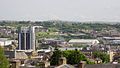
 Blackburn Panorama - geograph.org.uk - 7172155.jpg 3,869 × 2,177; 2.48 MB
-
 Blackburn Ragged School - geograph.org.uk - 449510.jpg 640 × 426; 354 KB
-

-
 Blackburn Rovers Memorial Garden, Ewood Park - geograph.org.uk - 6972660.jpg 1,200 × 900; 1.18 MB
-
 Blackburn Sudell Cross (1899).jpg 2,967 × 1,813; 1.47 MB
-
 Blackburn Technical College - panoramio (1).jpg 2,592 × 1,936; 1.48 MB
-
 Blackburn Technical College - panoramio (2).jpg 2,592 × 1,936; 1.97 MB
-
 Blackburn Technical College - panoramio (3).jpg 2,592 × 1,936; 1.71 MB
-
 Blackburn Technical College - panoramio (4).jpg 2,592 × 1,936; 1.87 MB
-
 Blackburn Technical College - panoramio (5).jpg 2,592 × 1,936; 2.21 MB
-
 Blackburn Technical College - panoramio (6).jpg 2,592 × 1,936; 2.12 MB
-
 Blackburn Technical College - panoramio (7).jpg 2,592 × 1,936; 2.04 MB
-
 Blackburn Technical College - panoramio (8).jpg 2,592 × 1,936; 2.18 MB
-
 Blackburn Technical College - panoramio.jpg 2,592 × 1,936; 1.69 MB
-
 Blackburn Technical School - geograph.org.uk - 5433377.jpg 1,280 × 960; 1.04 MB
-
 Blackburn Telephone Exchange (1) - geograph.org.uk - 5501437.jpg 2,592 × 1,944; 1.42 MB
-
 Blackburn Telephone Exchange (2) - geograph.org.uk - 5501446.jpg 2,592 × 1,944; 1.41 MB
-
 Blackburn Telephone Exchange - geograph.org.uk - 1079388.jpg 480 × 640; 61 KB
-
 Blackburn Telephone Exchange - geograph.org.uk - 1992358.jpg 1,632 × 1,224; 561 KB
-
-
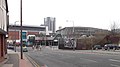
 Blackburn Town Centre - geograph.org.uk - 2704651.jpg 640 × 480; 120 KB
-
 Blackburn Town view - geograph.org.uk - 1136210.jpg 640 × 480; 88 KB
-
 Blackburn townhall and St James church in distance - panoramio.jpg 2,816 × 2,112; 1.77 MB
-
 Blackburn unparished area UK locator map.svg 1,099 × 1,305; 291 KB
-

-
 Blackburn with Darwen Borough Council makeup.svg 360 × 185; 3 KB
-
 Blackburn Youth Zone - geograph.org.uk - 7272488.jpg 1,600 × 1,200; 367 KB
-
 Blackburn's Panopticon.Colourfields. - panoramio.jpg 1,000 × 753; 169 KB
-
 Blackburn, Lancashire - geograph.org.uk - 1994156.jpg 1,632 × 1,144; 508 KB
-
 Blackburn, UK - panoramio (22).jpg 3,264 × 2,448; 2.3 MB
-
 Blackburn, UK - panoramio (23).jpg 3,264 × 2,448; 2.24 MB
-
 Blackburn, UK - panoramio (24).jpg 3,264 × 2,448; 2.23 MB
-
 Blackburn, UK - panoramio (25).jpg 3,264 × 2,448; 2.01 MB
-
 Blackburn, UK - panoramio (26).jpg 3,264 × 2,448; 2.27 MB
-
 Blackburn, UK - panoramio (27).jpg 3,264 × 2,448; 2.21 MB
-
 Blackburn, UK - panoramio (28).jpg 3,264 × 2,448; 2.34 MB
-
 Blackburn, UK - panoramio (29).jpg 3,264 × 2,448; 2.2 MB
-
 Blackburn, UK - panoramio (3).jpg 1,504 × 1,000; 410 KB
-
 Blackburn, UK - panoramio (30).jpg 2,816 × 2,112; 1.49 MB
-
 Blackburn, UK - panoramio (31).jpg 2,816 × 2,112; 1.77 MB
-
 Blackburn, UK - panoramio (32).jpg 2,816 × 2,112; 1.73 MB
-
 Blackburn, UK - panoramio (33).jpg 2,816 × 2,112; 1.98 MB
-
 Blackburn, UK - panoramio (34).jpg 2,816 × 2,112; 1.91 MB
-
 Blackburn, UK - panoramio (35).jpg 1,280 × 1,280; 947 KB
-
 Blackburn, UK - panoramio (36).jpg 3,264 × 2,448; 2.23 MB
-
 Blackburn, UK - panoramio (37).jpg 3,264 × 2,448; 2.18 MB
-
 Blackburn, UK - panoramio (38).jpg 3,264 × 2,448; 1.77 MB
-
 Blackburn, UK - panoramio (39).jpg 3,264 × 2,448; 2.23 MB
-
 Blackburn, UK - panoramio (4).jpg 2,816 × 2,112; 2.26 MB
-
 Blackburn, UK - panoramio (40).jpg 3,264 × 2,448; 2.06 MB
-
 Blackburn, UK - panoramio (41).jpg 3,264 × 2,448; 1.92 MB
-
 Blackburn, UK - panoramio (42).jpg 3,264 × 2,448; 2.15 MB
-
 Blackburn, UK - panoramio (43).jpg 2,448 × 3,264; 1.91 MB
-
 Blackburn, UK - panoramio (44).jpg 2,448 × 3,264; 1.81 MB
-
 Blackburn, UK - panoramio (45).jpg 2,448 × 3,264; 1.78 MB
-
 Blackburn, UK - panoramio (46).jpg 3,264 × 2,448; 1.77 MB
-
 Blackburn, UK - panoramio (47).jpg 3,264 × 2,448; 2.06 MB
-
 Blackburn, UK - panoramio (48).jpg 3,264 × 2,448; 1.83 MB
-
 Blackburn, UK - panoramio (49).jpg 2,448 × 3,264; 1.76 MB
-
 Blackburn, UK - panoramio (5).jpg 1,205 × 904; 320 KB
-
 Blackburn, UK - panoramio (51).jpg 3,264 × 2,448; 2.15 MB
-
 Blackburn, UK - panoramio (52).jpg 3,264 × 2,448; 1.83 MB
-
 Blackburn, UK - panoramio (53).jpg 3,264 × 2,448; 1.83 MB
-
 Blackburn, UK - panoramio (54).jpg 2,448 × 3,264; 1.77 MB
-
 Blackburn, UK - panoramio (55).jpg 3,264 × 2,448; 1.82 MB
-
 Blackburn, UK - panoramio (6).jpg 1,205 × 904; 314 KB

_Blackburn_BB1_3HQ_-_geograph.org.uk_-_2279097.jpg)

_Bottomgate,_Blackburn,_Lancashire_BB1_3AD_-_geograph.org.uk_-_2279108.jpg)
_15_Mincing_Lane,_Blackburn,_Lancashire_BB2_2EB_-_geograph.org.uk_-_1992975.jpg)
_39-41_King_William_Street,_Blackburn_BB1_7DJ_-_geograph.org.uk_-_2279762.jpg)
_-_geograph.org.uk_-_1993003.jpg)


.jpg)
.jpg)
.jpg)


,_Blackburn.jpg)


.jpg)
.jpg)
.jpg)
.jpg)
.jpg)
.jpg)
.jpg)
.jpg)
.jpg)


_-_geograph.org.uk_-_7831560.jpg)


.jpg)


,_1902.jpg)


.jpg)
.jpg)
.jpg)
.jpg)
.jpg)
.jpg)
.jpg)
.jpg)
.jpg)


_-_geograph.org.uk_-_5501437.jpg)
_-_geograph.org.uk_-_5501446.jpg)


.jpg)
.jpg)
.jpg)
.jpg)
.jpg)
.jpg)
.jpg)
.jpg)
.jpg)
.jpg)
.jpg)
.jpg)
.jpg)
.jpg)
.jpg)
.jpg)
.jpg)
.jpg)
.jpg)
.jpg)
.jpg)
.jpg)
.jpg)
.jpg)
.jpg)
.jpg)
.jpg)
.jpg)
.jpg)
.jpg)
.jpg)
.jpg)
.jpg)
.jpg)
.jpg)
.jpg)
.jpg)