Category:Bay of Fundy
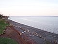
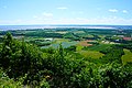
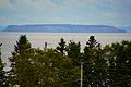
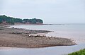
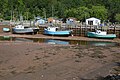
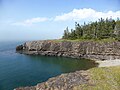
English: The Bay of Fundy is a bay on the Atlantic coast of North America, on the northeast end of the Gulf of Maine between the Canadian provinces of New Brunswick and Nova Scotia, with a small portion touching the U.S. state of Maine
bay on the Atlantic coast of Canada noted for high tides  | |||||
| Upload media | |||||
| Instance of | |||||
|---|---|---|---|---|---|
| Part of | |||||
| Location |
| ||||
| Inflows |
| ||||
| official website | |||||
 | |||||
Subcategories
This category has the following 44 subcategories, out of 44 total.
A
- Advocate Harbour (2 F)
B
C
- Cheney Island (2 F)
D
F
G
- Gannet Rock (empty)
H
- Hopewell Rocks (131 F)
I
- Indian Island (Bay of Fundy) (11 F)
J
- Joggins Fossil Cliffs (39 F)
K
M
- Macs Island (8 F)
- Maps of the Bay of Fundy (46 F)
- Minerals of Cape D'Or (1 F)
- Minerals of Morden (1 F)
- Minerals of Parrsboro (3 F)
- Minerals of Wasson Bluff (33 F)
N
- North Rock (1 F)
P
- Pendleton Island (4 F)
- Pope's Folly (8 F)
S
- St. Martins Sea Caves (12 F)
W
- Walton Harbour Lighthouse (17 F)
- Whales in Bay of Fundy (11 F)
- Wolf Islands (2 F)
Media in category "Bay of Fundy"
The following 184 files are in this category, out of 184 total.
-
 101 - Bay of Fundy.JPG 2,272 × 1,704; 2.22 MB
-
 102 - Bay of Fundy.JPG 2,272 × 1,704; 2.8 MB
-
 1961 power lines between Dry Ledge and McMaster Macs Island.png 573 × 494; 254 KB
-
 2009-07 - nova scotia 031 bay of fundy (3733887848).jpg 1,280 × 960; 77 KB
-
 2009-07 - nova scotia 032 bay of fundy (3733087417).jpg 1,280 × 960; 74 KB
-
 2009-07 - nova scotia 033 bay of fundy (3733087481).jpg 1,280 × 960; 80 KB
-
 2009-07 - nova scotia 034 bay of fundy (3733087545).jpg 960 × 1,280; 123 KB
-
 A Kayak Adventure (36840928975).jpg 2,048 × 1,366; 770 KB
-
 Across fundy.jpg 2,560 × 1,920; 761 KB
-
 Adam Island NB (1).jpg 1,892 × 1,049; 1.86 MB
-
 Alma - NB - Harbour.jpg 2,184 × 1,327; 1.31 MB
-
 Angelwing-and-Burrows-in-Sandstone Bay-of-Fundy March2003 b.jpg 1,945 × 1,458; 2.11 MB
-

-
 Autumn Colors in the Bay of Fundy (MODIS).jpg 1,630 × 1,472; 928 KB
-
 Baltimore and Ohio employes magazine (1915) (14574435200).jpg 4,704 × 3,130; 3.63 MB
-
 Barnacles seaweed fucus spiralis NS.jpg 5,442 × 3,594; 11.63 MB
-
 Barnes Island Bird Audio (1).jpeg 2,957 × 2,687; 6.67 MB
-
 Barnes Simpson Beans Islands.png 915 × 526; 824 KB
-
 BaxterHarbourNS 4.jpg 1,455 × 1,455; 1.32 MB
-
 Baxters Harbour.jpg 4,080 × 3,072; 4.27 MB
-
 Bay of Fundy (1644081626).jpg 2,272 × 1,704; 1.32 MB
-
 Bay of Fundy (3555024059).jpg 2,032 × 1,524; 532 KB
-
 Bay of Fundy (3555024623).jpg 2,032 × 1,524; 838 KB
-
 Bay of Fundy (3555835648).jpg 2,032 × 1,524; 528 KB
-
 Bay of Fundy (4338709549).jpg 2,048 × 1,536; 737 KB
-
 Bay of Fundy (4339282010).jpg 2,048 × 1,536; 662 KB
-
 Bay of Fundy (5518119).jpg 600 × 400; 70 KB
-
 Bay of Fundy - Tide In.jpg 2,272 × 1,704; 1.02 MB
-
 Bay of Fundy - Tide Out.jpg 2,272 × 1,704; 1.07 MB
-
 Bay of Fundy at Grand Pre, NS Canada - panoramio.jpg 3,320 × 2,527; 3.26 MB
-
 Bay of Fundy at low tide.JPG 3,648 × 2,736; 2.37 MB
-
 Bay of Fundy at Low Tide.jpg 4,914 × 3,242; 5.93 MB
-
 Bay of Fundy High Tide.jpg 300 × 450; 115 KB
-
 Bay of Fundy Low Tide.jpg 300 × 450; 142 KB
-
 Bay of Fundy low tide.jpg 5,472 × 3,648; 8.47 MB
-
 Bay of Fundy shore (3555024751).jpg 2,032 × 1,524; 505 KB
-
 Bay of Fundy, New Brunswick, Canada (8169791550).jpg 5,184 × 3,456; 2.67 MB
-
 Bay of Fundy, Woodpoint, New Brunswick (3140456385).jpg 600 × 450; 68 KB
-
 Bay of Fundy.jpg 600 × 450; 69 KB
-
 Bay of Minas at Truro.jpg 4,000 × 3,000; 2.93 MB
-
 BayofFundy.JPG 1,280 × 960; 584 KB
-
 Bayshore Low Tide.jpg 3,264 × 2,448; 2.57 MB
-
 Beach and Cove (49674175292).jpg 7,360 × 4,912; 25.37 MB
-
 Beach at West Hall's Harbour.jpg 453 × 604; 33 KB
-
 Beans Island and Surrounding.png 658 × 312; 285 KB
-
 Big Salmon River - Fundy Trail Parkway, New Brunswick (23670403589).jpg 5,760 × 3,014; 12.56 MB
-
 Bleak scene at little dyke.JPG 1,504 × 873; 600 KB
-
 Bricher Bay of Fundy.png 726 × 481; 576 KB
-
 Brook.jpg 2,048 × 1,536; 1.4 MB
-
 Cape Enrage lighthouse.jpg 4,320 × 3,240; 2.08 MB
-
 Capechignectoprovpark.jpg 1,024 × 768; 353 KB
-
 Casco Bay Island and Surrounding.png 611 × 349; 285 KB
-
 Casco Bay Island For Rent.png 608 × 344; 171 KB
-
 Casco Bay Island.png 488 × 430; 296 KB
-
 Chocolate Cove Deer Island.png 797 × 527; 248 KB
-

-
 Crossing the Bay of Fundy - Bay Ferries Digby to St. John (24935485493).jpg 5,538 × 3,692; 11.84 MB
-
 Crow Island West isles.jpg 2,199 × 1,031; 1.67 MB
-
 CumberlandBasinFromWoodPoint.jpg 1,536 × 1,536; 1,008 KB
-
 Cummings Cove, Deer Island.png 685 × 420; 135 KB
-
 Cyprian Southack Bay of Fundy.png 951 × 561; 686 KB
-
 Cyprian Southack map of Deer Island Campobello.png 1,094 × 509; 788 KB
-
 Death on Cheney Island and White Head Island.png 332 × 229; 75 KB
-
 Deer Island Harbour - Canadian Geographic NBTB 1959.jpg 711 × 922; 298 KB
-
 Deer Island Point to Eastport Maine ferry.png 749 × 398; 177 KB
-
 DGJ 4129 - Peacock (6179180044).jpg 2,848 × 4,288; 9.09 MB
-
 DGJ 5095 - A Fixer Upper......... (6238734423).jpg 4,288 × 2,848; 12.74 MB
-
 DGJ 5110 - Sanderling (6238750759).jpg 4,288 × 2,848; 11.62 MB
-
 Dinner Island NB Nex.jpg 1,877 × 1,125; 979 KB
-
 DSC08992 (7574801754).jpg 4,912 × 3,264; 13.62 MB
-
 Eagle near Bliss (1).jpeg 4,096 × 3,072; 1.93 MB
-
 Electrical Workers Journal 1925.jpg 953 × 1,413; 354 KB
-
 Fata Morgana in Eastern Canada.png 572 × 447; 228 KB
-
 Fish Island NB (1).jpeg 2,455 × 1,613; 2.71 MB
-
 Fiveislands20191109 162253-01.jpg 4,608 × 3,456; 4.97 MB
-
 FMIB 44374 Rush of the Bay of Fundy (Moneton, N B).jpeg 1,103 × 721; 557 KB
-
 Foot of Atlas - HDR (7667233318).jpg 1,800 × 1,200; 1.64 MB
-
 Frye Island NB (1).jpg 3,072 × 4,096; 11.07 MB
-
 Frye Island NB.png 697 × 390; 500 KB
-
 Frye Island Wheel (1).jpg 3,072 × 4,096; 11.77 MB
-
 Fundy Isles Chart.jpg 1,368 × 1,519; 1.53 MB
-
 Fundy NB (53203447087).jpg 4,000 × 6,000; 6.01 MB
-
 Fundy NB (53203465212).jpg 6,000 × 4,000; 5.22 MB
-
 Fundy Rose - Digby-St. John Bay Ferries Crossing (23184361339).jpg 3,264 × 2,374; 3.91 MB
-
 Fundytrail.JPG 10,296 × 2,898; 4.41 MB
-
 Gannet Rock Light Station.png 546 × 434; 117 KB
-
 Gannet Rock Light.png 484 × 297; 126 KB
-
 Glooscap Trail (15550275902).jpg 3,565 × 2,675; 1.42 MB
-
 Governor Generals Drawing.png 341 × 518; 130 KB
-
 Grand Manan Wood Green White Head.png 701 × 599; 759 KB
-
 Green Islands Grand Manan.png 768 × 487; 647 KB
-
 Hall's Harbour, Nova Scotia, Canada.jpg 12,416 × 1,856; 6.98 MB
-
 Hardwood Island, West Isles, NB (1).jpg 3,072 × 1,873; 3.62 MB
-
 Herring Cove (10105704513).jpg 4,090 × 2,633; 1.02 MB
-
 Herring Cove.jpg 5,000 × 3,253; 4.38 MB
-
 Hopewellrockslow.JPG 1,024 × 768; 194 KB
-
 Hospital Island NB 1.png 471 × 287; 183 KB
-
 Hospital Island NB 2.png 498 × 546; 372 KB
-
 Hospital Island NB 3.png 578 × 223; 115 KB
-
 Humpback Whales 3, Nova Scotia, Canada.jpg 942 × 530; 111 KB
-
 IMTA cultured mussels (Mytilus edulis) in the Bay of Fundy Canada.jpg 687 × 620; 477 KB
-
 Indian Island Fundy.png 172 × 259; 60 KB
-
 Indian Island Pre-1908.png 788 × 290; 148 KB
-
 Indian Island Schoolhouse.jpg 364 × 217; 40 KB
-
 Isle Haute, Bay of Fundy.jpg 4,853 × 3,225; 4.3 MB
-
 July 2009, Sunset reflects in bridge window (4812809394).jpg 3,216 × 2,136; 1.55 MB
-
 Lighthouses of the Fundy Isles.png 421 × 440; 231 KB
-

-
 Lords Cove, Deer Island 1941.png 807 × 474; 212 KB
-
 Low tide, Bay of Fundy (20214469966).jpg 4,896 × 3,167; 6.55 MB
-
 Manawagonish Island Nature Preserve.jpg 8,064 × 5,161; 34.14 MB
-
 Mithel Map of the Passamaquoddy Bay.jpg 773 × 1,180; 376 KB
-
 Morden0429-2014 (14069696514).jpg 2,400 × 1,799; 742 KB
-
 Mowat Island NB (1).jpeg 1,991 × 1,245; 1.11 MB
-
 Muddy ripples.JPG 3,456 × 2,304; 4.87 MB
-
 Natural Buttress (49674417237).jpg 4,912 × 7,360; 23.06 MB
-
 Navy Island in St. Andrews, NB.jpg 3,957 × 2,532; 3.98 MB
-
 NB - Daniels Flat (Bay of Fundy).jpg 2,523 × 1,422; 1,023 KB
-
 NB Fundy5 tango7174.jpg 1,620 × 600; 296 KB
-
 New brunswick (16) (48342615091).jpg 6,016 × 4,000; 6.32 MB
-
 New brunswick (17) (48342754062).jpg 6,016 × 4,000; 4.96 MB
-
 New brunswick (20) (48342608976).jpg 6,016 × 4,000; 6.35 MB
-
 New brunswick (21) (48342746307).jpg 6,016 × 4,000; 6.32 MB
-
 New Brunswick Empty Boats in Bay of Fundy Canada IMG 2427 (39222253381).jpg 4,032 × 3,024; 5.51 MB
-
 North Rock Grand Manan.png 581 × 435; 170 KB
-
 Northwest Harbour, Deer Island.png 723 × 522; 156 KB
-
 Nova Scotia DSC07907 - Halls Harbour Low Tide (35439522093).jpg 6,000 × 4,000; 19.2 MB
-
 Nova Scotia DSC07908 - Halls Harbour Low Tide (36110656611).jpg 6,136 × 4,207; 11.45 MB
-
 Nova Scotia Shelburne to Annapolis Royal, August 2015 (20386668083).jpg 2,560 × 1,920; 1.84 MB
-
 Nova Scotia Shelburne to Annapolis Royal, August 2015 (20819547158).jpg 2,560 × 1,920; 2 MB
-
 Nova Scotia Shelburne to Annapolis Royal, August 2015 (20819721010).jpg 2,560 × 1,920; 2.46 MB
-
 Nova Scotia Shelburne to Annapolis Royal, August 2015 (20819745928).jpg 2,560 × 1,920; 1.29 MB
-
 Nova Scotia Shelburne to Annapolis Royal, August 2015 (20819756820).jpg 1,920 × 2,560; 3.84 MB
-
 Nova Scotia Shelburne to Annapolis Royal, August 2015 (20819803568).jpg 2,560 × 1,920; 2.03 MB
-
 Nova Scotia Shelburne to Annapolis Royal, August 2015 (20820033738).jpg 2,560 × 1,920; 1.48 MB
-
 Nova Scotia Shelburne to Annapolis Royal, August 2015 (20820143528).jpg 1,889 × 2,512; 6.05 MB
-
 Nova Scotia Shelburne to Annapolis Royal, August 2015 (20820454678).jpg 1,835 × 2,448; 3.04 MB
-
 Nova Scotia Shelburne to Annapolis Royal, August 2015 (20820865348).jpg 2,802 × 820; 811 KB
-
 Nova Scotia Shelburne to Annapolis Royal, August 2015 (20821522489).jpg 2,802 × 820; 1.1 MB
-
 Nova Scotia Shelburne to Annapolis Royal, August 2015 (20981439836).jpg 2,560 × 1,920; 1.41 MB
-
 Nova Scotia Shelburne to Annapolis Royal, August 2015 (20982075896).jpg 2,560 × 1,920; 1.63 MB
-
 Nova Scotia Shelburne to Annapolis Royal, August 2015 (20997605852).jpg 3,648 × 848; 1.1 MB
-
 Nova Scotia Shelburne to Annapolis Royal, August 2015 (20998405552).jpg 2,421 × 1,816; 2.36 MB
-
 Nova Scotia Shelburne to Annapolis Royal, August 2015 (21007685495).jpg 2,560 × 1,920; 1.45 MB
-
 Nova Scotia Shelburne to Annapolis Royal, August 2015 (21015027011).jpg 2,560 × 1,920; 1.62 MB
-
 Nova Scotia Shelburne to Annapolis Royal, August 2015 (21015323071).jpg 1,920 × 2,560; 4.23 MB
-
 Nova Scotia Shelburne to Annapolis Royal, August 2015 (21015478691).jpg 1,920 × 2,560; 3.18 MB
-
 Nova Scotia Shelburne to Annapolis Royal, August 2015 (21015888001).jpg 2,658 × 799; 946 KB
-
 Old Sow 1941.png 981 × 474; 202 KB
-
 Overlooking Bay of Fundy (3555021525).jpg 2,032 × 1,524; 457 KB
-
 Overlooking Bay of Fundy (3555833196).jpg 2,032 × 1,524; 715 KB
-
 Popes Folly Island.png 719 × 505; 436 KB
-
 Power To The People (21697573268).jpg 6,000 × 4,000; 17.43 MB
-
 Princess of Acadia Ferry Saint John NB Digby NS.jpg 2,176 × 1,224; 1.83 MB
-
 Princess of Acadia Ferry02 Saint John NB Digby NS.jpg 2,159 × 1,493; 1.82 MB
-
 Princess of acadia leaving SJ for last time.JPG 1,024 × 266; 98 KB
-
 Proposed Quoddy Power Station.png 743 × 434; 398 KB
-
 Quoddy Hellgate.png 732 × 475; 458 KB
-
 Rbsc map bayfield-123 0000.jpg 2,019 × 2,990; 640 KB
-
 Report of the Charlotte County Auxiliary Bible Society, 1824.pdf 725 × 1,025, 45 pages; 18.27 MB
-
 Report on Frye's Cailiff Island.pdf 1,218 × 1,412, 37 pages; 2.58 MB
-
 Ripples BayofFundy1.jpg 3,456 × 2,304; 7.38 MB
-
 Ripples BayofFundy3.jpg 3,456 × 2,304; 6.08 MB
-
 Ross Cheney White Head.png 498 × 515; 440 KB
-
 Saint John, NB Mispec Wharf, low tide.jpg 2,048 × 1,536; 717 KB
-
 Simpsons Island NB (1).jpeg 4,096 × 3,072; 2.95 MB
-
 Spruce Hospital White Tinkers Dinner.png 828 × 493; 537 KB
-
 St. Martins at Low Tide, New Brunswick, Canada (23701656050).jpg 5,748 × 3,403; 9.46 MB
-
 St. Martins Ocean Floor Rocks (25368017705).jpg 5,760 × 3,840; 19.14 MB
-
 Stmartinscaves.jpg 10,326 × 2,638; 3.97 MB
-
 Sunset on the Bay of Fundy.png 726 × 441; 561 KB
-
 The Friendly Isles of Fundy - RCGS.pdf 1,141 × 1,585, 16 pages; 4.57 MB
-
 Three Islands, Grand Manan.png 571 × 524; 530 KB
-
 Tide is out on the Bay of Fundy - panoramio.jpg 4,179 × 2,729; 4.47 MB
-
 Trott Cobscook Bay Historical Species List.pdf 900 × 1,350, 64 pages; 1.3 MB
-
 Unidentified Beach in New Brunswick (49674174022).jpg 7,360 × 4,912; 27.3 MB
-
 Unloading the Ferry (21889671392).jpg 5,760 × 3,840; 19.89 MB
-
 Wellington1.JPG 1,600 × 1,200; 596 KB
-
 Wellington2.JPG 1,588 × 940; 421 KB
-
 West Isles Parish Islets.png 439 × 206; 103 KB
-
 Westappleriver.jpg 1,600 × 1,200; 387 KB
-
 White Head Island - lone tree.png 284 × 250; 34 KB
-
 White Head Island 1855.png 805 × 616; 726 KB
-
 Wolf islands NB.png 355 × 246; 59 KB


.jpg)
.jpg)
.jpg)
.jpg)
.jpg)

.jpg)


_(1992)_(19557921580).jpg)
.jpg)
_(14574435200).jpg)

.jpeg)


.jpg)
.jpg)
.jpg)
.jpg)
.jpg)
.jpg)
.jpg)


.jpg)
.jpg)
.jpg)


.jpg)


.jpg)


.jpg)
.jpg)


.jpg)
.jpg)
.jpg)

.jpg)
.jpeg)


.jpeg)

.jpeg)
.jpg)
.jpg)

.jpg)

.jpg)
.jpg)
.jpg)


.jpg)


.jpg)
.jpg)


_in_the_Bay_of_Fundy_Canada.jpg)


.jpg)


.jpg)


.jpg)
.jpeg)

.jpg)

.jpg)
_(48342615091).jpg)
_(48342754062).jpg)
_(48342608976).jpg)
_(48342746307).jpg)
.jpg)


.jpg)
.jpg)
.jpg)
.jpg)
.jpg)
.jpg)
.jpg)
.jpg)
.jpg)
.jpg)
.jpg)
.jpg)
.jpg)
.jpg)
.jpg)
.jpg)
.jpg)
.jpg)

.jpg)
.jpg)

.jpg)


.jpeg)

.jpg)
.jpg)


.jpg)
.jpg)


.jpg)
.jpg)
.jpg)
.jpg)