Category:Barguna District
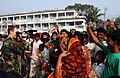
বাংলা: বরগুনা জেলা বাংলাদেশের দক্ষিনাঞ্চলের বরিশাল বিভাগের একটি প্রশাসনিক অঞ্চল। ২০০৭ সালে ঘূর্ণঝড় সিডর-এর আঘাতে সবচেয়ে ক্ষতিগ্রস্ত জেলা।
Deutsch: Barguna ( Bengalisch: ) ist ein Verwaltungsdistrikt im südwestlichen Bangladesch, der innerhalb der Division Barishal liegt.
English: Barguna ( Borguna) is a district in South-western Bangladesh. It is a part of the Barisal Division.
Français : Barguna est un district du Bangladesh. Il est situé dans la division de Barisal. La ville principale est Barguna.
Italiano: Il Distretto di Barguna (in bengalese বরগুনা জেলা, Bargunā jelā) è uno dei 6 distretti della divisione di Barisal, nel Bangladesh meridionale.
Português: Barguna (বরগুনা, em bengali) é um distrito localizado na divisão de Barisal, no sudoeste do Bangladesh. A principal cidade é Barguna.
Română: Barguna este un oraș din Bangladesh.
Русский: Баргуна — округ на юге Бангладеш, в области Барисал. Образован в 1984 году. Административный центр — город Баргуна. Площадь округа — 1831 км². По данным переписи 2001 года население округа составляло 837 955 человек. Уровень грамотности взрослого населения составлял 40,14 %, что немного ниже среднего уровня по Бангладеш (43,1 %). 91,01 % населения округа исповедовало ислам, 8,69 % — индуизм.
Simple English: Barguna is a district in South-western Bangladesh. It is a part of the Barisal Division. It has a total area of 1831.31 km².
Tiếng Việt: Barguna là một huyện thuộc division Barisal, Bangladesh. Huyện này có diện tích 1832 km², dân số năm 2002 là 837955 người, mật độ dân số là 457 người/km².
Winaray : An Barguna amo an usa ka distrito ha nasod han Bangladesh.
district in Bangladesh's Barisal Division  | |||||
| Upload media | |||||
| Pronunciation audio | ⓘ | ||||
|---|---|---|---|---|---|
| Instance of | |||||
| Location | Barisal Division, Bangladesh | ||||
| Capital |
| ||||
| Inception |
| ||||
| Population |
| ||||
| Area |
| ||||
| Elevation above sea level |
| ||||
| official website | |||||
 | |||||
Subcategories
This category has the following 4 subcategories, out of 4 total.
Media in category "Barguna District"
The following 73 files are in this category, out of 73 total.
-
 Barguna (16658301069).jpg 4,859 × 1,763; 937 KB
-
 Barguna Coastal area, Bangladesh (2).jpg 4,733 × 2,917; 1.44 MB
-
 Barguna Coastal area, Bangladesh.jpg 5,184 × 3,456; 1.28 MB
-
 Barguna District 01.jpg 5,184 × 3,456; 768 KB
-
 Barguna District 02.jpg 4,546 × 3,428; 1.31 MB
-
 Barguna District 03.jpg 5,184 × 3,456; 1.14 MB
-
 Barguna District 04.jpg 5,184 × 3,456; 812 KB
-
 Barguna District 05.jpg 3,350 × 4,524; 2.56 MB
-
 Barguna District 06.jpg 3,456 × 5,184; 1.75 MB
-
 Barguna District 07.jpg 4,333 × 3,456; 1.92 MB
-
 Barguna District 08.jpg 5,184 × 3,456; 1.77 MB
-
 Barguna District 09.jpg 3,456 × 5,184; 1.59 MB
-
 Barguna District 10.jpg 3,456 × 5,184; 2.44 MB
-
 Barguna District 11.jpg 3,456 × 5,184; 890 KB
-
 Barguna District 12.jpg 5,126 × 2,157; 1.15 MB
-
 Barguna District 13.jpg 5,184 × 3,456; 2.41 MB
-
 Barguna District 14.jpg 4,995 × 2,659; 1.25 MB
-
 Barguna District 15.jpg 4,213 × 2,384; 858 KB
-
 Barguna District 16.jpg 3,708 × 1,158; 491 KB
-
 Barguna District 17.jpg 5,184 × 3,456; 2.84 MB
-
 Barguna District 18.jpg 4,496 × 2,550; 1.01 MB
-
 Barguna District 19.jpg 4,010 × 3,456; 1.39 MB
-
 Barguna District 20.jpg 4,865 × 2,919; 1.31 MB
-
 Barguna District 21.jpg 5,184 × 3,030; 1.14 MB
-
 Barguna District 22.jpg 4,144 × 2,953; 1.01 MB
-
 Barguna District upazila geocode map - Small Area Atlas Bangladesh.svg 608 × 730; 2.81 MB
-
 Barguna Pouroshoba.jpg 994 × 745; 174 KB
-
 Barguna.jpg 1,280 × 720; 262 KB
-
 Bombax ceiba - Cotton tree - Shimul Flower (2).jpg 3,456 × 5,184; 1.78 MB
-
 Bombax ceiba - Cotton Tree - Shimul Flower.jpg 5,184 × 3,456; 1.63 MB
-
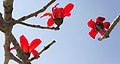 Bombax ceiba - Shimul Flower.jpg 5,184 × 2,746; 720 KB
-
 Clerodendrum viscosum - ভাট ফুল - বনজুঁই (Bn).jpg 5,184 × 3,456; 1.7 MB
-
 Cottage in Barguna Coastal area, Bangladesh (2).jpg 5,050 × 2,416; 1.04 MB
-
 Cottage in Barguna Coastal area, Bangladesh.jpg 4,624 × 2,539; 1.15 MB
-
 Cyclone affected coastal forest in Barguna, Bangladesh.jpg 5,000 × 1,355; 535 KB
-
 Farmer's joy.jpg 3,120 × 3,900; 6 MB
-
 Fishermen at a canal in the Sundarbans.jpg 5,768 × 2,884; 10.56 MB
-
 Fishing boat in Barguna, Bangladesh (2).jpg 3,241 × 3,442; 858 KB
-
 Fishing boat in Barguna, Bangladesh (3) (cropped).jpg 4,430 × 1,263; 1.16 MB
-
 Fishing boat in Barguna, Bangladesh (3).jpg 4,752 × 2,576; 964 KB
-
 Fishing boat in Barguna, Bangladesh.jpg 4,503 × 3,030; 1.17 MB
-
 Fishing boat01.jpg 2,160 × 3,840; 2.59 MB
-
 Foot bridge in the sundarbans.jpg 4,000 × 6,000; 17.51 MB
-
 Gastropoda (Snails) in Barguna, Bangladesh.jpg 5,184 × 3,456; 2.74 MB
-
 Insect love.jpg 1,626 × 2,148; 1.33 MB
-
 Jackfruit (2).jpg 5,184 × 3,456; 1.16 MB
-
 Mangrove tree roots.jpg 4,793 × 2,396; 7.14 MB
-
 Moss on a path.jpg 6,000 × 4,000; 2.88 MB
-
 Radhachura flower.jpg 6,000 × 4,000; 522 KB
-
 Seabirds in Barguna Coastal area (2).jpg 5,160 × 1,165; 652 KB
-
 Seabirds in Barguna Coastal area, Bangladesh (3).jpg 4,184 × 1,530; 761 KB
-
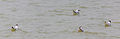
 Seabirds in Barguna Coastal area, Bangladesh.jpg 5,141 × 2,250; 908 KB
-
 Seabirds in Barguna, Bangladesh (4).jpg 3,657 × 1,174; 261 KB
-
 Seabirds in Barguna, Bangladesh (5).jpg 2,799 × 883; 233 KB
-
 Seabirds in Barguna, Bangladesh (6).jpg 2,700 × 769; 205 KB
-
 Shil Koroi tree.jpg 3,996 × 5,595; 20.73 MB
-
 Small Area Atlas of Bangladesh - Barguna Zila.pdf 1,462 × 1,800, 52 pages; 85.5 MB
-
 Sunset at Barguna, Bangladesh (2).jpg 4,756 × 2,487; 511 KB
-
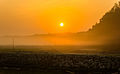 Sunset at Barguna, Bangladesh.jpg 5,184 × 3,215; 765 KB
-
 Uprooted tree in Barguna, Bangladesh.jpg 5,184 × 3,456; 2.93 MB
-

-

-

-

-

-

-
-
-
-
 Village Boy.jpg 3,120 × 3,900; 4.82 MB
-
 দীঘির পাড়,বরগুনা সদর.jpg 3,096 × 4,128; 3.08 MB
-
 বরগুনায় মাছ ধরার নৌকা.jpg 4,020 × 600; 451 KB
-
 সূর্যাস্তের ছবি, বরগুনা সদর.jpg 3,096 × 4,128; 2.81 MB
.jpg)


.jpg)


.jpg)
.jpg)


.jpg)
.jpg)


_in_Barguna,_Bangladesh.jpg)

.jpg)


.jpg)


(Special_Operations_Capable).jpg)
_),_cuts_a_cast_off_a_Bangladeshi_child.jpg)
,_videotapes_Bangladeshi_locals.jpg)


.jpg)
_(cropped).jpg)
.jpg)
.jpg)
.jpg)
.jpg)
.jpg)