Category:Ayr
town and former Royal Burgh situated on the west coast of Ayrshire in Scotland   | |||||
| Upload media | |||||
| Instance of |
| ||||
|---|---|---|---|---|---|
| Location |
| ||||
| Inception |
| ||||
| Population |
| ||||
| Area |
| ||||
| Elevation above sea level |
| ||||
| official website | |||||
 | |||||

Čeština: Ayr (ve skotské gaelštině Inbhir Àir) je přístavní město ležící v jihozápadním Skotsku. Ayr byl královské město od roku 1205 do 1975, dříve centrem bývalého hrabství Ayrshire a nyní Jižního Ayrshiru. Ve městě žije podle sčítání lidu v roce 2001 46 431 obyvatel. Město je známé díky Robertu Burnsovi, skotskému spisovateli a básníkovi.
Dansk: Ayr er en by i det sydvestlige Skotland, med et indbyggertal (pr. 2006) på cirka 46.000. Byen er centrum i countyet South Ayrshire, ved kysten til Atlanterhavet.
Deutsch: Ayr ( gälisch Inbhir Àir) ist eine Stadt im Südwesten von Schottland, am Firth of Clyde gelegen, wo der gleichnamige Fluss Ayr mündet. Sie ist die Hauptstadt der traditionellen Grafschaft Ayrshire und der Verwaltungssitz der Unitary Authority von South Ayrshire. Gemäß dem General Register Office of Scotland betrug im Jahr 2003 die Einwohnerzahl 45.860.
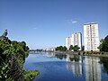
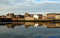
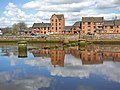
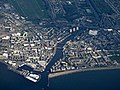
English: Ayr ( Mouth of the River Ayr) is a town and port situated on the Firth of Clyde, in south-west Scotland. With a population of around 46,000, Ayr is the second largest settlement in Ayrshire, of which it is the county town, and has held royal burgh status since 1205. Ayr is the administrative centre of the South Ayrshire council area, which is the unitary local authority.
Español: Ayr (en gaélico escocés Inbhir Àir) es una población situada en el fiordo de Clyde, al sudoeste de Escocia. Se convirtió en "pueblo real" (en inglés Royal Burgh) en el año 1205.
Euskara: Ayr ( Eskoziako gaeleraz: Inbhir Àir), Eskozia hego-mendebaldeko udalerria da, Clydeko fiordoaren ertzean kokatuta. 48.000 biztanle baino gehiago izanik, Ayr Ayrshire konderriko hiriburua eta herririk handiena da.
Français : Ayr (en gaélique écossais, Inbhir Àir) est une ville portuaire située sur le Firth of Clyde, dans le sud-ouest de l'Écosse. La ville a eu le statut de burgh royal de 1205 à 1975 et fut le chef-lieu de l'ancien comté d'Ayrshire. Ayr est le centre administratif du South Ayrshire Council. Au recensement de 2001, la population de la ville s'élevait à 46 431 habitants. En 2002, elle fut l'une des quatre villes écossaises en compétition pour accueillir le jubilé d'or de la reine Élisabeth II (rôle qui fut attribué à Stirling).
Gàidhlig: 'S e baile ann a deas na h- Alba a th' ann an Inbhir Àir (Beurla:Ayr). Tha an ath ann an deas de Inbhir Àir baile beag agus iomall baile, Allmhaigh, ceangailte ri Raibeart Burns. Tha am prìomh-oifis do Chomhairle Shiorrachd Àir a Deas ann agus bha prìomh-oifis do Shiorrachd Inbhir Àir ann. Tha e faisg air Preastabhaig agus am Port Adhair Preastabhaig.
Galego: Ayr (gaélico escocés: Inbhir Àir) é unha vila de Escocia, localízase no esteiro de Clyde. Capital da da rexión de Sur Ayrshire. Conta con 60.830 habitantes.
日本語: エア(別表記:エアー、 英語・スコットランド語:Ayr、スコットランド・ゲール語:Inbhir Àir)は、スコットランド南西部のサウス・エアシャイア(サウス・エアシャー)にある都市。州都でもある。
Nederlands: Ayr is een havenstad gelegen aan de Firth of Clyde in het zuidwesten van Schotland
Norsk bokmål: Ayr er administrasjonsbyen i South Ayrshire i det sørvestlige Skottland. Den ligger ved Firth of Clyde. Byen hadde i 2001 46 432 innbyggere.
Русский: Эйр — город в юго-западной части Шотландии, административный центр области Южный Эйршир. Расположен на берегу залива Ферт-оф-Клайд.
Subcategories
This category has the following 22 subcategories, out of 22 total.
A
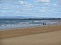
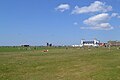
- Ayr Beach (79 F)
B
- Butlins Ayr (21 F)
C
- Coat of arms of Ayr (7 F)
D
- Douglas, Heron & Company (1 F)
F
- Falkland Yard, Ayr (1 F)
H
- Heads Of Ayr Farm Park (169 F)
M
P
- Postcards of Ayr (1 F)
R
- Rozelle House Galleries (112 F)
- Rozelle Park, Ayr (249 F)
S
- Slaphouse Burn (3 F)
Media in category "Ayr"
The following 200 files are in this category, out of 413 total.
(previous page) (next page)-
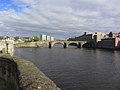
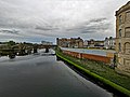
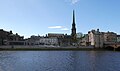
 (NS3322) - Ayr river bridges and Town Hall spire.jpg 1,600 × 1,066; 353 KB
-
 AyrMontage.jpg 397 × 564; 291 KB
-
 A day out in Ayr (27539312127).jpg 4,160 × 3,120; 3.24 MB
-
 A day out in Ayr (28533854688).jpg 4,160 × 3,120; 3.56 MB
-
 A day out in Ayr (41686696834).jpg 4,160 × 3,120; 3.43 MB
-
 A new public events space - geograph.org.uk - 7124590.jpg 800 × 558; 123 KB
-

-
 A77 South (Holmston Roundabout, Ayr) - geograph.org.uk - 344551.jpg 640 × 481; 135 KB
-
 Across The River Ayr - geograph.org.uk - 3786114.jpg 640 × 400; 64 KB
-
 Admiralty Chart No 2494 Ayr to Ardrossan, Published 1941.jpg 8,363 × 12,172; 26.75 MB
-
 After The Flood - geograph.org.uk - 1008192.jpg 640 × 474; 94 KB
-
 Andy Wilson Try.png 983 × 590; 1.28 MB
-
 Arran View - geograph.org.uk - 5626639.jpg 640 × 401; 73 KB
-
 Auchencruive ice pond.JPG 2,288 × 1,712; 1.32 MB
-
 Auld Bridge over the River Ayr - geograph.org.uk - 6441966.jpg 2,048 × 1,536; 1.7 MB
-
 Auld Brig, Ayr - geograph.org.uk - 7753930.jpg 2,624 × 1,968; 3.17 MB
-
 Auld Brig, Ayr - geograph.org.uk - 7753985.jpg 2,624 × 1,968; 3.22 MB
-
 Auld Brig, Ayr - geograph.org.uk - 7754018.jpg 2,624 × 1,968; 3.08 MB
-
 Auld Brig, Ayr - geograph.org.uk - 7754020.jpg 2,624 × 1,968; 3.23 MB
-
 Auld Brig, Ayr - geograph.org.uk - 7754099.jpg 2,624 × 1,968; 3.19 MB
-
 Auld Brig, Ayr - geograph.org.uk - 7754145.jpg 2,624 × 1,968; 3.21 MB
-
 Auld Brig, Ayr, South Ayrshire - geograph.org.uk - 7958290.jpg 1,600 × 992; 421 KB
-
 Auld Kirk of Ayr, Interior.jpg 4,000 × 3,000; 4.56 MB
-
 Auld's Bakers - Ayr - geograph.org.uk - 6036785.jpg 1,600 × 1,067; 1.36 MB
-
 Autumn at Dobbies, Ayr - geograph.org.uk - 5942328.jpg 2,895 × 1,881; 1.22 MB
-
 Autumn at Dobbies, Ayr - geograph.org.uk - 5942329.jpg 2,928 × 1,881; 1.26 MB
-
 Autumn at Kings Court Car Park, Ayr - geograph.org.uk - 5193632.jpg 1,920 × 1,280; 1.95 MB
-
 Autumn at Kings Court, Ayr - geograph.org.uk - 5193336.jpg 1,920 × 1,280; 2.33 MB
-
 Ayr (Scottish Parliament constituency).svg 336 × 262; 71 KB
-
 Ayr - 1972 - geograph.org.uk - 3290040.jpg 1,515 × 2,272; 705 KB
-

-
 AYR - panoramio (11).jpg 4,608 × 3,456; 4.49 MB
-
 AYR - panoramio (13).jpg 4,608 × 3,456; 4.13 MB
-
 AYR - panoramio (14).jpg 4,608 × 3,456; 4.85 MB
-
 AYR - panoramio (17).jpg 4,608 × 3,456; 4.49 MB
-
 AYR - panoramio (19).jpg 4,608 × 3,456; 4.07 MB
-
 AYR - panoramio (20).jpg 4,608 × 3,456; 4.18 MB
-
 AYR - panoramio (21).jpg 4,608 × 3,456; 4.86 MB
-
 AYR - panoramio (26).jpg 3,223 × 2,078; 1.82 MB
-
 AYR - panoramio (27).jpg 4,608 × 3,456; 4.05 MB
-
 AYR - panoramio (29).jpg 4,608 × 3,456; 6.58 MB
-
 AYR - panoramio (3).jpg 4,608 × 3,456; 4.76 MB
-
 AYR - panoramio (32).jpg 4,608 × 3,456; 4.71 MB
-
 AYR - panoramio (4).jpg 4,608 × 3,456; 6.63 MB
-
 AYR - panoramio (40).jpg 4,608 × 3,456; 5.09 MB
-
 AYR - panoramio (42).jpg 4,608 × 3,456; 4.61 MB
-
 AYR - panoramio (5).jpg 4,510 × 3,382; 3.85 MB
-
 AYR - panoramio (6).jpg 4,608 × 3,456; 3.91 MB
-
 AYR - panoramio (7).jpg 4,608 × 3,456; 3.93 MB
-
 Ayr - River St ^ Auld Brig - geograph.org.uk - 3747969.jpg 1,024 × 768; 191 KB
-
 Ayr - View upstream along R Ayr to Auld Brig - geograph.org.uk - 3747966.jpg 1,024 × 768; 139 KB
-
 Ayr B Ward Map 2011.svg 481 × 868; 52 KB
-
 Ayr Beach Park (1) (27542535347).jpg 4,608 × 3,072; 5.25 MB
-
 Ayr Beach Park (2) (41510441695).jpg 4,608 × 3,072; 5.5 MB
-
 Ayr Beach Park (3) (27542345227).jpg 4,608 × 3,072; 5.1 MB
-
 Ayr Beach Park (4) (27542501807).jpg 4,608 × 3,072; 4.66 MB
-
 Ayr Beach Park (5) (27542474867).jpg 4,608 × 3,072; 4.99 MB
-
 Ayr Beach Park (6) (28539797678).jpg 4,608 × 3,072; 4.2 MB
-
 Ayr Bus Station (27542430837).jpg 4,608 × 3,072; 5.69 MB
-
 Ayr Central Shopping Centre (41510004485).jpg 4,608 × 3,072; 5.52 MB
-
 Ayr Chart.png 467 × 403; 18 KB
-
 Ayr Corporation Tramways.jpg 600 × 600; 91 KB
-
 Ayr from the air (geograph 6100952).jpg 1,024 × 768; 414 KB
-
 Ayr Harbour from the New Bridge - geograph.org.uk - 6871599.jpg 800 × 423; 90 KB
-
 Ayr Harbour view - geograph.org.uk - 7929018.jpg 800 × 489; 104 KB
-
 Ayr Hospital entrance - geograph.org.uk - 63609.jpg 640 × 424; 87 KB
-
 Ayr League Winners Photo.jpg 2,048 × 1,536; 1.6 MB
-
 Ayr Old Bridge from New Bridge Street - geograph.org.uk - 7737301.jpg 2,110 × 1,422; 890 KB
-
 Ayr pier - panoramio.jpg 3,456 × 2,304; 5.06 MB
-
 Ayr Pier 1907.jpg 2,451 × 1,560; 1.01 MB
-
 Ayr ScottishParliamentConstituency.PNG 1,556 × 1,213; 61 KB
-
 Ayr Sea Front (North of Ayr Harbour) - geograph.org.uk - 1112665.jpg 640 × 480; 67 KB
-
 Ayr Seafront Flats - geograph.org.uk - 4096454.jpg 640 × 340; 44 KB
-
 Ayr Town Centre (2) (41689524404).jpg 4,608 × 3,072; 5.16 MB
-
 Ayr Town Centre (27542364487).jpg 4,608 × 3,072; 4.67 MB
-
 Ayr Town Centre (3) (41510164525).jpg 4,608 × 3,072; 4.71 MB
-
 Ayr Town Centre (4) (41689491544).jpg 4,608 × 3,072; 4.48 MB
-
 Ayr Town Centre (41509963965).jpg 4,608 × 3,072; 5.05 MB
-
 Ayr Town Centre (42363021552).jpg 4,608 × 3,072; 5.45 MB
-
 Ayr Town Centre (42413044021).jpg 4,608 × 3,072; 4.7 MB
-
 Ayr Town Centre (42413109101).jpg 4,608 × 3,072; 4.38 MB
-
 Ayr Town Centre (5) (40604608420).jpg 4,608 × 3,072; 4.02 MB
-
 Ayr Town Centre (7) (41689299994).jpg 4,608 × 3,072; 5.35 MB
-
 Ayr Town Centre - geograph.org.uk - 557042.jpg 640 × 480; 85 KB
-
 Ayr Town Centre Redevelopment - geograph.org.uk - 5548199.jpg 640 × 440; 67 KB
-
 Ayr Town Centre, South Ayrshire - geograph.org.uk - 7958248.jpg 1,600 × 1,036; 292 KB
-
 Ayr UK Chart.png 488 × 428; 18 KB
-
 Ayr Yeo Badge.png 205 × 161; 20 KB
-

-

-
 Ayr, 2-4 River Terrace.jpg 4,950 × 3,284; 3.59 MB
-
 Ayr, 3 Craigweil Road, Youth Hostel.jpg 4,950 × 3,284; 1.8 MB
-
 Ayr, Carrick and Cumnock UK Chart.png 464 × 341; 15 KB
-
 Ayr, divided by the River Ayr - geograph.org.uk - 4146539.jpg 3,264 × 2,448; 2.97 MB
-
 Ayr, River Ayr. View upstream from the Auld Brig.jpg 4,896 × 2,752; 2.64 MB
-
 Ayr-02-2009-gje.jpg 3,072 × 2,048; 2.32 MB
-
 Ayr-04-2009-gje.jpg 1,719 × 2,604; 1.5 MB
-
 Ayr-08-2009-gje.jpg 2,028 × 2,712; 2.8 MB
-
 Ayr-Scotland (Location).png 553 × 933; 177 KB
-
 Ayrshire Ayr 2.jpg 3,968 × 2,976; 7.31 MB
-
 Ayrshire Ayr 3.jpg 4,608 × 3,456; 8.51 MB
-
 Ayrshire Farmers' Market - geograph.org.uk - 1034043.jpg 640 × 480; 96 KB
-
 Ayr’s Auld Bridge - geograph.org.uk - 7929002.jpg 800 × 462; 70 KB
-
 Ayr’s New Bridge - geograph.org.uk - 7929015.jpg 800 × 524; 139 KB
-
 Bath Place, Ayr - geograph.org.uk - 6956611.jpg 2,976 × 1,984; 2.52 MB
-
 Beach, Ayr - geograph.org.uk - 1587305.jpg 640 × 480; 66 KB
-
 Belleisle Golf Course, South Ayrshire.jpg 1,920 × 1,013; 718 KB
-
 Beside The River Ayr - geograph.org.uk - 5890311.jpg 640 × 348; 67 KB
-
 Big clouds over Newton-on-Ayr - geograph.org.uk - 7065314.jpg 800 × 561; 84 KB
-
 Bird's-Eye View of Fullarton Street (Geograph).jpg 640 × 445; 99 KB
-
 Bird, forest.jpg 2,322 × 4,128; 3.8 MB
-
 Blackburn Drive, Ayr - geograph.org.uk - 4768179.jpg 2,560 × 1,920; 3.11 MB
-
 Blackfriars Court, Ayr - geograph.org.uk - 1020544.jpg 640 × 482; 72 KB
-
 Blackfriars Walk - geograph.org.uk - 1020530.jpg 640 × 486; 76 KB
-
 Cattle market entrance - geograph.org.uk - 178752.jpg 640 × 480; 54 KB
-
 Centranthus ruber or Red Valerian on walling at at Ayr Citadel.JPG 3,553 × 2,809; 5.22 MB
-
 Cliffside,ayr.jpg 2,322 × 4,128; 3.46 MB
-
 Cloverhill - geograph.org.uk - 588230.jpg 640 × 470; 116 KB
-
 Corsehill Park - geograph.org.uk - 365258.jpg 640 × 482; 215 KB
-
 Credit Crunched^ - geograph.org.uk - 1034072.jpg 640 × 464; 95 KB
-
 Cromwell's Wall - geograph.org.uk - 1179077.jpg 640 × 444; 115 KB
-
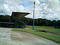 Dam park Grandstand.jpg 500 × 374; 100 KB
-
 Dam park Track and Field.jpg 131 × 175; 3 KB
-
 Debenhams, Ayr - NS3321 - geograph 5538533.jpg 2,548 × 1,647; 577 KB
-
 Demolishing Ayr’s riverside flats - geograph.org.uk - 7361805.jpg 800 × 535; 130 KB
-
 Demolition of Riverside Place - geograph.org.uk - 8148798.jpg 768 × 1,024; 190 KB
-
 Dog ayr.jpg 2,322 × 4,128; 6.4 MB
-
 Down The River - geograph.org.uk - 579091.jpg 640 × 483; 94 KB
-
 Duck family on the water near the sands - geograph.org.uk - 170628.jpg 640 × 426; 113 KB
-
 Ellisland Square - geograph.org.uk - 3290712.jpg 1,600 × 1,200; 497 KB
-
 Esplanade - panoramio - Alexander Reuss.jpg 2,048 × 1,536; 1.84 MB
-
 Evening at Ayr Beach - geograph.org.uk - 1513795.jpg 640 × 518; 50 KB
-
 Fishing boats returning to Ayr, 1970 - geograph.org.uk - 6871636.jpg 640 × 413; 73 KB
-
 Footpath to River Street - geograph.org.uk - 7753991.jpg 2,624 × 1,968; 3.33 MB
-
 Forehill Primary School.jpg 1,170 × 713; 253 KB
-
 Former BHS Building, Ayr, South Ayrshire - geograph.org.uk - 7958282.jpg 1,600 × 1,119; 492 KB
-
 Funfair (16989453602).jpg 5,184 × 3,456; 3.96 MB
-
 Garden at River Terrace, Ayr - geograph.org.uk - 5193556.jpg 1,920 × 1,280; 2.28 MB
-
 Going....going.... - geograph.org.uk - 1086145.jpg 640 × 480; 135 KB
-
 Greenan Farm - geograph.org.uk - 249795.jpg 640 × 480; 123 KB
-
 Greenan Farm, near Ayr - geograph.org.uk - 249790.jpg 640 × 480; 151 KB
-
 Greenan Shore with frost and ice - geograph.org.uk - 1638018.jpg 640 × 480; 65 KB
-
 Gulls in a Row - geograph.org.uk - 6006807.jpg 1,859 × 2,852; 558 KB
-
 Half Mile Burn - sea outlet, Newton-on-Ayr promenade.jpg 4,536 × 3,360; 5.73 MB
-
 Half Mile Burn outflow, Newton-on-Ayr.jpg 4,568 × 3,402; 4.65 MB
-
 Harbour Development - geograph.org.uk - 384365.jpg 640 × 480; 72 KB
-
 Harbourside apartments - geograph.org.uk - 1574148.jpg 640 × 480; 118 KB
-
 High Street, Ayr - geograph.org.uk - 7753988.jpg 2,624 × 1,968; 3.22 MB
-
 Horses At Mainholm - geograph.org.uk - 579064.jpg 640 × 472; 106 KB
-
 Ice on the River Ayr - geograph.org.uk - 7361807.jpg 800 × 588; 162 KB
-
 In the playground (258812155).jpg 2,048 × 1,536; 850 KB
-
 Leisure Center In Ayr - panoramio.jpg 2,003 × 1,245; 1.35 MB
-
 Living On The Beach - panoramio.jpg 1,975 × 1,278; 1.43 MB
-
 Long Rue - geograph.org.uk - 3344040.jpg 640 × 442; 70 KB
-
 Long Rue - geograph.org.uk - 978028.jpg 640 × 480; 74 KB
-
 Low Green Ayr - geograph.org.uk - 1396470.jpg 640 × 480; 75 KB
-
 Low Tide on Ayr Beach - geograph.org.uk - 1007302.jpg 640 × 428; 40 KB
-
 New Bridge Street, Ayr - geograph.org.uk - 7753984.jpg 2,624 × 1,968; 2.92 MB
-
 New Bridge, Ayr - geograph.org.uk - 7753922.jpg 2,624 × 1,968; 3.24 MB
-
 New Bridge, Ayr - geograph.org.uk - 7753924.jpg 2,624 × 1,968; 3.03 MB
-
 New Bridge, Ayr - geograph.org.uk - 7754004.jpg 2,624 × 1,968; 3.2 MB
-
 New Bridge, Ayr - geograph.org.uk - 7754021.jpg 2,624 × 1,968; 3.2 MB
-
 New Bridge, Ayr - geograph.org.uk - 7754096.jpg 2,624 × 1,968; 3.06 MB
-
 New Bridge, Ayr - geograph.org.uk - 7754149.jpg 2,624 × 1,968; 3.24 MB
-
 New Bridge, Ayr - geograph.org.uk - 7754150.jpg 2,624 × 1,968; 3.18 MB
-
 New Bridge, Ayr, South Ayrshire - geograph.org.uk - 7958285.jpg 1,600 × 948; 300 KB
-
 New Map of the Ayr clan post-expansion..jpg 1,401 × 1,138; 174 KB
-
 New Plaza at Ayr - geograph.org.uk - 7753987.jpg 2,624 × 1,968; 3.09 MB
-
 New Plaza at Ayr - geograph.org.uk - 7753999.jpg 2,624 × 1,968; 3.18 MB
-
 New Plaza at Ayr - geograph.org.uk - 7754151.jpg 2,510 × 1,833; 824 KB
-
 New riverside square - geograph.org.uk - 7890819.jpg 1,024 × 683; 166 KB
-
 Newton Loch site, old Sanquhar Farm, Newton-on-Ayr.jpg 4,536 × 3,358; 5.35 MB
-
 Newton Loch site, Sanquhar Farm, Newton-on-Ayr.jpg 4,604 × 3,450; 7.22 MB
-
 Newton Loch, Sanquhar Farm, Newton-on-Ayr.jpg 4,130 × 2,276; 3.21 MB
-
 Newton Loch.jpg 1,122 × 802; 602 KB
-
 No Coastal Path Walkers Today - geograph.org.uk - 3752367.jpg 640 × 444; 76 KB
-
 North Ayr from the air - geograph.org.uk - 1731623.jpg 912 × 684; 101 KB
-
 NS3220 - After sun-down at Ayr.jpg 800 × 491; 86 KB
-
 NS3322 - A new events space in Ayr.jpg 800 × 525; 108 KB
-
 NS3322 - Ayr Town Centre, South Ayrshire.jpg 1,024 × 663; 130 KB
-
 NS3322 - New Plaza at Ayr (2).jpg 2,624 × 1,968; 3.28 MB
-
 NS3322 - New Plaza at Ayr.jpg 1,023 × 604; 126 KB
-
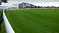 NS3422 - Ayr Racecourse.jpg 1,024 × 578; 209 KB
-
-
 Old bridge & Gate house, Belleisle Park, South Ayrshire, Scotland.jpg 1,699 × 917; 779 KB
-
 Old I.M Lewis Map of the Ayr clan settlement, 1931..png 823 × 745; 572 KB
-
 Old Lochside Road, Newton Loch, Newton-on-Ayr.jpg 4,590 × 3,434; 6.32 MB
-
 Old Toll, near Ayr - geograph.org.uk - 63631.jpg 640 × 424; 59 KB
-
 On the Auld Brig - geograph.org.uk - 1682212.jpg 640 × 480; 94 KB
-
 Ordnance Survey One-Inch Sheet 67 Ayr, Published 1964 2.jpg 8,940 × 10,712; 20.03 MB
-
 Ordnance Survey One-Inch Sheet 67 Ayr, Published 1964.jpg 8,489 × 9,865; 11.31 MB
-
 Ordnance Survey One-Inch Sheet 78 Kilmarnock & Ayr, Published 1925.jpg 12,243 × 9,307; 21.46 MB
-
 Ordnance Survey Quarter-inch sheet 2 Scotland south-west, published 1946.jpg 15,110 × 10,911; 17.48 MB
-
 Ordnance Survey Town Plans Ayr Motherwell Glasgow, Published 1948.jpg 2,700 × 3,650; 1.18 MB
-
 Place De Saint-Germain-en-Laye, Ayr - geograph.org.uk - 1417281.jpg 640 × 480; 142 KB
-
 Ramsey Gardens, Ayr - geograph.org.uk - 7754146.jpg 2,624 × 1,968; 3.17 MB
-
 Reflections On The River - geograph.org.uk - 579084.jpg 423 × 600; 70 KB
-
 Riders on Ayr Beach - geograph.org.uk - 1005202.jpg 640 × 324; 44 KB
-
 River Ayr - geograph.org.uk - 1682214.jpg 640 × 480; 60 KB
-
 River Ayr - geograph.org.uk - 2793999.jpg 1,600 × 1,200; 415 KB
_-_Ayr_river_bridges_and_Town_Hall_spire.jpg)

.jpg)
.jpg)
.jpg)


_-_geograph.org.uk_-_344551.jpg)


.svg)


.jpg)
.jpg)
.jpg)
.jpg)
.jpg)
.jpg)
.jpg)
.jpg)
.jpg)
.jpg)
.jpg)
.jpg)
.jpg)
.jpg)
.jpg)
.jpg)
.jpg)
.jpg)


_(27542535347).jpg)
_(41510441695).jpg)
_(27542345227).jpg)
_(27542501807).jpg)
_(27542474867).jpg)
_(28539797678).jpg)
.jpg)
.jpg)


.jpg)


_-_geograph.org.uk_-_1112665.jpg)

_(41689524404).jpg)
.jpg)
_(41510164525).jpg)
_(41689491544).jpg)
.jpg)
.jpg)
.jpg)
.jpg)
_(40604608420).jpg)
_(41689299994).jpg)


.png)


.jpg)


.jpg)


.jpg)


.jpg)


