Category:Awaji Island
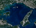
Seto Inland Sea Island  Satelitní fotografie z prosince 2010  | |||||
| Upload media | |||||
| Instance of | |||||
|---|---|---|---|---|---|
| Location | Seto Inland Sea, Osaka Prefecture, Japan | ||||
| Located in or next to body of water | |||||
| Capital | |||||
| Width |
| ||||
| Length |
| ||||
| Highest point | |||||
| Population |
| ||||
| Area |
| ||||
| Elevation above sea level |
| ||||
 | |||||
العربية: أواجي (جزيرة)
Dansk: Avaji
Esperanto: Aŭaĝi
日本語: 淡路島
한국어: 아와지 섬
Lietuvių: Avadžis
Русский: Авадзи (остров)
ไทย: เกาะอะวะจิ
Українська: Авадзі
中文:淡路島
Subcategories
This category has the following 13 subcategories, out of 13 total.
A
- Awaji Onions (27 F)
- Awaji Roof Tiles (7 F)
C
M
- Maps of Awaji Island (10 F)
N
- Narugashima Island (9 F)
S
V
Y
Media in category "Awaji Island"
The following 34 files are in this category, out of 34 total.
-
 Apollon AAAL.jpg 2,400 × 1,636; 812 KB
-
 Awaji chicken Bajiru Sand.jpg 3,264 × 2,448; 3.21 MB
-
 Awaji Island milk.JPG 1,536 × 2,304; 1.49 MB
-
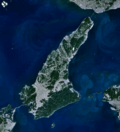
 Awaji island.jpg 639 × 639; 140 KB
-
 Awaji Onion.JPG 3,264 × 2,448; 3.56 MB
-
 Awaji, Japan.jpg 2,048 × 1,280; 948 KB
-
 Awaji-island 1.png 903 × 995; 372 KB
-
 Customers to gather Bussan facility during Golden Week.JPG 2,304 × 1,728; 1.86 MB
-
 Ferrysouthern nal.jpg 3,872 × 2,592; 3.55 MB
-
 Fuki2 3 Nishiawajiline.jpg 3,008 × 2,000; 1.1 MB
-
 Fuki5 8 Nishiawajiline.jpg 2,483 × 1,627; 817 KB
-
 Harima-Nada 1.png 1,203 × 921; 755 KB
-
 Hikari2 Fukekaiun.jpg 1,600 × 1,061; 344 KB
-
 HinaseMaru SetouchiKankoKisen Tsuna 19960615.jpg 2,400 × 1,655; 552 KB
-
 Infinity pool - villa-mon-temps,Awaji.jpg 2,946 × 1,810; 1.22 MB
-
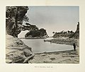
 Kusakabe Kimbei 1218 Awaji-Shima.JPG 820 × 643; 264 KB
-
 Naruto Strait NASA WorldWind Outflow.jpg 1,024 × 658; 89 KB
-
 Nushima gyokou.jpg 1,600 × 1,064; 770 KB
-
 Oge Coast 20160505-2.JPG 3,145 × 2,359; 2.41 MB
-
 Oge Coast 20160505.JPG 3,221 × 2,416; 2.04 MB
-
 Oishinohana.jpg 5,058 × 3,372; 2.15 MB
-
 Oishiyamahorui 1.jpg 3,284 × 2,436; 5.59 MB
-
 Shizukiport.jpg 4,928 × 3,264; 6.06 MB
-
 Suzuranmaru Bantanrenrakukisen.jpg 2,400 × 1,624; 1.01 MB
-
 Tomoya2011-ProfileLogo.png 1,108 × 1,107; 455 KB
-
 Tsunaport koshienferry.jpg 4,928 × 3,264; 6.73 MB
-
 Typhoon Talas – The way home.jpg 1,024 × 680; 189 KB
-
 View of Awaji-shima, Inland Sea (3110695678).jpg 760 × 647; 61 KB
-
 Wakatsurumaru Awajiferryboat.jpg 2,400 × 1,647; 1.05 MB
-
 WUL-he02 08100 0096 淡路島.pdf 4,033 × 2,683, 10 pages; 2.36 MB
-
 Yura district and Yura bay lagoon Aerial photograph.2020.jpg 5,518 × 7,593; 21.57 MB
-
 成ヶ島img357.jpg 1,280 × 778; 248 KB
-
 須磨浦 - Flickr - m-louis.jpg 5,525 × 3,683; 5.89 MB
-
 高い低い 深い浅い 厚い薄い 強い弱い 多い少ない (4812049927).jpg 1,600 × 1,200; 704 KB


.jpg)
.jpg)