Category:ArcGIS
geographic information system maintained by Esri   | |||||
| Upload media | |||||
| Instance of |
| ||||
|---|---|---|---|---|---|
| Copyright license |
| ||||
| Has use |
| ||||
| Collection |
| ||||
| Developer | |||||
| Platform | |||||
| Operating system | |||||
| Software version identifier |
| ||||
| Inception |
| ||||
| Replaces |
| ||||
| official website | |||||
| |||||
Subcategories
This category has the following 4 subcategories, out of 4 total.
Media in category "ArcGIS"
The following 15 files are in this category, out of 15 total.
-
 2012 SOTM (8091896729).jpg 4,288 × 2,848; 6.18 MB
-
 ArcGIS globe (cropped).png 600 × 600; 185 KB
-
 ArcGIS globe (cropped).svg 259 × 259; 13 KB
-
 ArcGIS globe.png 945 × 945; 194 KB
-
 ArcGIS-Extension 1.jpg 400 × 243; 32 KB
-
 Arcgis-logo-128.png 128 × 128; 5 KB
-
 ArcGIS10.2.png 847 × 529; 460 KB
-
 ArcINFO Coverage.svg 990 × 765; 134 KB
-
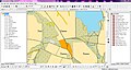
 ArcMap 10.3 screenshot.png 1,920 × 1,160; 1.46 MB
-
 ASCII grid example.svg 210 × 330; 3 KB
-
 GIP Detailansicht Wien, Kreuzung Schottenring-Börsegasse.png 1,500 × 911; 715 KB
-
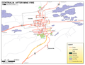 PA CENTRALIA NEW.PNG 3,300 × 2,550; 420 KB
-
 PA CENTRALIA OLD b.jpg 3,300 × 2,550; 2.86 MB
-
 PA CENTRALIA OLD.PNG 3,300 × 2,550; 388 KB
-
 Rastr.JPG 1,365 × 727; 195 KB
.jpg)
.png)
.svg)


