Category:Ammassalik Island
island in Greenland  | |||||
| Upload media | |||||
| Instance of | |||||
|---|---|---|---|---|---|
| Location | Sermersooq, Greenland | ||||
| Located in or next to body of water | |||||
| Capital | |||||
| Width |
| ||||
| Length |
| ||||
| Population |
| ||||
| Area |
| ||||
| Different from | |||||
 | |||||
Subcategories
This category has the following 9 subcategories, out of 9 total.
K
M
N
- Nature of Ammassalik Island (329 F)
P
- Polhem Fjeld (126 F)
Q
- Qaqqartivakajik (11 F)
S
- Sermilik Station (38 F)
- Sivinganeq (13 F)
T
V
- Vegas Fjeld (8 F)
Media in category "Ammassalik Island"
The following 25 files are in this category, out of 25 total.
-
 20190625 E.Nielsenvej 9822 (48478142542).jpg 5,304 × 7,952; 26.6 MB
-
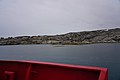 20190627 Tini Havn 1882 (48493664857).jpg 7,952 × 5,304; 23.25 MB
-
 20190627 Tini Havn 1886 (48493491821).jpg 7,952 × 5,304; 25.31 MB
-
 20190627 Tini Havn 1888 (48493490151).jpg 7,952 × 5,304; 20.88 MB
-
 20190627 Tini Havn 1896 (48493485511).jpg 7,952 × 5,304; 18.63 MB
-
 20190627 Tini Havn 1897 (48493485176).jpg 7,952 × 5,304; 22.84 MB
-
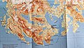 20190628 TasiilaqMap 1880 (48495549192).jpg 3,984 × 2,275; 3.8 MB
-
 Ammassalik 13.jpg 6,000 × 4,000; 5.42 MB
-
 Ammassalik 24.jpg 6,000 × 4,000; 11.75 MB
-
 Ammassalik 39.jpg 6,000 × 4,000; 11.39 MB
-
 Ammassalik-island.jpg 3,872 × 2,176; 4.08 MB
-
 Angmagssalik map.jpg 9,267 × 6,963; 16.68 MB
-
 Angmagssalik map.tiff 9,267 × 6,963, 2 pages; 184.84 MB
-
 Angmagssalik.png 9,267 × 6,963; 95.47 MB
-
 Greenland Glaciers outside of Ammassalik (5562580093).jpg 4,272 × 2,848; 7.14 MB
-
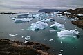
 Iceberg near Ammassalik - East Greenland1.jpg 4,683 × 2,634; 6.24 MB
-
 KRABBE(33) Greenland. Summer tents at Ammassalik (9665015564).jpg 4,642 × 3,361; 1.84 MB
-
 KRABBE(34) Greenland. Women’s boats and kayaks near Ammassalik (9661781579).jpg 4,642 × 3,361; 1.84 MB
-
 KRABBE(35) Greenland. Kayaks near Ammassalik (9661781823).jpg 4,663 × 3,413; 1.23 MB
-
 KRABBE(36) Greenland. Salmon trout fishing at Ammassalik (10976009084).jpg 4,694 × 3,382; 1.44 MB
-
 Sermilik 10.jpg 6,000 × 4,000; 6.41 MB
-
 Sermilik 13.jpg 6,000 × 4,000; 7.31 MB
-
 Sermilik 15.jpg 6,000 × 4,000; 6.76 MB
-
 Sermilik 22.jpg 6,000 × 4,000; 5.83 MB
-
 Valley on Ammassalik Island, East Greenland - 45749718464.jpg 6,000 × 3,375; 11.99 MB
.jpg)
.jpg)
.jpg)
.jpg)
.jpg)
.jpg)
.jpg)


.jpg)

_Greenland._Summer_tents_at_Ammassalik_(9665015564).jpg)
_Greenland._Women’s_boats_and_kayaks_near_Ammassalik_(9661781579).jpg)
_Greenland._Kayaks_near_Ammassalik_(9661781823).jpg)
_Greenland._Salmon_trout_fishing_at_Ammassalik_(10976009084).jpg)


