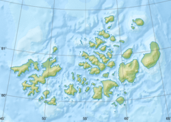
"Fayl:Relief Map of Franz Josef Land.png" üçün qlobal istifadə
Bu səhifə faylın digər vikilərdə harada istifadə edildiyini göstərir. Siz həmçinin bu məlumatı faylın təsviri səhifəsinin altında tapa bilərsiniz.

az.wikipedia.org layihəsində istifadəsi
- Şablon:Arxipelaq
- Şablon:Arxipelaq/doc
- Şablon:Ada
- Şablon:Ada/doc
- Frans-İosif Torpağı
- Şablon:Yer xəritəsi Rusiya Frans-İosif Torpağı
- Pontremoli adaları
be.wikipedia.org layihəsində istifadəsi
cs.wikipedia.org layihəsində istifadəsi
cv.wikipedia.org layihəsində istifadəsi
de.wikipedia.org layihəsində istifadəsi
- Hayes-Insel
- Wilczek-Insel
- Wilczekland
- Rudolf-Insel
- Graham-Bell-Insel
- Hall-Insel (Franz-Josef-Land)
- Alexandraland
- Prinz-Georg-Land
- Koldewey-Insel
- Wiener-Neustadt-Insel
- Hohenlohe-Insel
- Northbrook-Insel
- Hooker-Insel
- Eva-Liv-Insel
- Jackson-Insel
- Champ-Insel
- Alger-Insel
- Vorlage:Positionskarte Franz-Josef-Land
- Ziegler-Insel
- Salisbury-Insel
- McClintock-Insel
- Perlmutt-Insel
- Arthur-Insel
- La-Ronciere-Insel
- Bell-Insel
- Mabel-Insel
- Becker-Insel
- Greely-Insel
- Salm-Insel
- Kane-Insel
- Kuhn-Insel (Franz-Josef-Land)
- Karl-Alexander-Insel
- Hoffmann-Insel
- Lütke-Insel
- Brosch-Insel
- Hochstetter-Inseln