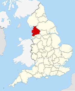
"Fayl:Lancashire UK locator map 2010.svg" üçün qlobal istifadə
Bu səhifə faylın digər vikilərdə harada istifadə edildiyini göstərir. Siz həmçinin bu məlumatı faylın təsviri səhifəsinin altında tapa bilərsiniz.

af.wikipedia.org layihəsində istifadəsi
ar.wikipedia.org layihəsində istifadəsi
arz.wikipedia.org layihəsində istifadəsi
ast.wikipedia.org layihəsində istifadəsi
az.wikipedia.org layihəsində istifadəsi
be-tarask.wikipedia.org layihəsində istifadəsi
be.wikipedia.org layihəsində istifadəsi
bg.wikipedia.org layihəsində istifadəsi
br.wikipedia.org layihəsində istifadəsi
ca.wikipedia.org layihəsində istifadəsi
ceb.wikipedia.org layihəsində istifadəsi
cs.wikipedia.org layihəsində istifadəsi
de.wikivoyage.org layihəsində istifadəsi
en.wikipedia.org layihəsində istifadəsi
- Lancashire
- National nature reserves in Lancashire
- Grit Fell
- Wolfhole Crag
- Fair Snape Fell
- Leyland Hundred
- Lonsdale Hundred
- Knott End-on-Sea
- Great Altcar
- Trawden
- Plungington
- White Hill (Forest of Bowland)
- Hawthornthwaite Fell
- Gambleside
- Brownhill
- Catforth
- Over Wyre
- Oakenshaw, Lancashire
- Langho
- River Tawd
- Downholland Cross
- Haskayne
- Farington
- Salwick
- Barrow Nook
- Foulridge
- Wennington, Lancashire
- Template:Lancashire-geo-stub
- Eagland Hill
- Yarrow Valley Country Park
- Quernmore
- Central Lancashire
- Whittington, Lancashire
- River Hyndburn
- Barley-with-Wheatley Booth
- Barnacre-with-Bonds