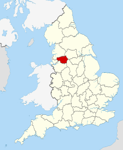
"Fayl:Greater Manchester UK locator map 2010.svg" üçün qlobal istifadə
Bu səhifə faylın digər vikilərdə harada istifadə edildiyini göstərir. Siz həmçinin bu məlumatı faylın təsviri səhifəsinin altında tapa bilərsiniz.

af.wikipedia.org layihəsində istifadəsi
an.wikipedia.org layihəsində istifadəsi
ar.wikipedia.org layihəsində istifadəsi
arz.wikipedia.org layihəsində istifadəsi
ast.wikipedia.org layihəsində istifadəsi
az.wikipedia.org layihəsində istifadəsi
ban.wikipedia.org layihəsində istifadəsi
be-tarask.wikipedia.org layihəsində istifadəsi
be.wikipedia.org layihəsində istifadəsi
bg.wikipedia.org layihəsində istifadəsi
bn.wikipedia.org layihəsində istifadəsi
br.wikipedia.org layihəsində istifadəsi
ca.wikipedia.org layihəsində istifadəsi
ceb.wikipedia.org layihəsində istifadəsi
cs.wikipedia.org layihəsində istifadəsi
de.wikivoyage.org layihəsində istifadəsi
en.wikipedia.org layihəsində istifadəsi
- Greater Manchester
- Egerton, Greater Manchester
- Etherow Country Park
- River Croal
- Parrs Wood
- Transport for Greater Manchester
- Friezland
- Strinesdale Reservoir
- Moorside, Greater Manchester
- Heald Green
- Bryn, Greater Manchester
- Three Sisters Recreation Area
- Peel Green
- Audenshaw Reservoirs
- Gorton North
- Carrbrook
- Ancoats and Clayton
- Adswood
- Turf Lea
- Hawk Green
- Template:GreaterManchester-geo-stub
- Bosden Farm
- Talk:Greater Manchester Passenger Transport Executive
- Makerfield
- Exchange Square, Manchester
- Old Moat
- Worthington, Greater Manchester
- Prestolee
- Copley, Greater Manchester
- Benchill
- Standish-with-Langtree
- Bucklow Rural District