
Bu fayl Vikianbarda yerləşir. Açıqlama səhifəsindəki məlumatlar aşağıda göstərilib. Vikianbar azad lisenziyalı media anbarıdır. Siz də töhfə verə bilərsiniz. |
Xülasə
| İzah |
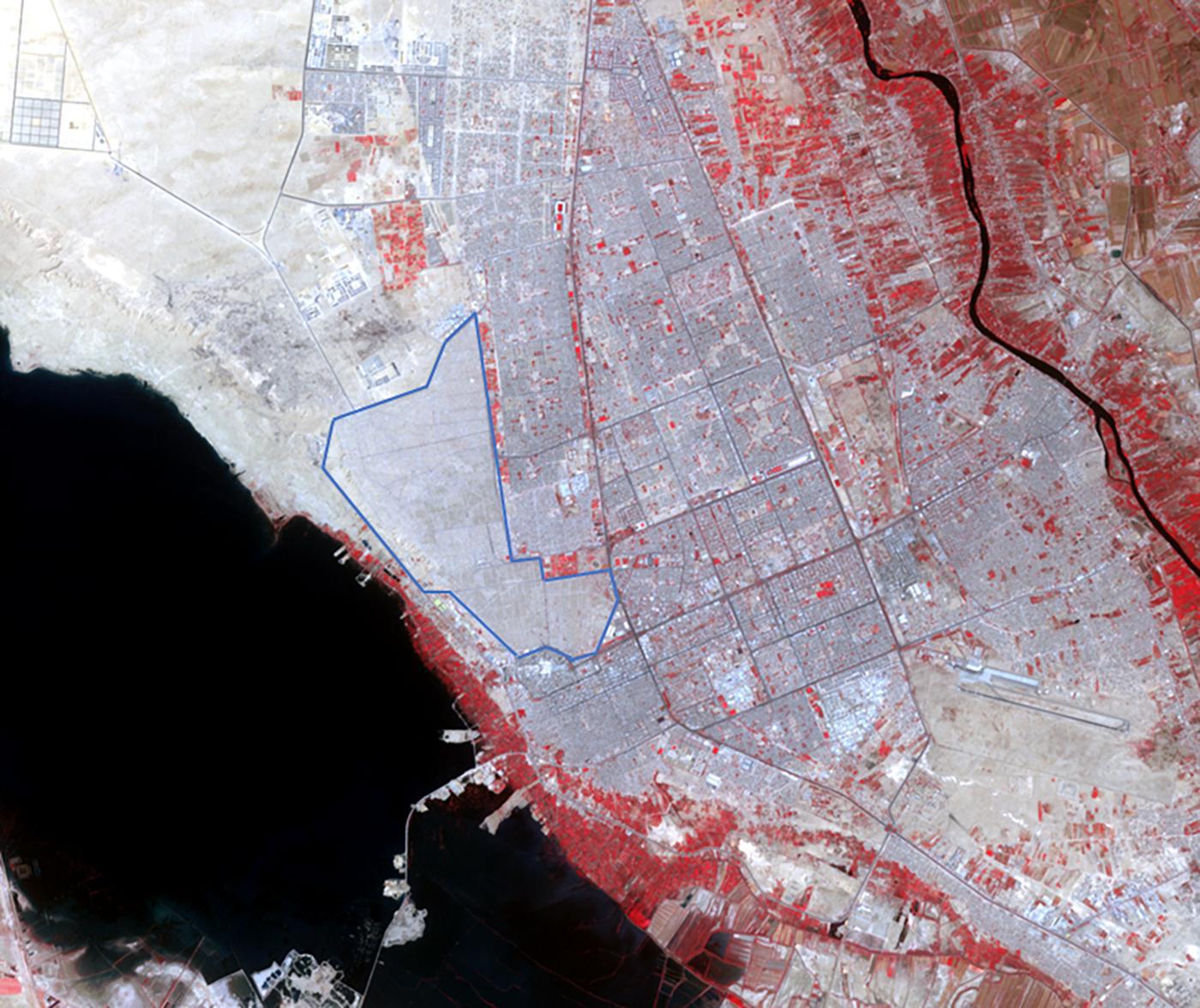
English: The world's largest cemetery is located in the holy city of Najaf, Iraq, west of the Euphrates River, and along the Najaf Sea. The Wadi-al-Salam cemetery, Arabic for "Peace Valley", covers an area of about 10 square kilometers, and has over 6 million graves. Daily burials have been going on for over 1400 years. The image was acquired May 5, 2021, covers an area of 18 by 21.5 km, and is located at 32 degrees north, 44.3 degrees east. With its 14 spectral bands from the visible to the thermal infrared wavelength region and its high spatial resolution of about 50 to 300 feet (15 to 90 meters), ASTER images Earth to map and monitor the changing surface of our planet. ASTER is one of five Earth-observing instruments launched Dec. 18, 1999, on Terra. The instrument was built by Japan's Ministry of Economy, Trade and Industry. A joint U.S./Japan science team is responsible for validation and calibration of the instrument and data products. The broad spectral coverage and high spectral resolution of ASTER provides scientists in numerous disciplines with critical information for surface mapping and monitoring of dynamic conditions and temporal change. Example applications are monitoring glacial advances and retreats; monitoring potentially active volcanoes; identifying crop stress; determining cloud morphology and physical properties; wetlands evaluation; thermal pollution monitoring; coral reef degradation; surface temperature mapping of soils and geology; and measuring surface heat balance. The U.S. science team is located at NASA's Jet Propulsion Laboratory in Pasadena, Calif. The Terra mission is part of NASA's Science Mission Directorate, Washington. More information about ASTER is available at https://asterweb.jpl.nasa.gov/. |
| Tarix | (published 2023-06-01T21:24:38Z) |
| Mənbə | Catalog page · Full-res (JPEG · TIFF) · Full-res ([ MP4]) · Full-res ([ GIF]) |
| Müəllif | NASA/METI/AIST/Japan Space Systems, and U.S./Japan ASTER Science Team |
| Digər versiyalar |
|

.jpg)
.jpg)
.jpg)
| Camera location | | View this and other nearby images on: OpenStreetMap |
|---|
.jpg¶ms=032.000000_N_0044.300000_E_globe:Earth_type:camera__&language=az)
This image or video was catalogued by Jet Propulsion Laboratory of the United States National Aeronautics and Space Administration (NASA) under Photo ID: PIA25896. This tag does not indicate the copyright status of the attached work. A normal copyright tag is still required. See Commons:Licensing. Other languages:
|
| This media is a product of the Terra mission Credit and attribution belongs to the mission team, if not already specified in the "author" row |
Lisenziya

|
Bu faylın müəllif hüququ sahibi NASA/JPL-Caltech, hər kəsə hər hansı bir məqsəd üçün istifadə etməyə icazə verir, bir şərtlə ki, müəllif hüququ sahibinə düzgün istinad edilsin. Yenidən paylama, törəmə iş, kommersiya məqsədli istifadə və bütün digər istifadələrə icazə verilir. |
|
|
| According to JPL's image use policy additional restriction is that no endorsement of any product or service by Caltech, JPL or NASA is claimed or implied.
Caltech's disclaimer: Caltech makes no representations or warranties with respect to ownership of copyrights in the images, and does not represent others who may claim to be authors or owners of copyright of any of the images, and makes no warranties as to the quality of the images. Caltech shall not be responsible for any loss or expenses resulting from the use of the images, and you release and hold Caltech harmless from all liability arising from such use. Usage on the English Wikipedia: On the English Wikipedia you can use the {{JPL Image}} template to display the copyright notice. (See w:Wikipedia:Using JPL images for details) |
Faylın tarixçəsi
Faylın əvvəlki versiyasını görmək üçün gün/tarix bölməsindəki tarixlərə klikləyin.
| Tarix/Vaxt | Miniatür | Ölçülər | İstifadəçi | Şərh | |
|---|---|---|---|---|---|
| hal-hazırkı | 21:26, 30 iyun 2023 | | 1.400 × 1.176 (246 KB) | OptimusPrimeBot | #Spacemedia - Upload of https://photojournal.jpl.nasa.gov/jpeg/PIA25896.jpg via Commons:Spacemedia |
Faylın istifadəsi
Bu faylı istifadə edən səhifə yoxdur (digər layihələrdəki səhifələr göstərilmir).
.jpg)