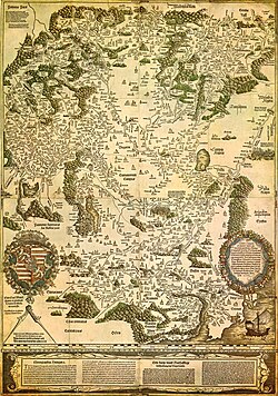
Sınaq göstərişi ölçüsü: 421 × 600 piksel. Digər ölçülər: 168 × 240 piksel | 337 × 480 piksel | 539 × 768 piksel | 719 × 1.024 piksel | 1.438 × 2.048 piksel | 3.236 × 4.609 piksel.
Faylın orijinalı (3.236 × 4.609 piksel, fayl həcmi: 3,27 MB, MIME növü: image/jpeg)
Faylın tarixçəsi
Faylın əvvəlki versiyasını görmək üçün gün/tarix bölməsindəki tarixlərə klikləyin.
| Tarix/Vaxt | Miniatür | Ölçülər | İstifadəçi | Şərh | |
|---|---|---|---|---|---|
| hal-hazırkı | 23:02, 29 avqust 2009 |  | 3.236 × 4.609 (3,27 MB) | Qorilla | {{Information |Description={{en|1=Tabula Hungariae, first printed map of Hungary}} |Source=Hungarian Wikipedia |Author=Lázár deák (Lazarus secretarius) |Date=somewhere between 1526-1528 |Permission= |other_versions= }} Category:Old maps of Hungary |
Faylın istifadəsi
Aşağıdakı 33 səhifə bu faylı istifadə edir:
- Birinci Dünya müharibəsində Macarıstan
- Birinci Macarıstan Respublikası
- Birinci Vyana arbitrajı
- Boçkai üsyanı
- Budapeşt tarixi
- Hərbi sərhəd
- Kadarizm
- Macarlardan əvvəlki Macarıstan
- Macarların Pannon düzənliyini fəthi
- Macarların qədim tarixi
- Macarıstan Respublikası (1919–1920)
- Macarıstan dövləti
- Macarıstan knyazlığı
- Macarıstan krallığı (1000–1301)
- Macarıstan krallığı (1301–1526)
- Macarıstan krallığı (1526–1867)
- Macarıstan krallığı (1920–1946)
- Macarıstan krallığında reformasiya
- Macarıstan zadəganlığı
- Macarıstanın Yuqoslaviya ərazilərini işğalı
- Macarıstan–Osmanlı müharibələri
- Macarıstan–Xorvatiya uniyası
- Maqnatlar sui-qəsdi
- Monqolların Macarıstana yürüşləri
- Müharibələrarası dövrdə Macarıstan
- Qızıl bulla (1222)
- Rakotsi üsyanı
- Transilvaniya knyazlığı (1711–1867)
- Yuxarı Macarıstan knyazlığı
- İkinci Dünya müharibəsində Macarıstan
- İkinci Vyana arbitrajı
- Şərqi Macarıstan krallığı
- Şablon:Macarıstan tarixi
Faylın qlobal istifadəsi
Bu fayl aşağıdakı vikilərdə istifadə olunur:
- ar.wikipedia.org layihəsində istifadəsi
- bn.wikipedia.org layihəsində istifadəsi
- bs.wikipedia.org layihəsində istifadəsi
- ca.wikipedia.org layihəsində istifadəsi
- de.wikipedia.org layihəsində istifadəsi
- el.wikipedia.org layihəsində istifadəsi
- en.wikipedia.org layihəsində istifadəsi
- Hungary
- Pannonia
- Treaty of Trianon
- Hungarian Revolution of 1956
- Austro-Hungarian Compromise of 1867
- Military Frontier
- Hungarian nobility
- History of Hungary before the Hungarian conquest
- Hungarian prehistory
- Kingdom of Hungary (1526–1867)
- History of geography
- Georg Tannstetter
- Upper Hungary
- History of the Jews in Hungary
- Music history of Hungary
- Bistrica, Novi Sad
- Lands of the Crown of Saint Stephen
- History of Transylvania
- Template:History of Hungary
- Hungarian People's Republic
- Principality of Transylvania (1570–1711)
- Military history of Hungary
- First Hungarian Republic
- Ottoman Hungary
- Interwar Hungary
- Principality of Hungary
- Hungarian Revolution of 1848
- Rákóczi's War of Independence
- Eastern Hungarian Kingdom
- Kingdom of Hungary (1920–1946)
Bu faylın qlobal istifadəsinə baxın.


