Sınaq göstərişi ölçüsü: 391 × 600 piksel. Digər ölçülər: 156 × 240 piksel | 313 × 480 piksel | 720 × 1.104 piksel.
Faylın orijinalı (720 × 1.104 piksel, fayl həcmi: 89 KB, MIME növü: image/jpeg)
Bu fayl Vikianbarda yerləşir. Açıqlama səhifəsindəki məlumatlar aşağıda göstərilib. Vikianbar azad lisenziyalı media anbarıdır. Siz də töhfə verə bilərsiniz. |
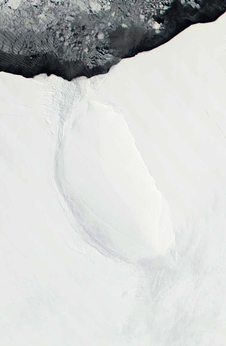
| İzah | Roosevelt Island and coast of Ross Ice Shelf, Antarctica. Darkened and cropped from a wider view of the ice shelf, a true-color image from NASA’s Moderate Resolution Imaging Spectroradiometer (MODIS) taken on November 11 and 12, 2001. |
| Tarix | 11-12 November 2001 |
| Mənbə | |
| Müəllif |
|
| Bu təsvirin si, orijinala əsaslanaraq rəqəmsal qaydadadır. Dəyişiklik: Cropped to focus on Roosevelt Island, and darkened. İlkin təsvir buradadır: Ross Ice Shelf and Saunders Coast, Antarctica.A2001315.1840.250m.jpg. etdi Avenue.
|
| This file is in the public domain in the United States because it was solely created by NASA. NASA copyright policy states that "NASA material is not protected by copyright unless noted". (See Template:PD-USGov, NASA copyright policy page or JPL Image Use Policy.) | ||
Warnings:
|
Orijinal yükləmə gündəliyi
This image is a derivative work of the following images:
- File:Ross_Ice_Shelf_and_Saunders_Coast,_Antarctica.A2001315.1840.250m.jpg licensed with PD-USGov-NASA
- 2010-09-23T01:55:56Z Avenue 6800x5200 (1958559 Bytes) {{Information |Description=Ross Ice Shelf and Saunders Coast, Antarctica. Original NASA description: "This pair of true-color images from NASA’s Moderate Resolution Imaging Spectroradiometer (MODIS) show the Ross Ice Shelf
Uploaded with derivativeFX
Faylın tarixçəsi
Faylın əvvəlki versiyasını görmək üçün gün/tarix bölməsindəki tarixlərə klikləyin.
| Tarix/Vaxt | Miniatür | Ölçülər | İstifadəçi | Şərh | |
|---|---|---|---|---|---|
| hal-hazırkı | 02:13, 23 sentyabr 2010 | | 720 × 1.104 (89 KB) | Avenue | Darkened to show island better. |
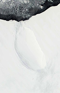
| 02:12, 23 sentyabr 2010 |  | 720 × 1.104 (58 KB) | Avenue | {{Information |Description=Roosevelt Island and coast of Ross Ice Shelf, Antarctica. Cropped from wider view of the ice shelf, a true-color images from NASA’s Moderate Resolution Imaging Spectroradiometer (MODIS) on November 11 and 12, 2001. |Source=*[ |
Faylın istifadəsi
Aşağıdakı səhifə bu faylı istifadə edir:
Faylın qlobal istifadəsi
Bu fayl aşağıdakı vikilərdə istifadə olunur:
- ast.wikipedia.org layihəsində istifadəsi
- bg.wikipedia.org layihəsində istifadəsi
- ca.wikipedia.org layihəsində istifadəsi
- ceb.wikipedia.org layihəsində istifadəsi
- cs.wikipedia.org layihəsində istifadəsi
- de.wikipedia.org layihəsində istifadəsi
- el.wikipedia.org layihəsində istifadəsi
- en.wikipedia.org layihəsində istifadəsi
- es.wikipedia.org layihəsində istifadəsi
- fa.wikipedia.org layihəsində istifadəsi
- fi.wikipedia.org layihəsində istifadəsi
- fr.wikipedia.org layihəsində istifadəsi
- gl.wikipedia.org layihəsində istifadəsi
- he.wikipedia.org layihəsində istifadəsi
- it.wikipedia.org layihəsində istifadəsi
- ja.wikipedia.org layihəsində istifadəsi
- lv.wikipedia.org layihəsində istifadəsi
- nl.wikipedia.org layihəsində istifadəsi
- nn.wikipedia.org layihəsində istifadəsi
- no.wikipedia.org layihəsində istifadəsi
- pl.wikipedia.org layihəsində istifadəsi
- ru.wikipedia.org layihəsində istifadəsi
- sv.wikipedia.org layihəsində istifadəsi
- uk.wikipedia.org layihəsində istifadəsi
- www.wikidata.org layihəsində istifadəsi
- zh.wikipedia.org layihəsində istifadəsi