Butun axtardiqlarinizi tapmaq ucun buraya: DAXIL OLUN
  Mp4 Mp3 Axtar Yukle
  Video Axtar Yukle
  Shekil Axtar Yukle
  Informasiya Melumat Axtar
  Hazir Inshalar Toplusu
  AZERI CHAT + Tanishliq
  1-11 Sinif Derslikler Yukle
  Saglamliq Tibbi Melumat
  Whatsapp Plus Yukle(Yeni)

  • Ana səhifə
  • Təsadüfi
  • Yaxınlıqdakılar
  • Daxil ol
  • Nizamlamalar
İndi ianə et Əgər Vikipediya sizin üçün faydalıdırsa, bu gün ianə edin.

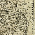
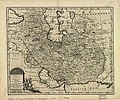
Fayl:Map of Afghanistan during the Safavid and Moghul Empire.jpg

  • Fayl
  • Müzakirə
  • Lokal izah əlavə et
  • Fayl
  • Faylın tarixçəsi
  • Faylın istifadəsi
  • Faylın qlobal istifadəsi
  • Metaməlumatlar
Fayl:Map of Afghanistan during the Safavid and Moghul Empire.jpg
Sınaq göstərişi ölçüsü: 800 × 548 piksel. Digər ölçülər: 320 × 219 piksel | 640 × 439 piksel | 1.024 × 702 piksel | 1.280 × 878 piksel | 2.532 × 1.736 piksel.

Faylın orijinalı (2.532 × 1.736 piksel, fayl həcmi: 1,16 MB, MIME növü: image/jpeg)

Bu fayl Vikianbarda yerləşir. Açıqlama səhifəsindəki məlumatlar aşağıda göstərilib.
Vikianbar azad lisenziyalı media anbarıdır. Siz də töhfə verə bilərsiniz.

Xülasə

İzahMap of Afghanistan during the Safavid and Moghul Empire.jpg Map of Afghanistan during the Safavid and Mughal Empire, from the 16th century to 1747 when the current nation-state was created. Extracted from Bowen's A new & accurate map of Persia, with the adjacent countries.
Tarix 1747
Mənbə

From: Bowen's A complete system of geography. London : Printed for W. Innys, R. Ware [etc.], 1747. Library of Congress Geography and Map Division, Call number G7620 1747 .B6

 
This map is available from the United States Library of Congress's Geography & Map Division
under the digital ID g7620.ct001185.
This tag does not indicate the copyright status of the attached work. A normal copyright tag is still required. See Commons:Licensing.

العربية ∙ беларуская (тарашкевіца) ∙ বাংলা ∙ čeština ∙ Deutsch ∙ English ∙ español ∙ فارسی ∙ suomi ∙ français ∙ galego ∙ עברית ∙ magyar ∙ Bahasa Indonesia ∙ Ido ∙ italiano ∙ 日本語 ∙ Bahaso Melayu Jambi ∙ lietuvių ∙ македонски ∙ മലയാളം ∙ Nederlands ∙ polski ∙ português ∙ português do Brasil ∙ română ∙ русский ∙ sicilianu ∙ slovenčina ∙ slovenščina ∙ Türkçe ∙ українська ∙ 中文 ∙ 中文(简体) ∙ 中文(繁體) ∙ +/−

Müəllif Bowen, Emanuel, d. 1767.
Digər versiyalar
  • original
    original

Lisenziya

Public domainPublic domainfalsefalse
Public domain

This work is in the public domain in its country of origin and other countries and areas where the copyright term is the author's life plus 100 years or fewer.


You must also include a United States public domain tag to indicate why this work is in the public domain in the United States.
Bu fayl bütün əlaqəli və qonşu hüquqlar da daxil olmaqla, müəllif hüquqları qanununa əsasən məlum məhdudiyyətlərdən azad olduğu müəyyən edilmişdir.

https://creativecommons.org/publicdomain/mark/1.0/PDMCreative Commons Public Domain Mark 1.0falsefalse

Başlıqlar

Bu faylın nəyi təmsil etdiyinə dair bir sətirlik izahat əlavə et

Bu faylda təsvir olunan elementlər

təsvir edir

yaranma tarixi

1747

Faylın tarixçəsi

Faylın əvvəlki versiyasını görmək üçün gün/tarix bölməsindəki tarixlərə klikləyin.

Tarix/VaxtMiniatürÖlçülərİstifadəçiŞərh
hal-hazırkı02:50, 2 mart 201102:50, 2 mart 2011 tarixindəki versiyanın miniatür görüntüsü2.532 × 1.736 (1,16 MB)Officer{{Information |Description= |Source= |Date= |Author= |Permission= |other_versions= }}
02:42, 2 mart 201102:42, 2 mart 2011 tarixindəki versiyanın miniatür görüntüsü2.342 × 1.682 (1,04 MB)Officer{{Information |Description= |Source= |Date= |Author= |Permission= |other_versions= }}
02:32, 2 mart 201102:32, 2 mart 2011 tarixindəki versiyanın miniatür görüntüsü2.402 × 1.599 (1,02 MB)Officer{{Information |Description= |Source= |Date= |Author= |Permission= |other_versions= }}
01:37, 2 mart 201101:37, 2 mart 2011 tarixindəki versiyanın miniatür görüntüsü2.064 × 1.607 (856 KB)Officer{{Information |Description= |Source= |Date= |Author= |Permission= |other_versions= }}
14:39, 12 mart 201014:39, 12 mart 2010 tarixindəki versiyanın miniatür görüntüsü1.810 × 1.810 (915 KB)Officer{{Information |Description=Map of Afghanistan during the Safavid and Mughal Empire, from the 16th century to 1747 when the current nation-state was created. |Source=[http://memory.loc.gov/ The Library of Congress, American Memory] - [http://memory.loc.gov
03:48, 21 yanvar 201003:48, 21 yanvar 2010 tarixindəki versiyanın miniatür görüntüsü2.056 × 1.574 (983 KB)Officer{{Information |Description=Map of Afghanistan during the Safavid and Mughal Empire, from the 16th century to 1747 when the current nation-state was created. |Source=[http://memory.loc.gov/ The Library of Congress, American Memory] - [http://memory.loc.gov
01:29, 19 noyabr 200901:29, 19 noyabr 2009 tarixindəki versiyanın miniatür görüntüsü1.679 × 1.678 (790 KB)Officer{{Information |Description=Map of Afghanistan during the Safavid and Mughal Empire, from the 16th century to 1747 when the current nation-state was created. |Source=[http://memory.loc.gov/ The Library of Congress, American Memory] - [http://memory.loc.gov

Faylın istifadəsi

Aşağıdakı 3 səhifə bu faylı istifadə edir:

  • Nadir şah Əfşarın Xorasan səfəri
  • Səbzəvar ekspedisiyası
  • Səfəvi Qəndəharı

Faylın qlobal istifadəsi

Bu fayl aşağıdakı vikilərdə istifadə olunur:

  • ar.wikipedia.org layihəsində istifadəsi
    • معركة فرهادغرد
  • azb.wikipedia.org layihəsində istifadəsi
    • هوتاکی دؤولتی
    • میرویس خان هوتک
    • محمود هوتکی
    • عبدالعزیز شاه هوتاکی
  • bn.wikipedia.org layihəsində istifadəsi
    • মীরওয়াইস হুতাক
    • আবদুল আজিজ হুতাক
    • মাহমুদ হুতাক
    • হুতাক রাজবংশ
  • el.wikipedia.org layihəsində istifadəsi
    • Μίρβαϊς Χοτάκ
    • Αμπντούλ Αζίζ Χοτάκ
    • Μαχμούντ Χοτάκ
  • en.wikipedia.org layihəsində istifadəsi
    • Nur Jahan
    • Khorasan
    • Mirwais Hotak
    • Mahmud Hotak
    • Delhi–Multan road
    • Talk:Afghanistan/Archive 9
    • Abdul Aziz Hotak
    • Babur Mirza's Invasion of Khorasan
    • Battle of Farhadgerd
    • Khorasan campaign of Nader Shah
    • User:Amir Ghandi/Rustam Mirza
  • fa.wikipedia.org layihəsində istifadəsi
    • محمود هوتکی
    • خراسان
    • جنگ خراسان
  • he.wikipedia.org layihəsində istifadəsi
    • משתמש:WikiJunkie/רשימות שימושיות שמופקות באמצעות הבוט ליסטריה/פלישות היסטוריות - כל הערכים שחסרים
  • hi.wikipedia.org layihəsində istifadəsi
    • महमूद होतक
  • id.wikipedia.org layihəsində istifadəsi
    • Mirwais Hotak
  • it.wikipedia.org layihəsində istifadəsi
    • Dinastia Hotak
    • Campagna del Khorasan
  • ja.wikipedia.org layihəsində istifadəsi
    • ホータキー朝
  • nl.wikipedia.org layihəsində istifadəsi
    • Mirwais Hotaki
  • no.wikipedia.org layihəsində istifadəsi
    • Hotaki-dynastiet
  • pt.wikipedia.org layihəsində istifadəsi
    • Império Hotaqui
    • Mamude Hotaqui
  • ru.wikipedia.org layihəsində istifadəsi
    • Большой Хорасан
    • Нур-Джахан
    • Мир Абд ул-Азиз
  • ta.wikipedia.org layihəsində istifadəsi
    • நூர் சகான்
  • te.wikipedia.org layihəsində istifadəsi
    • నూర్జహాన్
  • tg.wikipedia.org layihəsində istifadəsi
    • Хуросони Бузург
  • uk.wikipedia.org layihəsində istifadəsi
    • Великий Хорасан
  • ur.wikipedia.org layihəsində istifadəsi
    • میر وایس ہوتک
  • www.wikidata.org layihəsində istifadəsi
    • Q4838098
    • Q4871000
    • Q18206937
  • zh.wikipedia.org layihəsində istifadəsi
    • 大呼罗珊
    • 漢達基王朝

Metaməlumatlar

Bu faylda fotoaparat və ya skanerlə əlavə olunmuş məlumatlar var. Əgər fayl sonradan olunubsa, bəzi parametrlər bu şəkildə göstərilənlərdən fərqli ola bilər.

OrientasiyaNormal
Proqram təminatıMicrosoft Windows Live Photo Gallery14.0.8081.709
Faylın dəyişməsi tarixi və vaxtı07:48, 2 mart 2011
Y və C komponetlərinə görə yerləşmə sırasıMərkəzləşdirilmiş
Exif versiyası2.2
DateTime subseconds796
Unique image ID0C1EF52B50524269A9D1677B73A12A8D
Mənbə — "https://az.wikipedia.org/wiki/Fayl:Map_of_Afghanistan_during_the_Safavid_and_Moghul_Empire.jpg"
Informasiya Melumat Axtar