Sınaq göstərişi ölçüsü: 517 × 599 piksel. Digər ölçülər: 207 × 240 piksel | 414 × 480 piksel | 653 × 757 piksel.
Faylın orijinalı (653 × 757 piksel, fayl həcmi: 113 KB, MIME növü: image/jpeg)
Bu fayl Vikianbarda yerləşir. Açıqlama səhifəsindəki məlumatlar aşağıda göstərilib. Vikianbar azad lisenziyalı media anbarıdır. Siz də töhfə verə bilərsiniz. |
Xülasə
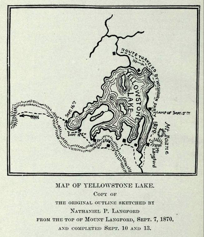
| İzah | Map of Yellowstone Lake, 1870 Washburn, Doane and Langford Expedition |
| Tarix | |
| Mənbə |
Extracted from Public Domain PDF File of DIARY OF THE WASHBURN EXPEDITION TO THE YELLOWSTONE AND FIREHOLE RIVERS IN THE YEAR 1870 BY NATHANIEL PITT LANGFORD (1905), on the Internet Archive |
| Müəllif | Mike Cline |
Lisenziya
This media file is in the public domain in the United States. This applies to U.S. works where the copyright has expired, often because its first publication occurred prior to January 1, 1931, and if not then due to lack of notice or renewal. See this page for further explanation.
|
 | |
Faylın tarixçəsi
Faylın əvvəlki versiyasını görmək üçün gün/tarix bölməsindəki tarixlərə klikləyin.
| Tarix/Vaxt | Miniatür | Ölçülər | İstifadəçi | Şərh | |
|---|---|---|---|---|---|
| hal-hazırkı | 01:53, 12 fevral 2008 | | 653 × 757 (113 KB) | Mike Cline | {{Information |Description=Map of Yellowstone Lake, 1870 Washburn, Doane and Langford Expedition |Source=Extracted from Public Domain PDF File of DIARY OF THE WASHBURN EXPEDITION TO THE YELLOWSTONE AND FIREHOLE RIVERS IN THE YEAR 1870 BY NATHANIEL PITT LA |
Faylın istifadəsi
Aşağıdakı səhifə bu faylı istifadə edir:
Faylın qlobal istifadəsi
Bu fayl aşağıdakı vikilərdə istifadə olunur:
- de.wikipedia.org layihəsində istifadəsi
- en.wikipedia.org layihəsində istifadəsi
- fr.wikipedia.org layihəsində istifadəsi
- he.wikipedia.org layihəsində istifadəsi
- nl.wikipedia.org layihəsində istifadəsi
- tr.wikipedia.org layihəsində istifadəsi