Sınaq göstərişi ölçüsü: 459 × 599 piksel. Digər ölçülər: 184 × 240 piksel | 367 × 480 piksel | 588 × 768 piksel | 784 × 1.024 piksel | 1.568 × 2.048 piksel | 2.778 × 3.628 piksel.
Faylın orijinalı (2.778 × 3.628 piksel, fayl həcmi: 3,24 MB, MIME növü: image/jpeg)
Bu fayl Vikianbarda yerləşir. Açıqlama səhifəsindəki məlumatlar aşağıda göstərilib. Vikianbar azad lisenziyalı media anbarıdır. Siz də töhfə verə bilərsiniz. |
Xülasə
| İzah |
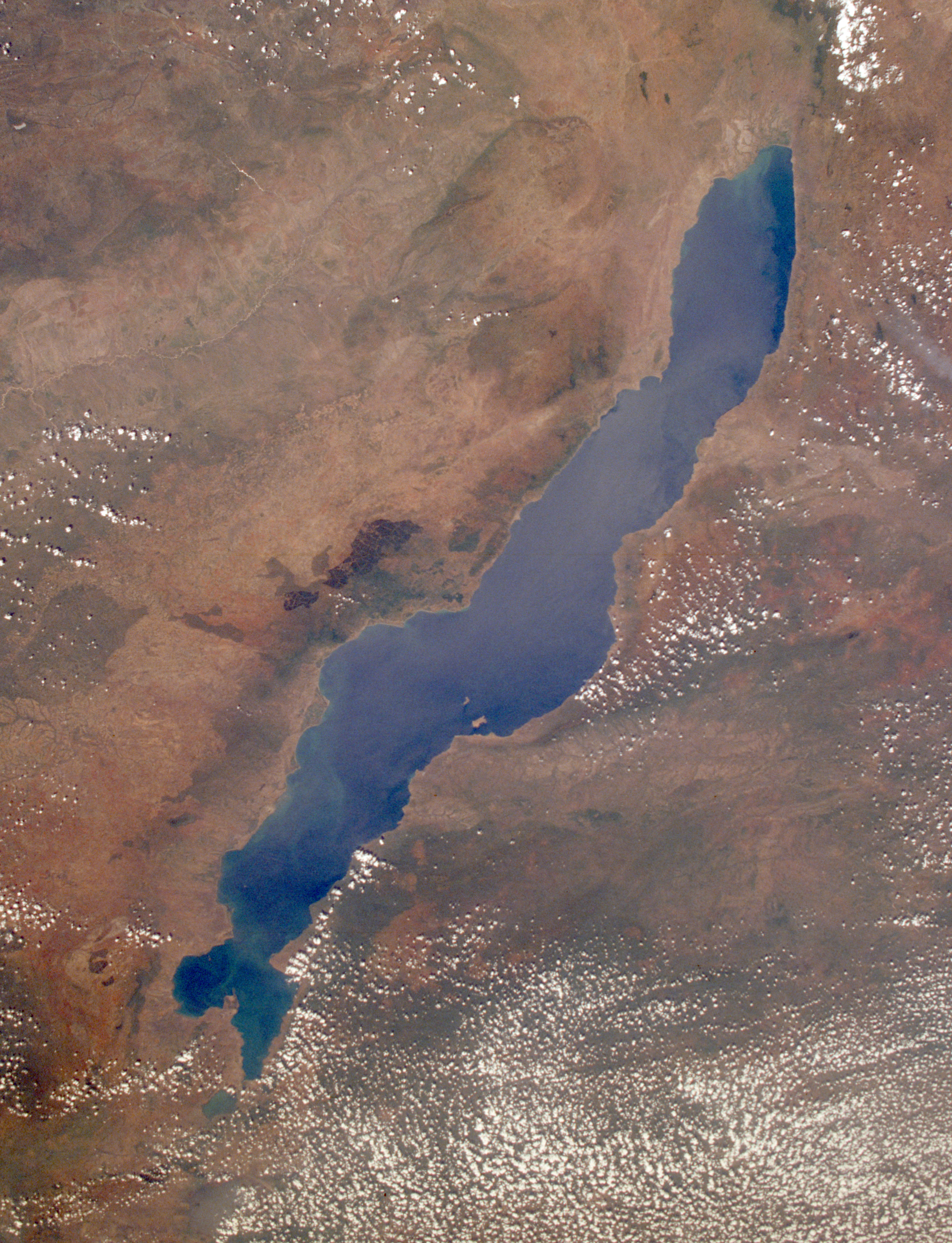
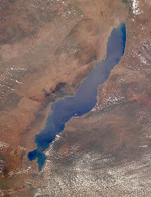
English: Lake Malawi, photographed by astronauts aboard the Space Shuttle. Original image courtesy of the Image Analysis Laboratory, NASA Johnson Space Center (eol.jsc.nasa.gov). Image ID: STS061-75-48. Image cropped, sharpened and gamma-corrected.
|
| Tarix | Taken on 3 dekabr 1998, 09:49:31 UTC |
| Mənbə | https://eol.jsc.nasa.gov/SearchPhotos/photo.pl?mission=STS061&roll=75&frame=48 |
| Müəllif | National Aeronautics and Space Administration (NASA) |
| Digər versiyalar |
This image or video was catalogued by Johnson Space Center of the United States National Aeronautics and Space Administration (NASA) under Photo ID: STS061-75-48. This tag does not indicate the copyright status of the attached work. A normal copyright tag is still required. See Commons:Licensing. Other languages:
|
Lisenziya
This file is in the public domain in the United States because it was created by the Image Science & Analysis Laboratory, of the NASA Johnson Space Center. NASA copyright policy states that "NASA material is not protected by copyright unless noted". (NASA media use guidelines or Conditions of Use of Astronaut Photographs).
Photo source: STS061-75-48.
|
Orijinal yükləmə gündəliyi
Uploaded to en wiki by User:Worldtraveller; moved here by User:Tintazul. Full original description follows.
Faylın tarixçəsi
Faylın əvvəlki versiyasını görmək üçün gün/tarix bölməsindəki tarixlərə klikləyin.
| Tarix/Vaxt | Miniatür | Ölçülər | İstifadəçi | Şərh | |
|---|---|---|---|---|---|
| hal-hazırkı | 19:17, 30 avqust 2019 | | 2.778 × 3.628 (3,24 MB) | Ras67 | high resolution, cropped and rotated from NASA's original TIFF |
| 12:27, 4 noyabr 2005 |  | 768 × 1.000 (271 KB) | Tintazul | ''Uploaded to en wiki by User:Worldtraveller; moved here by User:Tintazul. Full original description follows.'' Lake Malawi in Africa, photographed by astronauts aboard the Space Shuttle. Original image courtesy of the Image Analysis Laboratory, |
Faylın istifadəsi
Aşağıdakı 2 səhifə bu faylı istifadə edir:
Faylın qlobal istifadəsi
Bu fayl aşağıdakı vikilərdə istifadə olunur:
- af.wikipedia.org layihəsində istifadəsi
- als.wikipedia.org layihəsində istifadəsi
- ar.wikipedia.org layihəsində istifadəsi
- arz.wikipedia.org layihəsində istifadəsi
- ba.wikipedia.org layihəsində istifadəsi
- bcl.wikipedia.org layihəsində istifadəsi
- be-tarask.wikipedia.org layihəsində istifadəsi
- be.wikipedia.org layihəsində istifadəsi
- bg.wikipedia.org layihəsində istifadəsi
- Dimidiochromis compressiceps
- Labeotropheus trewavasae
- Labidochromis caeruleus
- Maylandia aurora
- Maylandia barlowi
- Maylandia benetos
- Maylandia callainos
- Maylandia chrysomallos
- Maylandia elegans
- Maylandia emmiltos
- Maylandia hajomaylandi
- Maylandia heteropicta
- Maylandia mbenjii
- Maylandia melabranchion
- Maylandia phaeos
- Maylandia pursa
- Maylandia pyrsonotos
- Maylandia thapsinogen
- Melanochromis parallelus
- Nimbochromis linni
- Nimbochromis polystigma
- Otopharynx brooksi
- Otopharynx lithobates
- Otopharynx tetrastigma
- Placidochromis electra
- Placidochromis johnstoni
- Placidochromis phenochilus
- Protomelas spilonotus
- Protomelas taeniolatus
Bu faylın qlobal istifadəsinə baxın.