Butun axtardiqlarinizi tapmaq ucun buraya: DAXIL OLUN
  Mp4 Mp3 Axtar Yukle
  Video Axtar Yukle
  Shekil Axtar Yukle
  Informasiya Melumat Axtar
  Hazir Inshalar Toplusu
  AZERI CHAT + Tanishliq
  1-11 Sinif Derslikler Yukle
  Saglamliq Tibbi Melumat
  Whatsapp Plus Yukle(Yeni)

  • Ana səhifə
  • Təsadüfi
  • Yaxınlıqdakılar
  • Daxil ol
  • Nizamlamalar
İndi ianə et Əgər Vikipediya sizin üçün faydalıdırsa, bu gün ianə edin.

Fayl:Kashmir Region November 2019.jpg

  • Fayl
  • Müzakirə
  • Lokal izah əlavə et
  • Fayl
  • Faylın tarixçəsi
  • Faylın istifadəsi
  • Faylın qlobal istifadəsi
  • Metaməlumatlar
Fayl:Kashmir Region November 2019.jpg
Sınaq göstərişi ölçüsü: 604 × 599 piksel. Digər ölçülər: 242 × 240 piksel | 484 × 480 piksel | 774 × 768 piksel | 1.033 × 1.024 piksel | 1.579 × 1.566 piksel.

Faylın orijinalı (1.579 × 1.566 piksel, fayl həcmi: 1,44 MB, MIME növü: image/jpeg)

Bu fayl Vikianbarda yerləşir. Açıqlama səhifəsindəki məlumatlar aşağıda göstərilib.
Vikianbar azad lisenziyalı media anbarıdır. Siz də töhfə verə bilərsiniz.

Xülasə

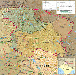
İzahKashmir Region November 2019.jpg
English: A map of the disputed region created by the US Central Intelligence Agency and hosted by the University of Texas-Austin Perry-Castañeda Library Map Collection; altered to show new jurisdictions,[1][2][3][4] by Fowler&fowler (müzakirə) 06:29, 14 November 2019 (UTC)
.
Tarix 1 yanvar 2004
Mənbə Map of Kashmir region created by the US Central Intelligence Agency, 2004; altered by Fowler&fowler (müzakirə) 06:29, 14 November 2019 (UTC)
Müəllif US Central Intelligence Agency
Digər versiyalar
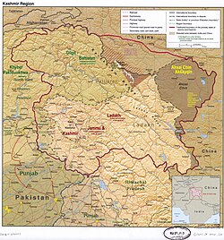
Original 2004 version
2020 version with circled skirmish locations
2023 version

Lisenziya

Public domainPublic domainfalsefalse
Public domain This image is a work of a Central Intelligence Agency employee, taken or made as part of that person's official duties. As a Work of the United States Government, this image or media is in the public domain in the United States.

čeština ∙ Deutsch ∙ eesti ∙ English ∙ español ∙ français ∙ italiano ∙ português ∙ polski ∙ sicilianu ∙ slovenščina ∙ suomi ∙ Tiếng Việt ∙ български ∙ македонски ∙ русский ∙ українська ∙ বাংলা ∙ മലയാളം ∙ 한국어 ∙ 日本語 ∙ 中文 ∙ 中文(简体) ∙ 中文(繁體) ∙ العربية ∙ پښتو ∙ +/−

Annotations
InfoField
This image is annotated: View the annotations at Commons
373
354
52
52
1579
1566

Gilgit (capital of Gilgit-Baltistan)

203
714
52
52
1579
1566

Muzaffarabad (capital of Azad Kashmir)

780
360
52
52
1579
1566

K2 (tallest mountain in Kashmir)

459
780
52
52
1579
1566

Srinagar (summer capital of Jammu and Kashmir)

465
1094
52
52
1579
1566

Jammu (winter capital of Jammu and Kashmir)

996
760
52
52
1579
1566

Leh

708
675
52
52
1579
1566

Kargil

1170
811
311
137
1579
1566

Pangong Tso

1416
513
46
43
1579
1566

Aksai Chin Lake

847
422
199
147
1579
1566

Siachen Glacier

415
709
78
56
1579
1566

Wular Lake

  1. ↑ India Revokes Kashmir’s Special Status, Raising Fears of Unrest[1], New York Times, 5 August 2019
  2. ↑ Regan, Helen (31 October 2019) India downgrades Kashmir's status and takes greater control over contested region[2], CNN
  3. ↑ Ellis-Peterson, Hannah (31 October 2019) India strips Kashmir of special status and divides it in two[3], Guardian
  4. ↑ State No More: India Formally Ends Statehood for Jammu and Kashmir[4], Diplomat, 31 October 2019

Başlıqlar

Bu faylın nəyi təmsil etdiyinə dair bir sətirlik izahat əlavə et
Kashmir Region November 2019
ఇండియా
Pakistan

Bu faylda təsvir olunan elementlər

təsvir edir

Kəşmir

copyright status ingilis

ictimai mülkiyyət

yaranma tarixi

1 yanvar 2004

media type ingilis

image/jpeg

Faylın tarixçəsi

Faylın əvvəlki versiyasını görmək üçün gün/tarix bölməsindəki tarixlərə klikləyin.

Tarix/VaxtMiniatürÖlçülərİstifadəçiŞərh
hal-hazırkı09:14, 2 iyun 202209:14, 2 iyun 2022 tarixindəki versiyanın miniatür görüntüsü1.579 × 1.566 (1,44 MB)Fowler&fowlerReverted to version as of 04:58, 21 February 2022 (UTC) Again and for the last time, there is a WikiProjects India, Pakistan, and China consensus for this file to only appear in this form. It cannot be changed to highlight one portion or other for any of the subdivisions. If you persist, I will request administrative action
14:44, 26 aprel 202214:44, 26 aprel 2022 tarixindəki versiyanın miniatür görüntüsü1.579 × 1.566 (2,15 MB)Aréatupdated the key. What's the problem with the colors for the up to date situation? It's a public domain file
04:58, 21 fevral 202204:58, 21 fevral 2022 tarixindəki versiyanın miniatür görüntüsü1.579 × 1.566 (1,44 MB)Fowler&fowlerReverted to version as of 14:08, 4 January 2021 (UTC). Sorry by a WikiProjects India-Pakistan consensus we cannot change the CIA maps and its colors; see "Indian-administered" color map on the top right.
04:04, 6 aprel 202104:04, 6 aprel 2021 tarixindəki versiyanın miniatür görüntüsü1.579 × 1.566 (2,09 MB)AréatDistinct colors for Ladakh and Jammu and Kashmir, sicne the map is used on their page, and the map as it was made it hard to see what their respective territory is
14:08, 4 yanvar 202114:08, 4 yanvar 2021 tarixindəki versiyanın miniatür görüntüsü1.579 × 1.566 (1,44 MB)Sbb1413Updated to include modern-day names of some provinces and states (e.g. North Western Frontier Province is now called Khyber Pakhtunkhwa, Uttaranchal is now called Uttarakhand).
06:13, 3 dekabr 202006:13, 3 dekabr 2020 tarixindəki versiyanın miniatür görüntüsü1.579 × 1.566 (1,27 MB)Sbb1413Reverted to version as of 16:29, 25 November 2019 (UTC)
06:05, 3 dekabr 202006:05, 3 dekabr 2020 tarixindəki versiyanın miniatür görüntüsü2.469 × 2.449 (1.023 KB)Sbb1413Added working boundary from File:File:Kashmir map big.jpg, also from CIA.
16:29, 25 noyabr 201916:29, 25 noyabr 2019 tarixindəki versiyanın miniatür görüntüsü1.579 × 1.566 (1,27 MB)Fowler&fowlerMoving labels to less cluttered spots; making Aksai Chin as big as other labels; drawing the J&K and Ladakh boundaries in green as indicated in info on the top left; making that info conform to the name change: Northern Areas-->Gilgit-Baltistan
06:29, 14 noyabr 201906:29, 14 noyabr 2019 tarixindəki versiyanın miniatür görüntüsü1.579 × 1.567 (1,35 MB)Fowler&fowlerUser created page with UploadWizard

Faylın istifadəsi

Aşağıdakı 2 səhifə bu faylı istifadə edir:

  • Dondurulmuş münaqişə
  • Kəşmir münaqişəsi

Faylın qlobal istifadəsi

Bu fayl aşağıdakı vikilərdə istifadə olunur:

  • ar.wikipedia.org layihəsində istifadəsi
    • نزاع كشمير
    • إلغاء الهند وضع جامو وكشمير الخاص
    • خط السيطرة الفعلية
    • وزارة شؤون كشمير وغلغت بلتستان
  • as.wikipedia.org layihəsində istifadəsi
    • আকছাই চীন
  • ba.wikipedia.org layihəsində istifadəsi
    • Кәшмир
  • bn.wikipedia.org layihəsində istifadəsi
    • আজাদ কাশ্মীর
    • লাদাখ
    • কাশ্মীর
    • লাদাখের ইতিহাস
    • আকসাই চীন
    • ভারতের জম্মু ও কাশ্মীরের বিশেষ মর্যাদা প্রত্যাহার
    • নিয়ন্ত্রণ রেখা
    • ভারতের সংবিধানের অনুচ্ছেদ ৩৭০
    • আজাদ কাশ্মীরের ইতিহাস
  • ca.wikipedia.org layihəsində istifadəsi
    • Caixmir
    • Conflicte del Caixmir
    • Història de Ladakh
  • ckb.wikipedia.org layihəsində istifadəsi
    • ھەڵوەشاندنەوەی پێگەی تایبەتی جامو و کەشمیر لەلایەن ھیندستان
  • de.wikipedia.org layihəsində istifadəsi
    • Kaschmir
    • Geschichte Ladakhs
    • Wikipedia:Kurier/Ausgabe 12 2020
  • de.wikivoyage.org layihəsində istifadəsi
    • Gilgit-Baltistan
  • en.wikipedia.org layihəsində istifadəsi
    • Territorial dispute
    • Line of Control
    • Baltistan
    • Line of Actual Control
    • Skardu
    • Trans-Karakoram Tract
    • Talk:List of ongoing armed conflicts
    • Dominion of India
    • Kashgar Prefecture
    • Frozen conflict
    • History of Ladakh
    • Talk:Robin Raphel
    • Sino-Indian border dispute
    • List of active separatist movements in Asia
    • History of Azad Kashmir
    • Jammu division
    • Ministry of Kashmir Affairs and Gilgit-Baltistan
    • Wikipedia talk:Noticeboard for India-related topics/Archive 69
    • Talk:Ladakh/Archive 1
    • Wikipedia talk:WikiProject Maps/Archive 2020
    • User:DutchTreat/Projects/Maps
    • Wikipedia:Noticeboard for Kashmir-related topics
    • Portal:Kashmir
    • Portal:Kashmir/Intro
    • User talk:Kautilya3/Archives/Archive 17
    • Talk:Azad Kashmir/Archives/2021
    • Talk:Jammu and Kashmir (union territory)/Archive 1

Bu faylın qlobal istifadəsinə baxın.

Metaməlumatlar

Bu faylda fotoaparat və ya skanerlə əlavə olunmuş məlumatlar var. Əgər fayl sonradan olunubsa, bəzi parametrlər bu şəkildə göstərilənlərdən fərqli ola bilər.

Üfüqi xətt96 dpi
Şaquli xətt96 dpi
Proqram təminatıpaint.net 4.2.14
Mənbə — "https://az.wikipedia.org/wiki/Fayl:Kashmir_Region_November_2019.jpg"
Informasiya Melumat Axtar