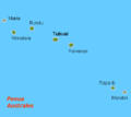
Karta_FP_Austral_isl.PNG (450 × 400 piksel, fayl həcmi: 5 KB, MIME növü: image/png)
Faylın tarixçəsi
Faylın əvvəlki versiyasını görmək üçün gün/tarix bölməsindəki tarixlərə klikləyin.
| Tarix/Vaxt | Miniatür | Ölçülər | İstifadəçi | Şərh | |
|---|---|---|---|---|---|
| hal-hazırkı | 10:38, 29 sentyabr 2012 |  | 450 × 400 (5 KB) | Koumz | trying to revert hoax change to file |
| 10:33, 29 sentyabr 2012 |  | 450 × 400 (5 KB) | Koumz | rv hoax | |
| 10:32, 29 sentyabr 2012 |  | 450 × 400 (5 KB) | Koumz | rv hoax | |
| 10:30, 29 sentyabr 2012 |  | 450 × 400 (5 KB) | Koumz | rv hoax | |
| 16:25, 28 sentyabr 2012 |  | 450 × 400 (5 KB) | Human anatomy | нова държава | |
| 09:05, 2 iyul 2009 |  | 450 × 400 (5 KB) | Telim tor | + Maria Atoll at the correct position | |
| 08:17, 10 oktyabr 2008 |  | 450 × 400 (4 KB) | Telim tor | uploaded version without "Maria" wich was definitely at the wrong place. The atoll Maria is not shown on this map. | |
| 12:57, 21 aprel 2007 |  | 450 × 400 (4 KB) | Hobe | karta Australöarna FP, Holger behr, own work |
Faylın istifadəsi
Aşağıdakı səhifə bu faylı istifadə edir:
Faylın qlobal istifadəsi
Bu fayl aşağıdakı vikilərdə istifadə olunur:
- af.wikipedia.org layihəsində istifadəsi
- ar.wikipedia.org layihəsində istifadəsi
- bg.wikipedia.org layihəsində istifadəsi
- da.wikipedia.org layihəsində istifadəsi
- de.wikipedia.org layihəsində istifadəsi
- el.wikipedia.org layihəsində istifadəsi
- en.wikipedia.org layihəsində istifadəsi
- eo.wikipedia.org layihəsində istifadəsi
- fi.wikipedia.org layihəsində istifadəsi
- frr.wikipedia.org layihəsində istifadəsi
- fr.wikipedia.org layihəsində istifadəsi
- fy.wikipedia.org layihəsində istifadəsi
- gl.wikipedia.org layihəsində istifadəsi
- he.wikipedia.org layihəsində istifadəsi
- hr.wikipedia.org layihəsində istifadəsi
- hu.wikipedia.org layihəsində istifadəsi
- it.wikipedia.org layihəsində istifadəsi
- it.wikivoyage.org layihəsində istifadəsi
- ja.wikipedia.org layihəsində istifadəsi
- ka.wikipedia.org layihəsində istifadəsi
- ko.wikipedia.org layihəsində istifadəsi
- la.wikipedia.org layihəsində istifadəsi
- lt.wikipedia.org layihəsində istifadəsi
- mrj.wikipedia.org layihəsində istifadəsi
- nl.wikipedia.org layihəsində istifadəsi
- no.wikipedia.org layihəsində istifadəsi
- pl.wikipedia.org layihəsində istifadəsi
- pt.wikipedia.org layihəsində istifadəsi
- ru.wikipedia.org layihəsində istifadəsi
- sr.wikipedia.org layihəsində istifadəsi
- sv.wikipedia.org layihəsində istifadəsi
- ta.wikipedia.org layihəsində istifadəsi
- tr.wikipedia.org layihəsində istifadəsi
- vi.wikipedia.org layihəsində istifadəsi
- zh-min-nan.wikipedia.org layihəsində istifadəsi
- zh-yue.wikipedia.org layihəsində istifadəsi
- zh.wikipedia.org layihəsində istifadəsi