Butun axtardiqlarinizi tapmaq ucun buraya: DAXIL OLUN
  Mp4 Mp3 Axtar Yukle
  Video Axtar Yukle
  Shekil Axtar Yukle
  Informasiya Melumat Axtar
  Hazir Inshalar Toplusu
  AZERI CHAT + Tanishliq
  1-11 Sinif Derslikler Yukle
  Saglamliq Tibbi Melumat
  Whatsapp Plus Yukle(Yeni)

  • Ana səhifə
  • Təsadüfi
  • Yaxınlıqdakılar
  • Daxil ol
  • Nizamlamalar
İndi ianə et Əgər Vikipediya sizin üçün faydalıdırsa, bu gün ianə edin.

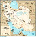
Fayl:Iran CIA map 1982.jpg

  • Fayl
  • Müzakirə
  • Lokal izah əlavə et
  • Fayl
  • Faylın tarixçəsi
  • Faylın istifadəsi
  • Faylın qlobal istifadəsi
  • Metaməlumatlar
Fayl:Iran CIA map 1982.jpg
Sınaq göstərişi ölçüsü: 594 × 599 piksel. Digər ölçülər: 238 × 240 piksel | 476 × 480 piksel | 989 × 998 piksel.

Faylın orijinalı (989 × 998 piksel, fayl həcmi: 153 KB, MIME növü: image/jpeg)

Bu fayl Vikianbarda yerləşir. Açıqlama səhifəsindəki məlumatlar aşağıda göstərilib.
Vikianbar azad lisenziyalı media anbarıdır. Siz də töhfə verə bilərsiniz.

Xülasə

İzahIran CIA map 1982.jpg
English: 1982 CIA political map of Iran.
Tarix 1982
Mənbə

Perry-Castañeda Library Map Collection: Iran Maps

Transferred from en.wikipedia to Commons by User:Dmitry89 using CommonsHelper.
Müəllif CIA

Lisenziya

This image is a copy or a derivative work of http://www.lib.utexas.edu/maps/middle_east_and_asia/iran_rel_1982.jpg, from the map collection of the Perry–Castañeda Library (PCL) of the University of Texas at Austin.
This tag does not indicate the copyright status of the attached work. A normal copyright tag is still required. See Commons:Licensing for more information.
Public domainPublic domainfalsefalse
Public domain This image is a work of a Central Intelligence Agency employee, taken or made as part of that person's official duties. As a Work of the United States Government, this image or media is in the public domain in the United States.

čeština ∙ Deutsch ∙ eesti ∙ English ∙ español ∙ français ∙ italiano ∙ português ∙ polski ∙ sicilianu ∙ slovenščina ∙ suomi ∙ Tiếng Việt ∙ български ∙ македонски ∙ русский ∙ українська ∙ বাংলা ∙ മലയാളം ∙ 한국어 ∙ 日本語 ∙ 中文 ∙ 中文(简体) ∙ 中文(繁體) ∙ العربية ∙ پښتو ∙ +/−

Orijinal yükləmə gündəliyi

The original description page was here. All following user names refer to en.wikipedia.
  • 2007-07-18 22:47 Dr Fil 989×998× (157093 bytes) 1982 CIA political map of Iran Downloaded from: http://www.lib.utexas.edu/maps/middle_east_and_asia/iran_rel_1982.jpg U.S. government map, therefore falls under public domain {{PD-PCL}}

Başlıqlar

Bu faylın nəyi təmsil etdiyinə dair bir sətirlik izahat əlavə et
1982 CIA political map of Iran.

Bu faylda təsvir olunan elementlər

təsvir edir

copyright status ingilis

ictimai mülkiyyət

yaranma tarixi

1982

media type ingilis

image/jpeg

Faylın tarixçəsi

Faylın əvvəlki versiyasını görmək üçün gün/tarix bölməsindəki tarixlərə klikləyin.

Tarix/VaxtMiniatürÖlçülərİstifadəçiŞərh
hal-hazırkı18:39, 9 aprel 201118:39, 9 aprel 2011 tarixindəki versiyanın miniatür görüntüsü989 × 998 (153 KB)File Upload Bot (Magnus Manske) {{BotMoveToCommons|en.wikipedia|year={{subst:CURRENTYEAR}}|month={{subst:CURRENTMONTHNAME}}|day={{subst:CURRENTDAY}}}} {{Information |Description={{en|1982 CIA political map of Iran. From [http://www.lib.utexas.edu/maps/iran.html Perry-Castañeda Librar

Faylın istifadəsi

Aşağıdakı səhifə bu faylı istifadə edir:

  • Tehran UNO hadisəsi

Faylın qlobal istifadəsi

Bu fayl aşağıdakı vikilərdə istifadə olunur:

  • ar.wikipedia.org layihəsində istifadəsi
    • مشاهدة أجسام طائرة مجهولة في طهران عام 1976م
  • ca.wikipedia.org layihəsində istifadəsi
    • Frontera entre l'Aràbia Saudita i l'Iran
  • en.wikipedia.org layihəsində istifadəsi
    • 1976 Tehran UFO incident
    • User:Falcaorib/Mediterranean Basin, Near East and Middle East
  • fa.wikipedia.org layihəsində istifadəsi
    • اشیای پرنده ناشناخته در آسمان تهران (۱۳۵۵)
    • رؤیت یوفو در ایران
  • hr.wikipedia.org layihəsində istifadəsi
    • Teheranski NLO incident 1976.
  • pt.wikipedia.org layihəsində istifadəsi
    • Incidente de OVNI em Teerã
  • ro.wikipedia.org layihəsində istifadəsi
    • Incidentul OZN de la Tehran
  • ru.wikipedia.org layihəsində istifadəsi
    • Тегеранский инцидент
  • sh.wikipedia.org layihəsində istifadəsi
    • Teheranski NLO incident 1976.
  • vi.wikipedia.org layihəsində istifadəsi
    • Sự kiện UFO Tehran 1976
  • www.wikidata.org layihəsində istifadəsi
    • Q560372
    • Q17351783

Metaməlumatlar

Bu faylda fotoaparat və ya skanerlə əlavə olunmuş məlumatlar var. Əgər fayl sonradan olunubsa, bəzi parametrlər bu şəkildə göstərilənlərdən fərqli ola bilər.

_error0
Mənbə — "https://az.wikipedia.org/wiki/Fayl:Iran_CIA_map_1982.jpg"
Informasiya Melumat Axtar