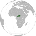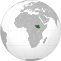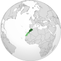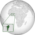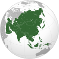
Bu SVG-faylın PNG formatındakı bu görünüşünün ölçüsü: 541 × 541 piksel. Digər ölçülər: 240 × 240 piksel | 480 × 480 piksel | 768 × 768 piksel | 1.024 × 1.024 piksel | 2.048 × 2.048 piksel.
Faylın orijinalı (SVG faylı, nominal olaraq 541 × 541 piksel, faylın ölçüsü: 280 KB)
Faylın tarixçəsi
Faylın əvvəlki versiyasını görmək üçün gün/tarix bölməsindəki tarixlərə klikləyin.
| Tarix/Vaxt | Miniatür | Ölçülər | İstifadəçi | Şərh | |
|---|---|---|---|---|---|
| hal-hazırkı | 10:35, 8 fevral 2025 |  | 541 × 541 (280 KB) | Yann | Reverted to version as of 03:58, 16 December 2024 (UTC) |
| 05:17, 8 fevral 2025 |  | 541 × 541 (572 KB) | Lukalovescats2 | Reverted to version as of 15:27, 25 November 2008 (UTC). Please upload version with Siachen Glacier under new file name and stopped revert to current version | |
| 03:58, 16 dekabr 2024 |  | 541 × 541 (280 KB) | Swtadi143 | Its not fine, siachen is controlled by india, pls refrain from changing this image, Reverted to version as of 12:29, 3 December 2024 (UTC) | |
| 20:24, 15 dekabr 2024 |  | 541 × 541 (167 KB) | FireBreathMan | Reverted to version as of 21:31, 12 September 2012 (UTC) Fine as it was | |
| 12:29, 3 dekabr 2024 |  | 541 × 541 (280 KB) | VNM EST.1976 02 | Reverted to version as of 05:06, 19 November 2024 (UTC) | |
| 07:10, 26 aprel 2023 |  | 541 × 541 (280 KB) | Swtadi143 | Reverted to version as of 07:34, 16 September 2021 (UTC) siachen glacier is fully controlled by india and not india pakistan jointly, see Siachen conflict for context. | |
| 10:02, 20 sentyabr 2021 |  | 512 × 512 (155 KB) | Ytpks896 | Reverted to version as of 17:38, 6 September 2021 (UTC) Siachen is a disputed territory not fully controlled by single country it is controlled by both Pakistan and india & some parts by china | |
| 07:34, 16 sentyabr 2021 |  | 541 × 541 (280 KB) | Ksh.andronexus | Reverted to version as of 16:08, 19 December 2019 (UTC) | |
| 17:38, 6 sentyabr 2021 |  | 512 × 512 (155 KB) | Milenioscuro | Siachen is a disputed territory between China, India and Pakistan | |
| 16:08, 19 dekabr 2019 |  | 541 × 541 (280 KB) | Goran tek-en | Added border for South Sudan as requested by {{u|Maphobbyist}} |
Faylın istifadəsi
Aşağıdakı səhifə bu faylı istifadə edir:
Faylın qlobal istifadəsi
Bu fayl aşağıdakı vikilərdə istifadə olunur:
- ace.wikipedia.org layihəsində istifadəsi
- ady.wikipedia.org layihəsində istifadəsi
- af.wikipedia.org layihəsində istifadəsi
- am.wikipedia.org layihəsində istifadəsi
- anp.wikipedia.org layihəsində istifadəsi
- an.wikipedia.org layihəsində istifadəsi
- arc.wikipedia.org layihəsində istifadəsi
- ar.wikipedia.org layihəsində istifadəsi
- ar.wiktionary.org layihəsində istifadəsi
- arz.wikipedia.org layihəsində istifadəsi
- ast.wikipedia.org layihəsində istifadəsi
- as.wikipedia.org layihəsində istifadəsi
- atj.wikipedia.org layihəsində istifadəsi
- avk.wikipedia.org layihəsində istifadəsi
- av.wikipedia.org layihəsində istifadəsi
- awa.wikipedia.org layihəsində istifadəsi
- azb.wikipedia.org layihəsində istifadəsi
- az.wiktionary.org layihəsində istifadəsi
- ban.wikipedia.org layihəsində istifadəsi
- bat-smg.wikipedia.org layihəsində istifadəsi
- ba.wikipedia.org layihəsində istifadəsi
- bbc.wikipedia.org layihəsində istifadəsi
- bcl.wikipedia.org layihəsində istifadəsi
- be-tarask.wikipedia.org layihəsində istifadəsi
- beta.wikiversity.org layihəsində istifadəsi
- be.wikipedia.org layihəsində istifadəsi
- bew.wikipedia.org layihəsində istifadəsi
- bh.wikipedia.org layihəsində istifadəsi
- bi.wikipedia.org layihəsində istifadəsi
- bjn.wikipedia.org layihəsində istifadəsi
- blk.wikipedia.org layihəsində istifadəsi
- bn.wikipedia.org layihəsində istifadəsi
Bu faylın qlobal istifadəsinə baxın.


