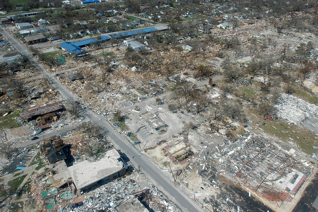
Sınaq göstərişi ölçüsü: 800 × 532 piksel. Digər ölçülər: 320 × 213 piksel | 640 × 426 piksel | 1.024 × 681 piksel | 1.280 × 851 piksel | 3.008 × 2.000 piksel.
Faylın orijinalı (3.008 × 2.000 piksel, fayl həcmi: 2,64 MB, MIME növü: image/jpeg)
Bu fayl Vikianbarda yerləşir. Açıqlama səhifəsindəki məlumatlar aşağıda göstərilib. Vikianbar azad lisenziyalı media anbarıdır. Siz də töhfə verə bilərsiniz. |
Xülasə
| İzah |
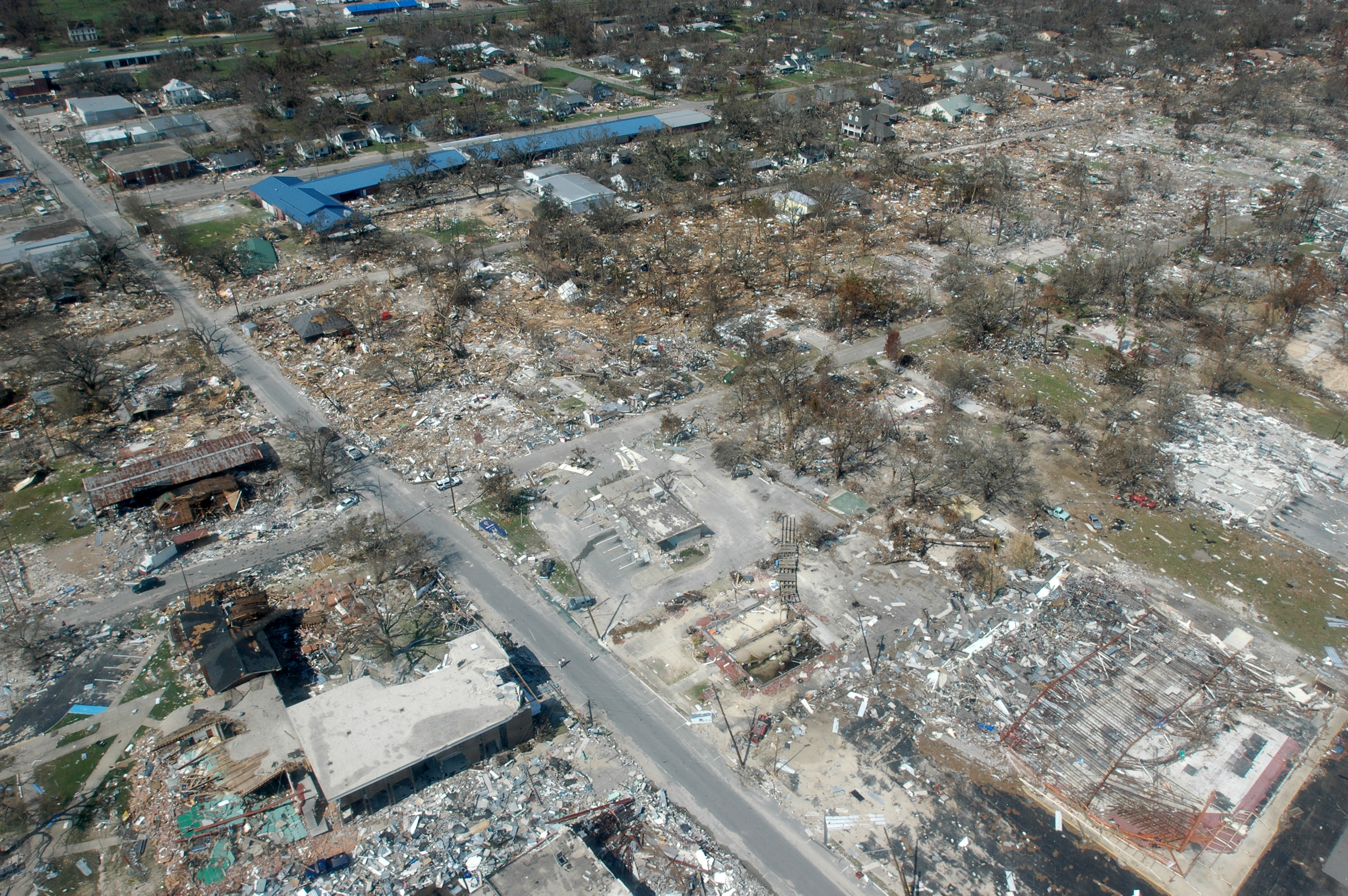
English: Long Beach, Mississippi, September 6, 2005 -- Destroyed businesses and municipal buildings on Jeff Davis Avenue in Long Beach, Mississippi from Hurricane Katrina (Long Beach is west of Gulfport and east of Pass Christian.) |
| Tarix | |
| Mənbə |
This image is from the FEMA Photo Library (obsolete as of 2019). An archived copy may be found at the Wayback Machine (note: link may be permanently dead, as not all photos were backed up in this way). If the FEMA link is permanently dead, the photo can be found at NARA Access to Archival Databases (only works if photo was taken between 1989 and October 2004), or at City-data.com. |
| Müəllif | Mark Wolfe |
Lisenziya
This image is a work of a Federal Emergency Management Agency employee, taken or made as part of that person's official duties. As works of the U.S. federal government, all FEMA images are in the public domain in the United States. Additional media usage information may be found at https://www.fema.gov/photo-video-audio-use-guidelines
|
Faylın tarixçəsi
Faylın əvvəlki versiyasını görmək üçün gün/tarix bölməsindəki tarixlərə klikləyin.
| Tarix/Vaxt | Miniatür | Ölçülər | İstifadəçi | Şərh | |
|---|---|---|---|---|---|
| hal-hazırkı | 03:42, 7 sentyabr 2005 | | 3.008 × 2.000 (2,64 MB) | Tom | {{PD-USGov}} http://www.photolibrary.fema.gov/photodata/original/14801.jpg Gulfport, Miss., September 6, 2005 -- Destroyed houses in Gulfport, Miss. Hurricane Katrina caused extensive damage all along the Mississippi gulf coast. New Orleans is being eva |
Faylın istifadəsi
Aşağıdakı səhifə bu faylı istifadə edir:
Faylın qlobal istifadəsi
Bu fayl aşağıdakı vikilərdə istifadə olunur:
- ar.wikipedia.org layihəsində istifadəsi
- ast.wikipedia.org layihəsində istifadəsi
- be.wikipedia.org layihəsində istifadəsi
- bn.wikipedia.org layihəsində istifadəsi
- cy.wikipedia.org layihəsində istifadəsi
- de.wiktionary.org layihəsində istifadəsi
- el.wikipedia.org layihəsində istifadəsi
- en.wikipedia.org layihəsində istifadəsi
- Geography of the United States
- Actuary
- Portal:Mathematics
- Hurricane Katrina
- Wikipedia:Today's featured article/September 10, 2006
- Tropical cyclone preparedness
- Portal:Tropical cyclones
- Wikipedia:Today's featured article/September 2006
- Effects of tropical cyclones
- User:Alex1996Ne/Neat Pictures
- User:E. Brown/Hurricane Hall of Fame, continued
- List of costliest Atlantic hurricanes
- Portal:Business/Selected article
- Portal:Business/Selected article/6
- User:MarioProtIV/Infobox test
- en.wikiversity.org layihəsində istifadəsi
- es.wikipedia.org layihəsində istifadəsi
- es.wikinews.org layihəsində istifadəsi
- fr.wikipedia.org layihəsində istifadəsi
- ga.wikipedia.org layihəsində istifadəsi
- ha.wikipedia.org layihəsində istifadəsi
- he.wikipedia.org layihəsində istifadəsi
- hi.wikipedia.org layihəsində istifadəsi
- hr.wikipedia.org layihəsində istifadəsi
- ia.wikipedia.org layihəsində istifadəsi
- id.wikipedia.org layihəsində istifadəsi
- it.wikipedia.org layihəsində istifadəsi
- ja.wikipedia.org layihəsində istifadəsi
- kk.wikipedia.org layihəsində istifadəsi
- kn.wikipedia.org layihəsində istifadəsi
- kw.wikipedia.org layihəsində istifadəsi
- li.wiktionary.org layihəsində istifadəsi
- lv.wikipedia.org layihəsində istifadəsi
- mn.wikipedia.org layihəsində istifadəsi
Bu faylın qlobal istifadəsinə baxın.