Butun axtardiqlarinizi tapmaq ucun buraya: DAXIL OLUN
  Mp4 Mp3 Axtar Yukle
  Video Axtar Yukle
  Shekil Axtar Yukle
  Informasiya Melumat Axtar
  Hazir Inshalar Toplusu
  AZERI CHAT + Tanishliq
  1-11 Sinif Derslikler Yukle
  Saglamliq Tibbi Melumat
  Whatsapp Plus Yukle(Yeni)

  • Ana səhifə
  • Təsadüfi
  • Yaxınlıqdakılar
  • Daxil ol
  • Nizamlamalar
İndi ianə et Əgər Vikipediya sizin üçün faydalıdırsa, bu gün ianə edin.

Fayl:Coromandel.arp.375pix.jpg

  • Fayl
  • Müzakirə
  • Lokal izah əlavə et
  • Fayl
  • Faylın tarixçəsi
  • Faylın istifadəsi
  • Faylın qlobal istifadəsi
Fayl:Coromandel.arp.375pix.jpg
Daha yüksək versiyası yoxdur.

Coromandel.arp.375pix.jpg (570 × 404 piksel, fayl həcmi: 38 KB, MIME növü: image/jpeg)

Bu fayl Vikianbarda yerləşir. Açıqlama səhifəsindəki məlumatlar aşağıda göstərilib.
Vikianbar azad lisenziyalı media anbarıdır. Siz də töhfə verə bilərsiniz.

Xülasə

İzahCoromandel.arp.375pix.jpg
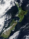
English: Close-up of the area around the city of Auckland (left) and Coromandel Peninsula (right). "This stunning true-color image provides a rare, cloud-free look at the island nation of New Zealand, including most of its North and South Islands. This scene was acquired by the Moderate Resolution Imaging Spectroradiometer (MODIS), flying aboard NASA’s Terra satellite, on October 23, 2002. New Zealand is situated in the South Pacific Ocean, roughly 2,000 km (1,250 miles) southeast of Australia. Wellington, the capital of New Zealand, is located on the southern tip of the North Island, looking across Cook Strait toward South Island."
Tarix Taken on 23 oktyabr 2002
Mənbə https://lance-modis.eosdis.nasa.gov/cgi-bin/imagery/single.cgi?image=NewZealand.A2002296.2220.250m.jpg (image link); see also https://earthobservatory.nasa.gov/images/3101/new-zealand and https://visibleearth.nasa.gov/view.php?id=62892
Müəllif NASA/GSFC/MODIS Land Rapid Response Team, Jacques Descloitres
Digər versiyalar
Image extraction process This image has an extracted file: Auckland isthmus.arp.375pix (cropped).jpg.
lang=az
File:New Zealand 23 October 2002.jpg
original uncropped image

Lisenziya

Public domainPublic domainfalsefalse
Public domain This file is in the public domain in the United States because it was solely created by NASA. NASA copyright policy states that "NASA material is not protected by copyright unless noted". (See Template:PD-USGov, NASA copyright policy page or JPL Image Use Policy.)
Warnings:
  • Use of NASA logos, insignia and emblems is restricted per U.S. law 14 CFR 1221.
  • The NASA website hosts a large number of images from the Soviet/Russian space agency, and other non-American space agencies. These are not necessarily in the public domain.
  • Materials based on Hubble Space Telescope data may be copyrighted if they are not explicitly produced by the STScI.[1] See also {{PD-Hubble}} and {{Cc-Hubble}}.
  • The SOHO (ESA & NASA) joint project implies that all materials created by its probe are copyrighted and require permission for commercial non-educational use. [2]
  • Images featured on the Astronomy Picture of the Day (APOD) web site may be copyrighted. [3]
  • The National Space Science Data Center (NSSDC) site has been known to host copyrighted content. Its photo gallery FAQ states that all of the images in the photo gallery are in the public domain "Unless otherwise noted."

Orijinal yükləmə gündəliyi

The original description page was here. All following user names refer to en.wikipedia.
  • 2004-11-16 03:08 Grutness 375×265×8 (29790 bytes) Close-up of part of Auckland.arp.750pix.jpg
Annotations
InfoField
This image is annotated: View the annotations at Commons
56
130
152
184
570
404

Auckland

Başlıqlar

Bu faylın nəyi təmsil etdiyinə dair bir sətirlik izahat əlavə et

Bu faylda təsvir olunan elementlər

təsvir edir

copyright status ingilis

ictimai varidat

yurisdiksiyasındadır: Amerika Birləşmiş Ştatları
təyinetmə üsulu: work of the federal government of the United States ingilis

yaranma tarixi

23 oktyabr 2002

media type ingilis

image/jpeg

checksum ingilis

1d0f0b050132bd75c6d24b9109a40ae866c66f81

təyinetmə üsulu: SHA-1

data size ingilis

39.190 Bayt

hündürlüyü/boyu

404 piksel

eni

570 piksel

Faylın tarixçəsi

Faylın əvvəlki versiyasını görmək üçün gün/tarix bölməsindəki tarixlərə klikləyin.

Tarix/VaxtMiniatürÖlçülərİstifadəçiŞərh
hal-hazırkı09:20, 30 iyun 201909:20, 30 iyun 2019 tarixindəki versiyanın miniatür görüntüsü570 × 404 (38 KB)HuntsterSlightly larger version from original file.
16:41, 19 mart 200716:41, 19 mart 2007 tarixindəki versiyanın miniatür görüntüsü375 × 265 (29 KB)Jörg Müller{{Information |Description=Close-up of part of Auckland.arp.750pix.jpg, showing Auckland city (left) and Coromandel Peninsula (right) |Source=Originally from [http://en.wikipedia.org en.wikipedia]; description page is/was [http://en.wikipedia.org/w/index.

Faylın istifadəsi

Aşağıdakı səhifə bu faylı istifadə edir:

  • Tamaki boğazı

Faylın qlobal istifadəsi

Bu fayl aşağıdakı vikilərdə istifadə olunur:

  • an.wikipedia.org layihəsində istifadəsi
    • Golfo de Hauraki
  • arz.wikipedia.org layihəsində istifadəsi
    • سلسلة جبال كورومانديل
  • br.wikipedia.org layihəsində istifadəsi
    • Firth
  • ceb.wikipedia.org layihəsində istifadəsi
    • Mercury Islands (kapuloan)
    • Hauraki Gulf (gulpo)
    • Coromandel Range
  • cs.wikipedia.org layihəsində istifadəsi
    • Mercury (souostroví)
  • de.wikipedia.org layihəsində istifadəsi
    • Hauraki Gulf
    • Coromandel Range
    • Firth of Thames
  • en.wikipedia.org layihəsində istifadəsi
    • Firth
    • Franklin District
    • Hauraki Gulf
    • Radio Hauraki
    • Mercury Islands
    • Firth of Thames
    • Coromandel Range
    • Ngāti Maru (Hauraki)
    • Ngāti Pāoa
    • Marutūāhu
  • eo.wikipedia.org layihəsində istifadəsi
    • Golfo Hauraki
    • Mercury
  • es.wikipedia.org layihəsində istifadəsi
    • Auckland
    • Isla Waiheke
    • Golfo de Hauraki
    • Firth
    • Hauraki Māori
    • Áreas protegidas de Nueva Zelanda
    • Sitios Ramsar de Nueva Zelanda
  • et.wikipedia.org layihəsində istifadəsi
    • Hauraki laht
  • fa.wikipedia.org layihəsində istifadəsi
    • جزایر مرکوری
    • خلیج هوراکی
  • fr.wikipedia.org layihəsində istifadəsi
    • Auckland (région)
    • Golfe de Hauraki
    • District de Franklin
    • Firth of Thames
    • Liste des sites Ramsar en Nouvelle-Zélande
  • fr.wikibooks.org layihəsində istifadəsi
    • Utilisateur:Simon Villeneuve/Britannica
  • gl.wikipedia.org layihəsində istifadəsi
    • Illa Waiheke
  • hy.wikipedia.org layihəsində istifadəsi
    • Մերկուրի կղզիներ
  • it.wikipedia.org layihəsində istifadəsi
    • Firth
    • Golfo di Hauraki
    • Firth of Thames
  • ja.wikipedia.org layihəsində istifadəsi
    • Firth
  • ka.wikipedia.org layihəsində istifadəsi
    • ჰაურაკის ყურე
    • მერკურის კუნძულები
  • kbd.wikipedia.org layihəsində istifadəsi
    • Фирф
  • ko.wikipedia.org layihəsində istifadəsi
    • 하우라키만
  • mi.wikipedia.org layihəsində istifadəsi
    • Ngāti Maru (Marutūāhu)
    • Hauraki (iwi)

Bu faylın qlobal istifadəsinə baxın.
Mənbə — "https://az.wikipedia.org/wiki/Fayl:Coromandel.arp.375pix.jpg"
Informasiya Melumat Axtar