Butun axtardiqlarinizi tapmaq ucun buraya: DAXIL OLUN
  Mp4 Mp3 Axtar Yukle
  Video Axtar Yukle
  Shekil Axtar Yukle
  Informasiya Melumat Axtar
  Hazir Inshalar Toplusu
  AZERI CHAT + Tanishliq
  1-11 Sinif Derslikler Yukle
  Saglamliq Tibbi Melumat
  Whatsapp Plus Yukle(Yeni)

  • Ana səhifə
  • Təsadüfi
  • Yaxınlıqdakılar
  • Daxil ol
  • Nizamlamalar
İndi ianə et Əgər Vikipediya sizin üçün faydalıdırsa, bu gün ianə edin.

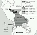
Fayl:Map Bolivia territorial loss-en.jpg

  • Fayl
  • Müzakirə
  • Lokal izah əlavə et
  • Fayl
  • Faylın tarixçəsi
  • Faylın istifadəsi
  • Faylın qlobal istifadəsi
  • Metaməlumatlar
Fayl:Map Bolivia territorial loss-en.jpg
Daha yüksək versiyası yoxdur.

Map_Bolivia_territorial_loss-en.jpg (471 × 447 piksel, fayl həcmi: 56 KB, MIME növü: image/jpeg)

Bu fayl Vikianbarda yerləşir. Açıqlama səhifəsindəki məlumatlar aşağıda göstərilib.
Vikianbar azad lisenziyalı media anbarıdır. Siz də töhfə verə bilərsiniz.
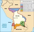
File:Map Bolivia territorial loss-en.svg is a vector version of this file. It should be used in place of this JPG file when not inferior.

File:Map Bolivia territorial loss-en.jpg → File:Map Bolivia territorial loss-en.svg

For more information, see Help:SVG.

In other languages
Alemannisch ∙ العربية ∙ беларуская (тарашкевіца) ∙ български ∙ বাংলা ∙ català ∙ нохчийн ∙ čeština ∙ dansk ∙ Deutsch ∙ Ελληνικά ∙ English ∙ British English ∙ Esperanto ∙ español ∙ eesti ∙ euskara ∙ فارسی ∙ suomi ∙ français ∙ Frysk ∙ galego ∙ Alemannisch ∙ עברית ∙ हिन्दी ∙ hrvatski ∙ magyar ∙ հայերեն ∙ Bahasa Indonesia ∙ Ido ∙ italiano ∙ 日本語 ∙ ქართული ∙ 한국어 ∙ lietuvių ∙ македонски ∙ മലയാളം ∙ Bahasa Melayu ∙ မြန်မာဘာသာ ∙ norsk bokmål ∙ Plattdüütsch ∙ Nederlands ∙ norsk nynorsk ∙ norsk ∙ occitan ∙ polski ∙ prūsiskan ∙ português ∙ português do Brasil ∙ română ∙ русский ∙ sicilianu ∙ Scots ∙ slovenčina ∙ slovenščina ∙ српски / srpski ∙ svenska ∙ தமிழ் ∙ ไทย ∙ Türkçe ∙ татарча / tatarça ∙ українська ∙ vèneto ∙ Tiếng Việt ∙ 中文 ∙ 中文(中国大陆) ∙ 中文(简体) ∙ 中文(繁體) ∙ 中文(马来西亚) ∙ 中文(新加坡) ∙ 中文(臺灣) ∙ +/−
New SVG image


Xülasə

İzahMap Bolivia territorial loss-en.jpg
English: Major Bolivian Territorial Losses, 1867–1938
Mənbə

https://www.loc.gov/resource/frdcstdy.boliviacountryst00huds_0/?sp=66

Taken from PDF file: https://web.archive.org/web/20090114233637/http://lcweb2.loc.gov/frd/cs/bolivia/bo01_05a.pdf

Converted by uploader
Müəllif Original work of US government for Library of Congress Country Study on Bolivia, "Country Studies"
Digər versiyalar

[]

  • English (JPEG original)
    English (JPEG original)
  • English
    English
  • español
    español
  • français
    français
  • magyar
    magyar
  • македонски
    македонски
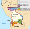
  • српски / srpski
    српски / srpski

Lisenziya

Public domainPublic domainfalsefalse
Public domain
This work is in the public domain in the United States because it is a work prepared by an officer or employee of the United States Government as part of that person’s official duties under the terms of Title 17, Chapter 1, Section 105 of the US Code. Note: This only applies to original works of the Federal Government and not to the work of any individual U.S. state, territory, commonwealth, county, municipality, or any other subdivision. This template also does not apply to postage stamp designs published by the United States Postal Service since 1978. (See § 313.6(C)(1) of Compendium of U.S. Copyright Office Practices). It also does not apply to certain US coins; see The US Mint Terms of Use.
Bu fayl bütün əlaqəli və qonşu hüquqlar da daxil olmaqla, müəllif hüquqları qanununa əsasən məlum məhdudiyyətlərdən azad olduğu müəyyən edilmişdir.

https://creativecommons.org/publicdomain/mark/1.0/PDMCreative Commons Public Domain Mark 1.0falsefalse


derivative works

Derivative works of this file:  Map Bolivia territorial loss-en.svg

Başlıqlar

Bu faylın nəyi təmsil etdiyinə dair bir sətirlik izahat əlavə et
Major Bolivian Territorial Losses, 1867–1938

Bu faylda təsvir olunan elementlər

təsvir edir

copyright status ingilis

ictimai mülkiyyət

yurisdiksiyasındadır: Amerika Birləşmiş Ştatları
təyinetmə üsulu: work of the federal government of the United States ingilis

Faylın tarixçəsi

Faylın əvvəlki versiyasını görmək üçün gün/tarix bölməsindəki tarixlərə klikləyin.

Tarix/VaxtMiniatürÖlçülərİstifadəçiŞərh
hal-hazırkı22:10, 24 yanvar 200622:10, 24 yanvar 2006 tarixindəki versiyanın miniatür görüntüsü471 × 447 (56 KB)BkwillwmCategory:Maps of Bolivia Category:LOC Wikiproject Taken from PDF file: http://lcweb2.loc.gov/frd/cs/bolivia/bo01_05a.pdf Converted by uploader The file is part of the Library of Congress Country Study on Bolivia

Faylın istifadəsi

Bu faylı istifadə edən səhifə yoxdur.

Faylın qlobal istifadəsi

Bu fayl aşağıdakı vikilərdə istifadə olunur:

  • en.wikibooks.org layihəsində istifadəsi
    • Wikijunior:South America/Bolivia
  • es.wikipedia.org layihəsində istifadəsi
    • Discusión:Imperio español/Archivo1
  • fr.wikipedia.org layihəsində istifadəsi
    • Wikipédia:Atelier graphique/Cartes/Archives/mai 2010

Metaməlumatlar

Bu faylda fotoaparat və ya skanerlə əlavə olunmuş məlumatlar var. Əgər fayl sonradan olunubsa, bəzi parametrlər bu şəkildə göstərilənlərdən fərqli ola bilər.

_error0
Mənbə — "https://az.wikipedia.org/wiki/Fayl:Map_Bolivia_territorial_loss-en.jpg"
Informasiya Melumat Axtar