Butun axtardiqlarinizi tapmaq ucun buraya: DAXIL OLUN
  Mp4 Mp3 Axtar Yukle
  Video Axtar Yukle
  Shekil Axtar Yukle
  Informasiya Melumat Axtar
  Hazir Inshalar Toplusu
  AZERI CHAT + Tanishliq
  1-11 Sinif Derslikler Yukle
  Saglamliq Tibbi Melumat
  Whatsapp Plus Yukle(Yeni)

  • Ana səhifə
  • Təsadüfi
  • Yaxınlıqdakılar
  • Daxil ol
  • Nizamlamalar
İndi ianə et Əgər Vikipediya sizin üçün faydalıdırsa, bu gün ianə edin.

Fayl:BlueMarble-2001-2002.jpg

  • Fayl
  • Müzakirə
  • Lokal izah əlavə et
  • Fayl
  • Faylın tarixçəsi
  • Faylın istifadəsi
  • Faylın qlobal istifadəsi
  • Metaməlumatlar
Fayl:BlueMarble-2001-2002.jpg
Sınaq göstərişi ölçüsü: 800 × 400 piksel. Digər ölçülər: 320 × 160 piksel | 640 × 320 piksel | 1.024 × 512 piksel | 1.280 × 640 piksel | 2.560 × 1.280 piksel | 4.096 × 2.048 piksel.

Faylın orijinalı (4.096 × 2.048 piksel, fayl həcmi: 1,22 MB, MIME növü: image/jpeg)

Bu fayl Vikianbarda yerləşir. Açıqlama səhifəsindəki məlumatlar aşağıda göstərilib.
Vikianbar azad lisenziyalı media anbarıdır. Siz də töhfə verə bilərsiniz.

Xülasə

İzahBlueMarble-2001-2002.jpg
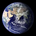
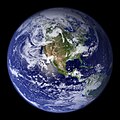
English: NASA created these two images to exhibit high-resolution global composites of Moderate Resolution Imaging Spectroradiometer (MODIS) data. The land surface data were acquired from June through September of 2001. The clouds were acquired on two separate days--July 29, 2001, for the northern hemisphere and November 16, 2001 for the southern hemisphere. The images were rendered in Electric Image and composited in Adobe Photoshop in late January, 2002.

For more information and access to high resolution texture maps, visit: The Blue Marble

Western Hemisphere (2048 by 2048 JPEG)
Eastern Hemisphere (2048 by 2048 JPEG) Originally uploaded to english wikipedia 14 March 2004 by Seth Ilys.

High resolution version made by User:Apoc2400 from globe_west_2048.tif and globe_east_2048.tif.
Tarix 8 fevral 2002
Mənbə https://visibleearth.nasa.gov/view.php?id=57723
Müəllif
  • Reto Stöckli (land surface, shallow water, clouds)
  • Robert Simmon (enhancements: ocean color, compositing, 3D globes, animation)
  • Data and technical support: MODIS Land Group; MODIS Science Data Support Team; MODIS Atmosphere Group; MODIS Ocean Group
  • Additional data: USGS EROS Data Center (topography); USGS Terrestrial Remote Sensing Flagstaff Field Center (Antarctica); Defense Meteorological Satellite Program (city lights).
İcazə
(Faylın təkrar istifadəsi)
Public domainPublic domainfalsefalse
Public domain This file is in the public domain in the United States because it was solely created by NASA. NASA copyright policy states that "NASA material is not protected by copyright unless noted". (See Template:PD-USGov, NASA copyright policy page or JPL Image Use Policy.)
Warnings:
  • Use of NASA logos, insignia and emblems is restricted per U.S. law 14 CFR 1221.
  • The NASA website hosts a large number of images from the Soviet/Russian space agency, and other non-American space agencies. These are not necessarily in the public domain.
  • Materials based on Hubble Space Telescope data may be copyrighted if they are not explicitly produced by the STScI.[1] See also {{PD-Hubble}} and {{Cc-Hubble}}.
  • The SOHO (ESA & NASA) joint project implies that all materials created by its probe are copyrighted and require permission for commercial non-educational use. [2]
  • Images featured on the Astronomy Picture of the Day (APOD) web site may be copyrighted. [3]
  • The National Space Science Data Center (NSSDC) site has been known to host copyrighted content. Its photo gallery FAQ states that all of the images in the photo gallery are in the public domain "Unless otherwise noted."
Digər versiyalar
  • Eastern Hemisphere in PNG format
    Eastern Hemisphere in PNG format
  • Western Hemisphere in PNG format
    Western Hemisphere in PNG format
  • Eastern Hemisphere in JPEG format
    Eastern Hemisphere in JPEG format
  • Western Hemisphere in JPEG format
    Western Hemisphere in JPEG format
  • Eastern Hemisphere in TIFF format
    Eastern Hemisphere in TIFF format
  • Western Hemisphere in TIFF format
    Western Hemisphere in TIFF format

Başlıqlar

Bu faylın nəyi təmsil etdiyinə dair bir sətirlik izahat əlavə et
Earth from water
물이 나온 이미지

Bu faylda təsvir olunan elementlər

təsvir edir

copyright status ingilis

ictimai mülkiyyət

yurisdiksiyasındadır: Amerika Birləşmiş Ştatları
təyinetmə üsulu: work of the federal government of the United States ingilis

yaranma tarixi

8 fevral 2002

media type ingilis

image/jpeg

checksum ingilis

e1b79d40cce9595dea0050370c78fc9167773c2f

təyinetmə üsulu: SHA-1

data size ingilis

1.277.547 Bayt

hündürlüyü/boyu

2.048 piksel

eni

4.096 piksel

Faylın tarixçəsi

Faylın əvvəlki versiyasını görmək üçün gün/tarix bölməsindəki tarixlərə klikləyin.

Tarix/VaxtMiniatürÖlçülərİstifadəçiŞərh
hal-hazırkı22:14, 20 dekabr 200922:14, 20 dekabr 2009 tarixindəki versiyanın miniatür görüntüsü4.096 × 2.048 (1,22 MB)Apoc2400High resolution.
02:10, 3 sentyabr 200502:10, 3 sentyabr 2005 tarixindəki versiyanın miniatür görüntüsü405 × 203 (19 KB)Saperaud~commonswikiNASA created these two images to exhibit high-resolution global composites of Moderate Resolution Imaging Spectroradiometer [http://modarch.gsfc.nasa.gov (MODIS)] data. The land surface data were acquired from June through September of 2001. The clouds we

Faylın istifadəsi

Aşağıdakı səhifə bu faylı istifadə edir:

  • Okean biologiyası

Faylın qlobal istifadəsi

Bu fayl aşağıdakı vikilərdə istifadə olunur:

  • af.wikipedia.org layihəsində istifadəsi
    • Bewoonbare sone
  • ar.wikipedia.org layihəsində istifadəsi
    • علم الأحياء البحرية
    • استدامة
    • بوابة:بنية تحتية
    • بوابة:بنية تحتية/قضايا وأفكار/أرشيف
    • بوابة:بنية تحتية/قضايا وأفكار/5
    • أصل الماء على الأرض
    • مستخدم:Madleen Al-kanash
    • تنوع النظام البيئي
    • تجربة توأم الأرض الفكرية
  • ba.wikipedia.org layihəsində istifadəsi
    • Океан биологияһы
  • be.wikipedia.org layihəsində istifadəsi
    • Устойлівасць навакольнага асяроддзя
    • Біялогія акіяна
  • bh.wikipedia.org layihəsində istifadəsi
    • दि ब्लू मार्बल
  • bn.wikipedia.org layihəsində istifadəsi
    • পৃথিবীর পানির উৎস
    • ডুবো পরিবেশ
    • পরিবেশ বিজ্ঞান
    • দ্য ব্লু মার্বেল
  • bo.wikipedia.org layihəsində istifadəsi
    • ཁོར་ཡུག་རིག་པ།
  • bs.wikipedia.org layihəsində istifadəsi
    • Ekološka raznolikost
  • ca.wikipedia.org layihəsində istifadəsi
    • Història ambiental
    • Moviment ecologista
    • Entorn subaquàtic
  • cs.wikipedia.org layihəsində istifadəsi
    • Modrá skleněnka
  • cy.wikipedia.org layihəsində istifadəsi
    • Cynaliadwyedd
  • da.wikipedia.org layihəsində istifadəsi
    • Marinbiologi
  • de.wikipedia.org layihəsində istifadəsi
    • Erde
    • Herkunft des irdischen Wassers
    • Wikipedia:Kandidaten für exzellente Bilder/Archiv2012/3
  • diq.wikipedia.org layihəsində istifadəsi
    • Derya
  • el.wikipedia.org layihəsində istifadəsi
    • Δίδυμη Γη
  • en.wikipedia.org layihəsində istifadəsi
    • Marine biology
    • Environmental science
    • Twin Earth thought experiment
    • Underwater environment
    • The Blue Marble
    • Ecosystem diversity
    • Habitable zone
    • Environmental history
    • Environmentalism
    • Origin of water on Earth
    • Portal:Marine life
    • Portal:Environment
    • Portal:Environment/Selected article
    • Portal:Environment/Selected article/14
    • Sea
    • Talk:Sustainability/Archive 8
    • User:Nick carson/sandbox
    • Talk:Sustainability/Lead
    • Talk:Sustainability/Archive 25

Bu faylın qlobal istifadəsinə baxın.

Metaməlumatlar

Bu faylda fotoaparat və ya skanerlə əlavə olunmuş məlumatlar var. Əgər fayl sonradan olunubsa, bəzi parametrlər bu şəkildə göstərilənlərdən fərqli ola bilər.

_error0
Mənbə — "https://az.wikipedia.org/wiki/Fayl:BlueMarble-2001-2002.jpg"
Informasiya Melumat Axtar