Butun axtardiqlarinizi tapmaq ucun buraya: DAXIL OLUN
  Mp4 Mp3 Axtar Yukle
  Video Axtar Yukle
  Shekil Axtar Yukle
  Informasiya Melumat Axtar
  Hazir Inshalar Toplusu
  AZERI CHAT + Tanishliq
  1-11 Sinif Derslikler Yukle
  Saglamliq Tibbi Melumat
  Whatsapp Plus Yukle(Yeni)

  • Ana səhifə
  • Təsadüfi
  • Yaxınlıqdakılar
  • Daxil ol
  • Nizamlamalar
İndi ianə et Əgər Vikipediya sizin üçün faydalıdırsa, bu gün ianə edin.

Fayl:Blank US Map (states only).svg

  • Fayl
  • Müzakirə
  • Lokal izah əlavə et
  • Fayl
  • Faylın tarixçəsi
  • Faylın istifadəsi
  • Faylın qlobal istifadəsi
  • Metaməlumatlar
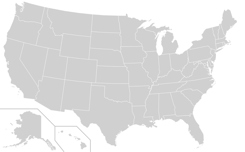
Fayl:Blank US Map (states only).svg
Bu SVG-faylın PNG formatındakı bu görünüşünün ölçüsü: 800 × 495 piksel. Digər ölçülər: 320 × 198 piksel | 640 × 396 piksel | 1.024 × 633 piksel | 1.280 × 791 piksel | 2.560 × 1.583 piksel | 959 × 593 piksel.

Faylın orijinalı (SVG faylı, nominal olaraq 959 × 593 piksel, faylın ölçüsü: 57 KB)

Bu fayl Vikianbarda yerləşir. Açıqlama səhifəsindəki məlumatlar aşağıda göstərilib.
Vikianbar azad lisenziyalı media anbarıdır. Siz də töhfə verə bilərsiniz.
This image should always reflect the most recent version. Feel free to update it when needed.

Xülasə

İzahBlank US Map (states only).svg
English: A blank map of the United States, not including territories such as Puerto Rico and Guam. Uses the Albers projection. All paths of the states in the file have been assigned an ID consisting of their standard two-letter abbreviations in order to enable easy editing using a text editor. Relative scales and omitted islands are described in comments in the file.
Español: Mapa en blanco de los Estados Unidos en formato de vector escalable.
Tarix 1 dekabr 2020
Mənbə Derived from File:Blank USA, w territories.svg
Müəllif Heitordp
Digər versiyalar

Alternative versions of this file:

  • Blank US Map (states only) 2.svg (More detailed outlines, different layout)

Other blank US maps:

  • Blank map of the U.S. with territories.svg (Includes territories such as Puerto Rico and Guam)
  • Blank USA, w territories 2.svg (Includes territories but in more realistic locations)
  • USA blank.svg (Alaska and Hawaii at full size)
  • BlankMap-USA-states-Canada-provinces, HI closer.svg
  • BlankMap-USA-states-Canada-provinces.svg
  • Usa and Canada with names.svg
  • Usa and Canada with names natural.svg
SVG genesis
InfoField
 
The SVG code is valid.
 
This map was created with a text editor.
This file is saved in human-editable plain text format. Any editing of the image or creation of any derivative work should be performed using a text editor. Please do not upload edits saved or exported with Inkscape or similar vector graphics editors, as well as with automated tools such as SVG Translate.

Lisenziya

Creative Commons CC-Zero Bu fayl Creative Commons CC0 1.0 Universal Public Domain Dedication lisenziyası altında yayımlanır.
Əsəri bu sənədlə əlaqələndirən şəxs müəllif hüquqları qanununa əsasən bütün dünyada qanunla icazə verilən həddə bütün əlaqəli və bitişik hüquqlar da daxil olmaqla əsərə olan bütün hüquqlarından imtina edərək əsəri ictimai mülkiyyətə buraxmışdır. Siz hətta kommersiya məqsədləri üçün icazə almadan işi kopyalaya, dəyişdirə, paylaşa bilərsiniz.

http://creativecommons.org/publicdomain/zero/1.0/deed.enCC0Creative Commons Zero, Public Domain Dedicationfalsefalse

Başlıqlar

Bu faylın nəyi təmsil etdiyinə dair bir sətirlik izahat əlavə et
Blank SVG map of the United States
Carte SVG vide des États-Unis

Bu faylda təsvir olunan elementlər

təsvir edir

yaradıcı

Vikidata elementi olmayan bir neçə dəyər

müəllifin qısa adı: Heitordp
Vikimedia istifadəçi adı: Heitordp
URL: /wiki/User:Heitordp

copyright status ingilis

copyrighted ingilis

müəllif hüquqları ilə qorunur, lakin müəllif hüquqlarının sahibi tərəfindən ictimai istifadəyə verilmişdir

lisenziya

GNU Free Documentation License, version 1.2 or later ingilis

CC BY-SA 3.0

Creative Commons CC0 License ingilis

yaranma tarixi

11 iyul 2006

media type ingilis

image/svg+xml

checksum ingilis

0e0a72b96ed8bf05a133c9dc04650c6ac5e78d88

təyinetmə üsulu: SHA-1

data size ingilis

58.766 Bayt

hündürlüyü/boyu

593 piksel

eni

959 piksel

Faylın tarixçəsi

Faylın əvvəlki versiyasını görmək üçün gün/tarix bölməsindəki tarixlərə klikləyin.

(ən yeni | ən əvvəlki) Göstər (10 daha yeni | 10 daha köhnə) (10 | 20 | 50 | 100 | 250 | 500).
Tarix/VaxtMiniatürÖlçülərİstifadəçiŞərh
hal-hazırkı21:54, 22 dekabr 202021:54, 22 dekabr 2020 tarixindəki versiyanın miniatür görüntüsü959 × 593 (57 KB)Jamesy0627144edit title, remove word "territories" from comments
01:27, 2 dekabr 202001:27, 2 dekabr 2020 tarixindəki versiyanın miniatür görüntüsü959 × 593 (57 KB)Kaldaribased on new version of File:Blank USA, w territories.svg by Heitordp
00:23, 23 may 202000:23, 23 may 2020 tarixindəki versiyanın miniatür görüntüsü959 × 593 (28 KB)KaldariReverted to version as of 27 May 2019. Newer versions were substantially different and should be uploaded as a separate file per Commons:Overwriting existing files
21:37, 1 may 202021:37, 1 may 2020 tarixindəki versiyanın miniatür görüntüsü958 × 602 (200 KB)Jamesy0627144moved Alaska and separator lines slightly (incorporated most recent change to File:Blank USA, w territories.svg)
01:23, 25 aprel 202001:23, 25 aprel 2020 tarixindəki versiyanın miniatür görüntüsü958 × 602 (200 KB)Jamesy0627144Fixed some flaws such as the non-overlapping borders that caused a double-line display when a stroke color was assigned. Other aspects of the map were also improved. Credit to Heitordp for originally uploading at File:Blank USA, w territories.svg; only change I made was to remove territories.
19:09, 27 may 201919:09, 27 may 2019 tarixindəki versiyanın miniatür görüntüsü959 × 593 (28 KB)Jamesy0627144add opacity property for DC circle, to allow to be hidden
18:44, 27 may 201918:44, 27 may 2019 tarixindəki versiyanın miniatür görüntüsü959 × 593 (27 KB)Jamesy0627144remove unused / duplicative "outlines" id
03:15, 25 aprel 201903:15, 25 aprel 2019 tarixindəki versiyanın miniatür görüntüsü959 × 593 (27 KB)Jamesy0627144Removed the stroke and stroke-width properties that I added earlier. These do not really work well for this file since border centerlines are offset from each other instead of directly overlapping. Would be better if they were overlapping as is the case with File:BlankMap-World.svg but would require some expertise to fix.
20:14, 27 mart 201920:14, 27 mart 2019 tarixindəki versiyanın miniatür görüntüsü959 × 593 (28 KB)Jamesy0627144Added stroke and stroke-width attributes for .state class. Not necessary to include these but doing so will be helpful for editors not familiar with SVG who may wish to tweak these settings. Also added title tags for each state so name pops up when hover with mouse.
02:24, 5 mart 201902:24, 5 mart 2019 tarixindəki versiyanın miniatür görüntüsü959 × 593 (26 KB)Jamesy0627144Added instructions to CSS block so people who don't know SVG (most people) will have an easier time figuring out how to color the map.
(ən yeni | ən əvvəlki) Göstər (10 daha yeni | 10 daha köhnə) (10 | 20 | 50 | 100 | 250 | 500).

Faylın istifadəsi

Bu faylı istifadə edən səhifə yoxdur.

Faylın qlobal istifadəsi

Bu fayl aşağıdakı vikilərdə istifadə olunur:

  • bg.wikipedia.org layihəsində istifadəsi
    • Потребител:Tourbillon/Полигон
  • bs.wikipedia.org layihəsində istifadəsi
    • Korisnik:C3r4/Bilješke/SAD
  • de.wikibooks.org layihəsində istifadəsi
    • Benutzer:Thirunavukkarasye-Raveendran/Ungarisch Lektion 1
  • en.wikipedia.org layihəsində istifadəsi
    • Illinois Mr. Basketball
    • User:Ric36/Sandbox
    • Iowa Mr. Basketball
    • Template:United States Labelled Map
    • Mr. Football Award (Kentucky)
    • North Dakota Mr. Basketball
    • Mr. Football Award (Ohio)
    • Mr. Basketball of Michigan
    • Kentucky Mr. Basketball
    • Kentucky Miss Basketball
    • Mr. Football Award (Florida)
    • Utah Mr. Basketball
    • Wikipedia:Graphics Lab/Images to improve/Archive/Aug 2007
    • List of place names of French origin in the United States
    • Wisconsin Mr. Basketball
    • Wikipedia:Graphics Lab/Images to improve/Archive/Mar 2008
    • User:The Obento Musubi/Sandbox 3
    • Indiana Mr. Basketball
    • Mr. Football Award (Alabama)
    • Template:Mr. Basketball Award
    • Louisiana Mr. Basketball
    • Wikipedia:Graphics Lab/Image workshop/Archive/May 2009
    • Tennessee Mr. Basketball
    • Wikipedia:Graphics Lab/Map workshop/Archive/Aug 2009
    • California Mr. Basketball
    • Ohio Mr. Basketball
    • Mr. Football Award (Indiana)
    • User:AtTheNecropolis
    • Alabama Mr. Basketball
    • Template:Miss Basketball Award
    • Florida Mr. Basketball
    • Tennessee Miss Basketball
    • Indiana Miss Basketball
    • Wisconsin Miss Basketball
    • Alabama Miss Basketball
    • Mr. Basketball of Arkansas
    • Mr. Georgia Basketball
    • Miss Georgia Basketball
    • User:Sgt. R.K. Blue/Userboxes/State Constitution
    • Michigan Miss Basketball
    • Mr. Football Award (South Carolina)
    • Mr. New York Basketball
    • User:JimmySand9/SandboxUser
    • Mr. New Hampshire Basketball
    • User:BK2011
    • Mr. Football Award (Texas)
    • User:Corei7Maniac

Bu faylın qlobal istifadəsinə baxın.

Metaməlumatlar

Bu faylda fotoaparat və ya skanerlə əlavə olunmuş məlumatlar var. Əgər fayl sonradan olunubsa, bəzi parametrlər bu şəkildə göstərilənlərdən fərqli ola bilər.

Qısa başlıqBlank map of the United States, territories not included
Genişlik959
Hündürlük593
Mənbə — "https://az.wikipedia.org/wiki/Fayl:Blank_US_Map_(states_only).svg"
Informasiya Melumat Axtar