Butun axtardiqlarinizi tapmaq ucun buraya: DAXIL OLUN
  Mp4 Mp3 Axtar Yukle
  Video Axtar Yukle
  Shekil Axtar Yukle
  Informasiya Melumat Axtar
  Hazir Inshalar Toplusu
  AZERI CHAT + Tanishliq
  1-11 Sinif Derslikler Yukle
  Saglamliq Tibbi Melumat
  Whatsapp Plus Yukle(Yeni)

  • Ana səhifə
  • Təsadüfi
  • Yaxınlıqdakılar
  • Daxil ol
  • Nizamlamalar
İndi ianə et Əgər Vikipediya sizin üçün faydalıdırsa, bu gün ianə edin.

Fayl:BlankMap-Europe.png

  • Fayl
  • Müzakirə
  • Lokal izah əlavə et
  • Fayl
  • Faylın tarixçəsi
  • Faylın istifadəsi
  • Faylın qlobal istifadəsi
  • Metaməlumatlar
Fayl:BlankMap-Europe.png
Daha yüksək versiyası yoxdur.

BlankMap-Europe.png (450 × 422 piksel, fayl həcmi: 15 KB, MIME növü: image/png)

Bu fayl Vikianbarda yerləşir. Açıqlama səhifəsindəki məlumatlar aşağıda göstərilib.
Vikianbar azad lisenziyalı media anbarıdır. Siz də töhfə verə bilərsiniz.
File:Blank map of Europe cropped.svg is a vector version of this file. It should be used in place of this PNG file when not inferior.

File:BlankMap-Europe.png → File:Blank map of Europe cropped.svg

For more information, see Help:SVG.

In other languages
Alemannisch ∙ العربية ∙ беларуская (тарашкевіца) ∙ български ∙ বাংলা ∙ català ∙ нохчийн ∙ čeština ∙ dansk ∙ Deutsch ∙ Ελληνικά ∙ English ∙ British English ∙ Esperanto ∙ español ∙ eesti ∙ euskara ∙ فارسی ∙ suomi ∙ français ∙ Frysk ∙ galego ∙ Alemannisch ∙ עברית ∙ हिन्दी ∙ hrvatski ∙ magyar ∙ հայերեն ∙ Bahasa Indonesia ∙ Ido ∙ italiano ∙ 日本語 ∙ ქართული ∙ 한국어 ∙ lietuvių ∙ македонски ∙ മലയാളം ∙ Bahasa Melayu ∙ norsk bokmål ∙ Plattdüütsch ∙ Nederlands ∙ norsk nynorsk ∙ norsk ∙ occitan ∙ polski ∙ prūsiskan ∙ português ∙ português do Brasil ∙ română ∙ русский ∙ sicilianu ∙ Scots ∙ slovenčina ∙ slovenščina ∙ српски / srpski ∙ svenska ∙ தமிழ் ∙ ไทย ∙ Türkçe ∙ татарча / tatarça ∙ українська ∙ vèneto ∙ Tiếng Việt ∙ 中文 ∙ 中文(中国大陆) ∙ 中文(简体) ∙ 中文(繁體) ∙ 中文(马来西亚) ∙ 中文(新加坡) ∙ 中文(臺灣) ∙ +/−
New SVG image


Xülasə

İzahBlankMap-Europe.png
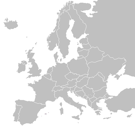
English: A blank political map of Europe as of 2004 (updated 2006 and 2008), made by the uploader for Wikipedia.
The list of independent states pictured on the map (source): Albania, Andorra, Austria, Belarus, Belgium, Bosnia and Herzegovina, Bulgaria, Croatia, Czech Republic, Cyprus, Denmark, Estonia, Finland, France, Germany, Greece, Hungary, Iceland, Ireland, Italy, Latvia, Liechtenstein, Lithuania, Luxembourg, Kosovo (disputed), Macedonia, Moldova, Monaco, Montenegro, Netherlands, Norway, Poland, Portugal, Romania, Russia, San Marino, Serbia, Slovakia, Slovenia, Spain, Sweden, Switzerland, Turkey, Ukraine, United Kingdom, Vatican City
Tarix 16 noyabr 2003 (original upload date)
Mənbə Öz işi
Müəllif Vardion at ingilis Vikipediya

Lisenziya

Public domainPublic domainfalsefalse
Public domain Mən, bu əsərin müəllif hüquqlarının sahibi kimi, əsəri ictimai mülkiyyətə buraxıram. Bu icazə bütün dünyada qüvvədədir.
In some countries this may not be legally possible; if so:
Mən hər kəsə bu əsərdən hər hansı bir məqsəd üçün, heç bir şərt olmadan, qanunla belə şərtlər tələb olunmadığı təqdirdə istifadə etmək hüququnu verirəm.

Orijinal yükləmə gündəliyi

The original description page was here. All following user names refer to en.wikipedia.
  • 2006-06-10 12:08 Astrokey44 422×422 (10216 bytes) montenegro independent
  • 2006-04-23 18:32 Lgriot 450×422 (7164 bytes) Reverted to earlier revision
  • 2006-04-23 18:32 Lgriot 415×422 (9421 bytes) Reverted to earlier revision
  • 2006-02-22 07:01 BionicWilliam 450×422 (9812 bytes) Reverted to earlier revision
  • 2006-02-22 07:01 BionicWilliam 415×422 (9421 bytes) Reverted to earlier revision
  • 2006-01-04 08:52 E Pluribus Anthony 450×422 (9812 bytes) Blank map of Europe (2005)
  • 2005-09-22 18:14 E Pluribus Anthony 450×422 (9805 bytes) Blank map of Europe (2005)
  • 2005-09-19 09:15 E Pluribus Anthony 450×422 (9804 bytes) Blank map of Europe, 2005
  • 2005-09-19 06:45 E Pluribus Anthony 450×422 (7164 bytes) Blank map of Europe
  • 2005-07-21 05:05 MishaChan 415×422 (5477 bytes) Reverted to earlier revision
  • 2005-07-21 05:04 MishaChan 415×422 (9421 bytes) Reverted to earlier revision
  • 2005-01-22 16:48 Richie 415×422 (5477 bytes) modified Ireland (border), Orkney, Shetlands
  • 2004-09-07 10:53 Gobnuts 415×422 (9421 bytes) Reverted to earlier revision
  • 2004-09-07 10:51 Gobnuts 415×422 (9410 bytes) Reverted to earlier revision
  • 2003-11-16 08:07 Vardion 415×422 (9421 bytes) Blank map of Europe (corrected again)
  • 2003-11-16 08:04 Vardion 415×422 (9410 bytes) Blank map of Europe (corrected)
  • 2003-11-16 07:16 Vardion 415×430 (9113 bytes) Blank map of Europe

Başlıqlar

Bu faylın nəyi təmsil etdiyinə dair bir sətirlik izahat əlavə et

Bu faylda təsvir olunan elementlər

təsvir edir

copyright status ingilis

müəllif hüquqları ilə qorunur, lakin müəllif hüquqlarının sahibi tərəfindən ictimai istifadəyə verilmişdir

lisenziya

released into the public domain by the copyright holder ingilis

yaranma tarixi

16 noyabr 2003

media type ingilis

image/png

source of file ingilis

original creation by uploader ingilis

checksum ingilis

fd8d2f1165f0bd5741de4e44d0bdfd3444feb56e

təyinetmə üsulu: SHA-1

data size ingilis

14.906 Bayt

hündürlüyü/boyu

422 piksel

eni

450 piksel

Faylın tarixçəsi

Faylın əvvəlki versiyasını görmək üçün gün/tarix bölməsindəki tarixlərə klikləyin.

(ən yeni | ən əvvəlki) Göstər (10 daha yeni | 10 daha köhnə) (10 | 20 | 50 | 100 | 250 | 500).
Tarix/VaxtMiniatürÖlçülərİstifadəçiŞərh
hal-hazırkı22:02, 23 sentyabr 201522:02, 23 sentyabr 2015 tarixindəki versiyanın miniatür görüntüsü450 × 422 (15 KB)OgreBot(BOT): Reverting to most recent version before archival
22:02, 23 sentyabr 201522:02, 23 sentyabr 2015 tarixindəki versiyanın miniatür görüntüsü450 × 422 (10 KB)OgreBot(BOT): Uploading old version of file from en.wikipedia; originally uploaded on 2006-01-04 08:52:21 by E Pluribus Anthony
22:02, 23 sentyabr 201522:02, 23 sentyabr 2015 tarixindəki versiyanın miniatür görüntüsü450 × 422 (10 KB)OgreBot(BOT): Uploading old version of file from en.wikipedia; originally uploaded on 2005-09-22 18:14:10 by E Pluribus Anthony
22:02, 23 sentyabr 201522:02, 23 sentyabr 2015 tarixindəki versiyanın miniatür görüntüsü450 × 422 (10 KB)OgreBot(BOT): Uploading old version of file from en.wikipedia; originally uploaded on 2005-09-19 09:15:43 by E Pluribus Anthony
22:02, 23 sentyabr 201522:02, 23 sentyabr 2015 tarixindəki versiyanın miniatür görüntüsü450 × 422 (7 KB)OgreBot(BOT): Uploading old version of file from en.wikipedia; originally uploaded on 2005-09-19 06:45:22 by E Pluribus Anthony
22:02, 23 sentyabr 201522:02, 23 sentyabr 2015 tarixindəki versiyanın miniatür görüntüsü415 × 422 (5 KB)OgreBot(BOT): Uploading old version of file from en.wikipedia; originally uploaded on 2005-01-22 16:48:46 by Richie
22:01, 23 sentyabr 201522:01, 23 sentyabr 2015 tarixindəki versiyanın miniatür görüntüsü415 × 422 (9 KB)OgreBot(BOT): Uploading old version of file from en.wikipedia; originally uploaded on 2003-11-16 08:04:27 by Vardion
22:01, 23 sentyabr 201522:01, 23 sentyabr 2015 tarixindəki versiyanın miniatür görüntüsü415 × 430 (9 KB)OgreBot(BOT): Uploading old version of file from en.wikipedia; originally uploaded on 2003-11-16 07:16:14 by Vardion
19:27, 21 iyul 200919:27, 21 iyul 2009 tarixindəki versiyanın miniatür görüntüsü450 × 422 (15 KB)Hoshiefixed Montenegro
08:20, 18 iyul 200908:20, 18 iyul 2009 tarixindəki versiyanın miniatür görüntüsü450 × 422 (15 KB)Hoshieredid Kosovo/Montenegro borders based on an older version of File:Continental-Europe-map.png; anti-aliasing has been removed.
(ən yeni | ən əvvəlki) Göstər (10 daha yeni | 10 daha köhnə) (10 | 20 | 50 | 100 | 250 | 500).

Faylın istifadəsi

Bu faylı istifadə edən səhifə yoxdur.

Faylın qlobal istifadəsi

Bu fayl aşağıdakı vikilərdə istifadə olunur:

  • ar.wikipedia.org layihəsində istifadəsi
    • قالب:خريطة أوروبا المعلمة
  • de.wikipedia.org layihəsində istifadəsi
    • Benutzer Diskussion:Fice/Archiv
  • en.wikipedia.org layihəsində istifadəsi
    • Wikipedia:Graphics Lab/Images to improve/Archive/Dec 2006
    • File:Telempe travel plans - Europe.png
    • User:Jaksmata/Temple sandbox
    • User:Jaksmata/Temple articles2
    • Wikipedia talk:WikiProject Countries/Archive 8
    • User:Jaksmata/LDS Temple Navbox
    • User:Ellsass/Euromap
    • User:Trödel/Temples
    • Wikipedia:Graphics Lab/Map workshop/Archive/Jan 2013
  • fi.wikipedia.org layihəsində istifadəsi
    • Käyttäjä:August-54/Hiekkalaatikko 2
  • hak.wikipedia.org layihəsində istifadəsi
    • Êu-chû
  • incubator.wikimedia.org layihəsində istifadəsi
    • Template:Wp/ruq/Evropa karta
  • krc.wikipedia.org layihəsində istifadəsi
    • Шаблон:Европаны политика картасы
    • Европа
  • ky.wikipedia.org layihəsində istifadəsi
    • Template:Портал:Еврокөрүнүү/Еврокөрүнүү ыр сынагына катышкан мамлекеттер
    • Template:Еврокөрүнүү ыр сынагына катышкан мамлекеттер картасы
  • mk.wikipedia.org layihəsində istifadəsi
    • Шаблон:Означена карта на Европа
  • nn.wikipedia.org layihəsində istifadəsi
    • Mal:Europakart
  • su.wikipedia.org layihəsində istifadəsi
    • Citakan:Europe Labelled Map
    • Éropa
  • sw.wikipedia.org layihəsində istifadəsi
    • Ulaya
    • Kigezo:Ulayamap
  • uk.wikipedia.org layihəsində istifadəsi
    • Італо-романські мови
    • Західнороманські мови
    • Галло-іберійські мови
  • vi.wikipedia.org layihəsində istifadəsi
    • Đội tuyển bóng chày quốc gia Cuba
    • Bóng chày tại Thế vận hội Mùa hè

Metaməlumatlar

Bu faylda fotoaparat və ya skanerlə əlavə olunmuş məlumatlar var. Əgər fayl sonradan olunubsa, bəzi parametrlər bu şəkildə göstərilənlərdən fərqli ola bilər.

Faylın dəyişməsi tarixi və vaxtı03:44, 28 noyabr 2006
Mənbə — "https://az.wikipedia.org/wiki/Fayl:BlankMap-Europe.png"
Informasiya Melumat Axtar